Two Congos, Gabon, Sao Tome & Principe and Cabinda
/
cameroon rainforest
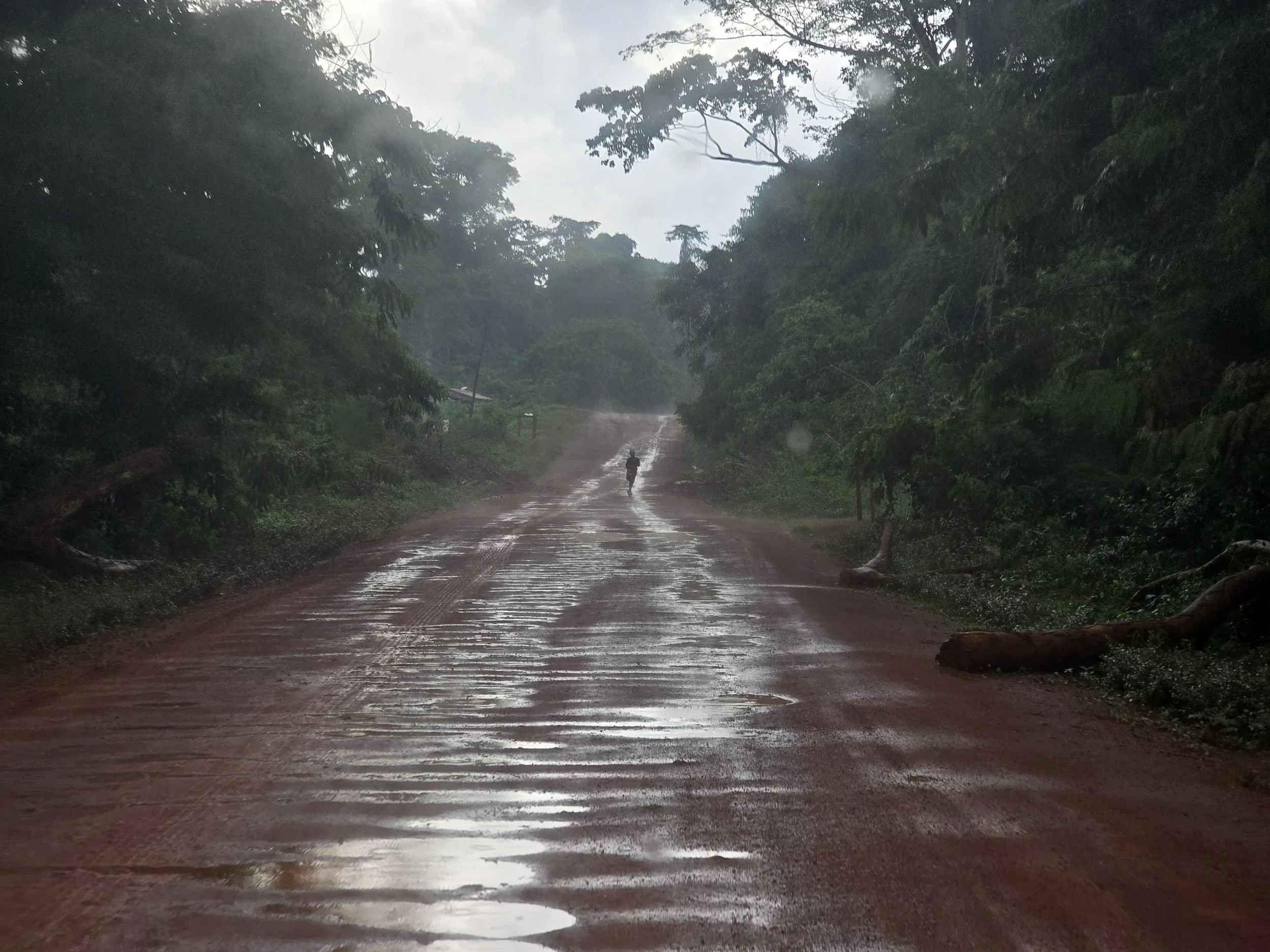
Adding an extra 1,500km to our route out of southeast Cameroon, courtesy of a river system with an unhelpful shortage of crossing points, was testing even by our standards. On the map it looked like a minor inconvenience. On the ground it meant a very long detour over roads that had already done their best to derail us.
The dirt tracks that had carried us into the Congo Basin had been just about manageable on the way in, as most things are when you don’t yet fully understand what you’ve signed up for. In a region that receives roughly twenty times the UK’s rainfall there was also the nagging possibility that our exit route would become impassable and we would, like Dr Livingstone, disappear for some time.
We spent much of the journey watching the sky with the sort of attention normally reserved for mechanical warning lights (spoiler alert) but, apart from one night of violent storms that transformed our quarry campground into an orange lagoon, the tracks remained open. Bob, for his part, continued with the stoicism of an elderly packhorse. Three days later we were back where we started in the relative civilization of Yaounde, coated in a thick film of red dust but otherwise intact.
the road to brazaville
In front of us now was a newly completed tarmac road stretching southeast towards Congo-Brazzaville: 1,600 km of uninterrupted ambition. Visas for the Central African countries ahead of us were smugly glued into our passports, and it was a rare overlanding interlude where everything was, temporarily, in agreement.
There are two Congos. The Republic of Congo (ROC) and the Democratic Republic of Congo (DRC) sit side by side in Central Africa, divided for much of their length by the mighty Congo River. Together with Cameroon, Equatorial Guinea, the Central African Republic (now behind us) and Gabon (off to our right somewhere in the greenery), they form the Congo Basin: a neat green patch on the maps but, on the ground, an endless wall of vegetation stretching beyond the horizon in every direction.
A vast, humid wilderness covering around 3.7 million square kilometers, it is the world’s second-largest rainforest after the Amazon but, interestingly, generates between 75% and 90% of its own rainfall, significantly more than the 50% produced by its global counterpart.
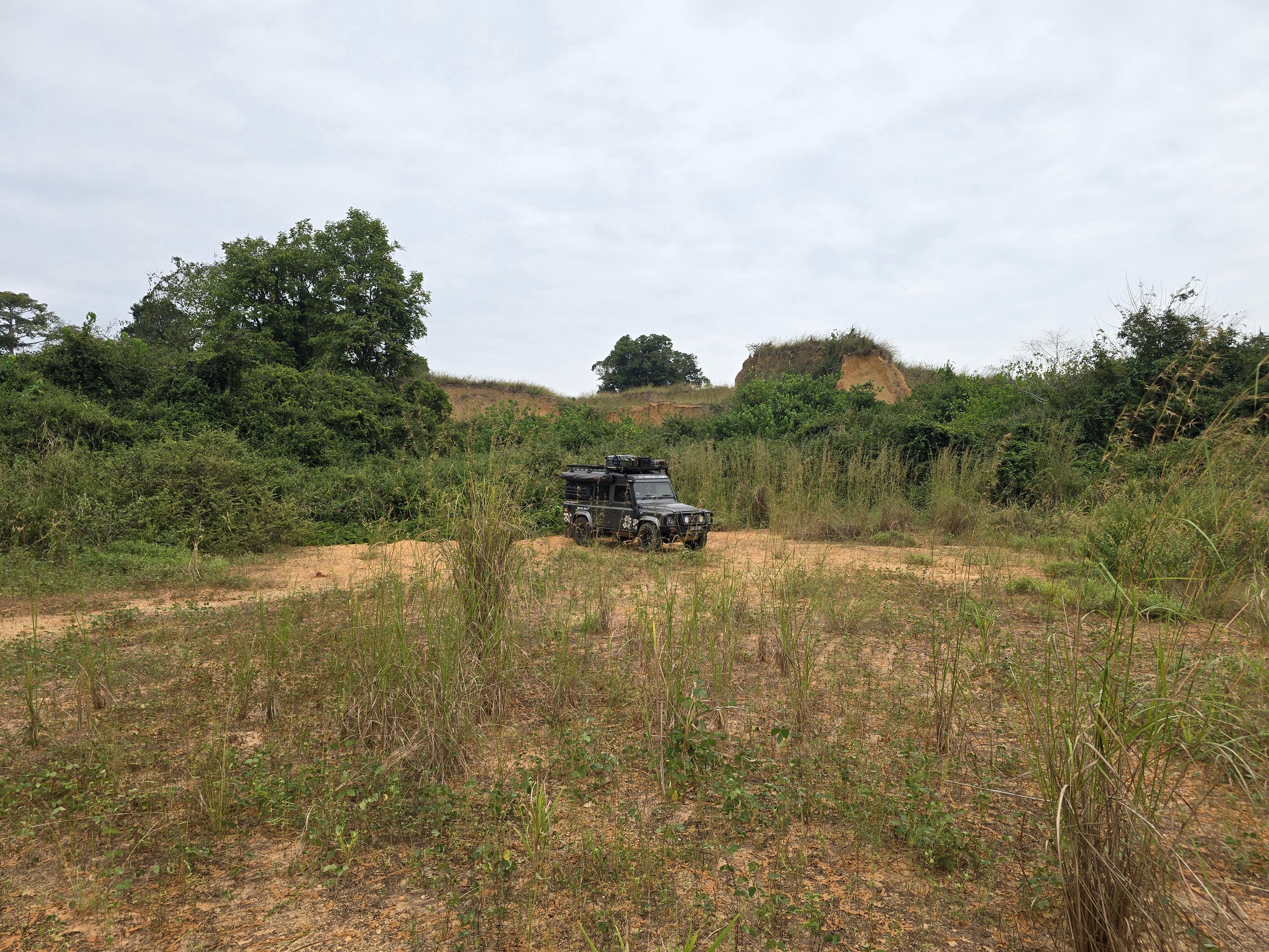
Crossing into the Republic of Congo marked our nineteenth African country. Around two-thirds of the ROC lies within the basin and most of its six million inhabitants are sensibly concentrated around the main cities. Away from these overpopulated hubs we were statistically more likely to encounter elephants or gorillas, although we did meet two overlanding Brits in an abandoned quarry. An implausible encounter to anyone unfamiliar with overlanding.
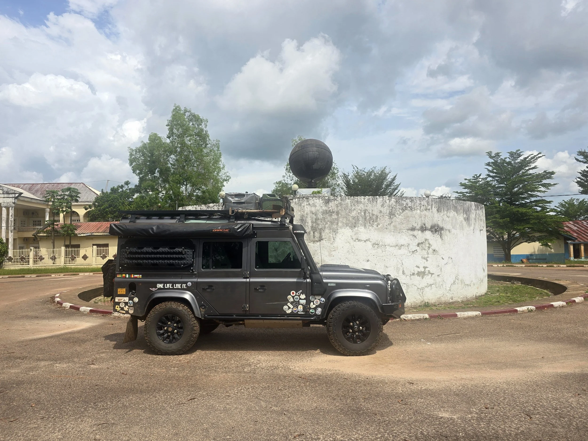
makoua, equator monument
Oil dominates the economy, but the steady stream of logging trucks, heavily laden with tropical hardwoods, was visible evidence of another valuable export heading towards distant markets. ROC’s largest customer is China, the relationship a classic African development trade-off: roads and investment on one side, dependence and resource extraction on the other. The dilemma is difficult to ignore, but as modern-day travellers we were definitely benefiting.
The smooth road carried us through an endless corridor of rainforest. A tiny detour allowed us to circle the equator monument a couple of times, but otherwise the view rarely changed as one hour stretched into the next. Thoughts wandered to European explorers, disappearing for years at a time into this malaria-infested wilderness, and we found ourselves admiring Stanley’s persistence. Whatever else history may choose to say about him, crossing the Congo Basin armed with little more than a notebook, a questionable map and a growing collection of increasingly unhappy porters was a level of commitment that deserves at least a passing acknowledgement.
We may well have mused longer on nineteenth-century exploration had the check engine warning light not illuminated prompting an unusually rapid response from Bob, who promptly dropped into limp mode.
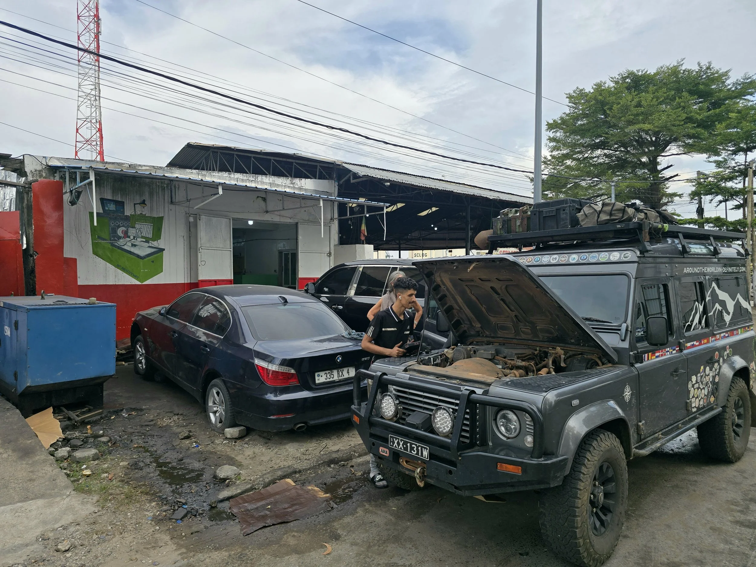
lebanese garage, brazaville
Our mechanical skills are embarrassingly pitiful. Yes, Bob is forcing us to expand our limited knowledge, but neither of us is particularly inclined and even simple maintenance, such as cleaning the air filter, often gets forgotten. Recalling recent weeks of dirty, dusty conditions, we were confident that we could fix our problem with a couple of hard slaps and a shake to the once-white filter, now bright orange and dense with trapped debris. Unfortunately, this achieved little beyond giving us something to do and, out of ideas, we averaged 40 kph over the remaining several hundred kilometres into Brazzaville. Finding a Lebanese garage owner armed with a diagnostic machine proved easy enough; a P0103-17 code - mass air flow problem – not so much.
What followed was a ritual that would be repeated at several garages in more than one country. Hoses were inspected, wiring was scrutinised, and the MAF sensor was cleaned and even temporarily replaced, but our problem persisted. Tired, increasingly irritated and no closer to a solution, we sought refuge in the only remaining diagnostic tool available: alcohol.
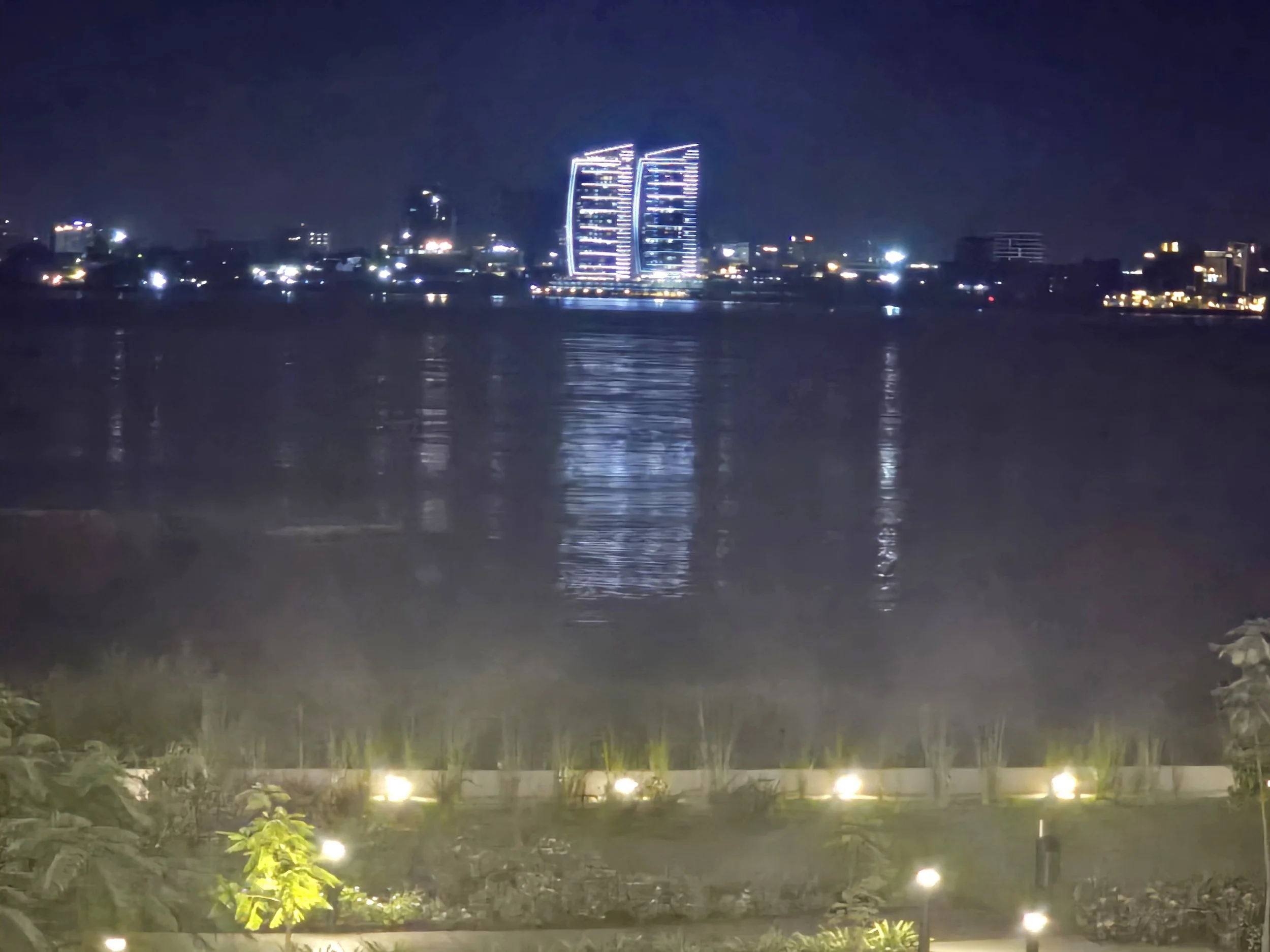
kinshasa, drc
Sitting on the terrace of the best hotel in town, looking across the Congo River at the twinkling lights of Kinshasa (capital of DRC), wasn’t the worst place to be, but dulling the frustration of our predicament with a stream of cocktails was going to be expensive. Pointe-Noire, Congo’s economic capital and largest port, promised a greater concentration of mechanics and short-lived hope.
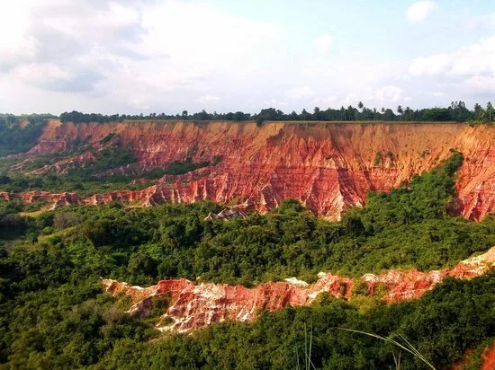
diosso gorge
The newly completed 535 km road linking the two cities should have been a delight as it wound through the Mayombe Mountains. The rainforest had been temporarily replaced with rolling, grassy savannahs and the dramatic steep-sided cliffs of the Diosso Gorge. But Bob was stubbornly remaining in limp mode, resulting in much of the journey being in second gear crawling up one steep ascent after another, a growing convoy of trucks behind us. Unable to reach Pointe-Noire in a day, we pulled into another abandoned quarry, this time finding a Dutch couple already installed. They had spent the previous night in a Brazzaville police station after being forcibly moved from their camping spot next to a local cemetery by gun-wielding officers.
Despite sharing our perhaps equally misplaced affection for Land Rovers, and spending well over an hour trying to find a solution, Bob remained stubbornly convinced that limp mode was the appropriate response to whatever was going on. There is a peculiar satisfaction in discovering fellow travellers whose experiences are every bit as testing as your own. Mutual sympathy was exchanged as another evening disappeared into a haze of alcohol.
Pointe-Noire’s garages proved no more successful, although one particularly determined French mechanic did manage to change the behaviour of the warning light (and associated limp mode) by applying duct tape to the wiring within the connection block. A brief burst of optimism.
Driving into Gabon was now too ambitious. One of the most heavily forested countries on earth, images of endless jungle roads through vast areas of remote and unpopulated regions, with the threat of heavy rain never far away were conjured up. Deciding on an easier option, we abandoned Bob in a hotel car park to reflect on his recent underperformance and flew in.
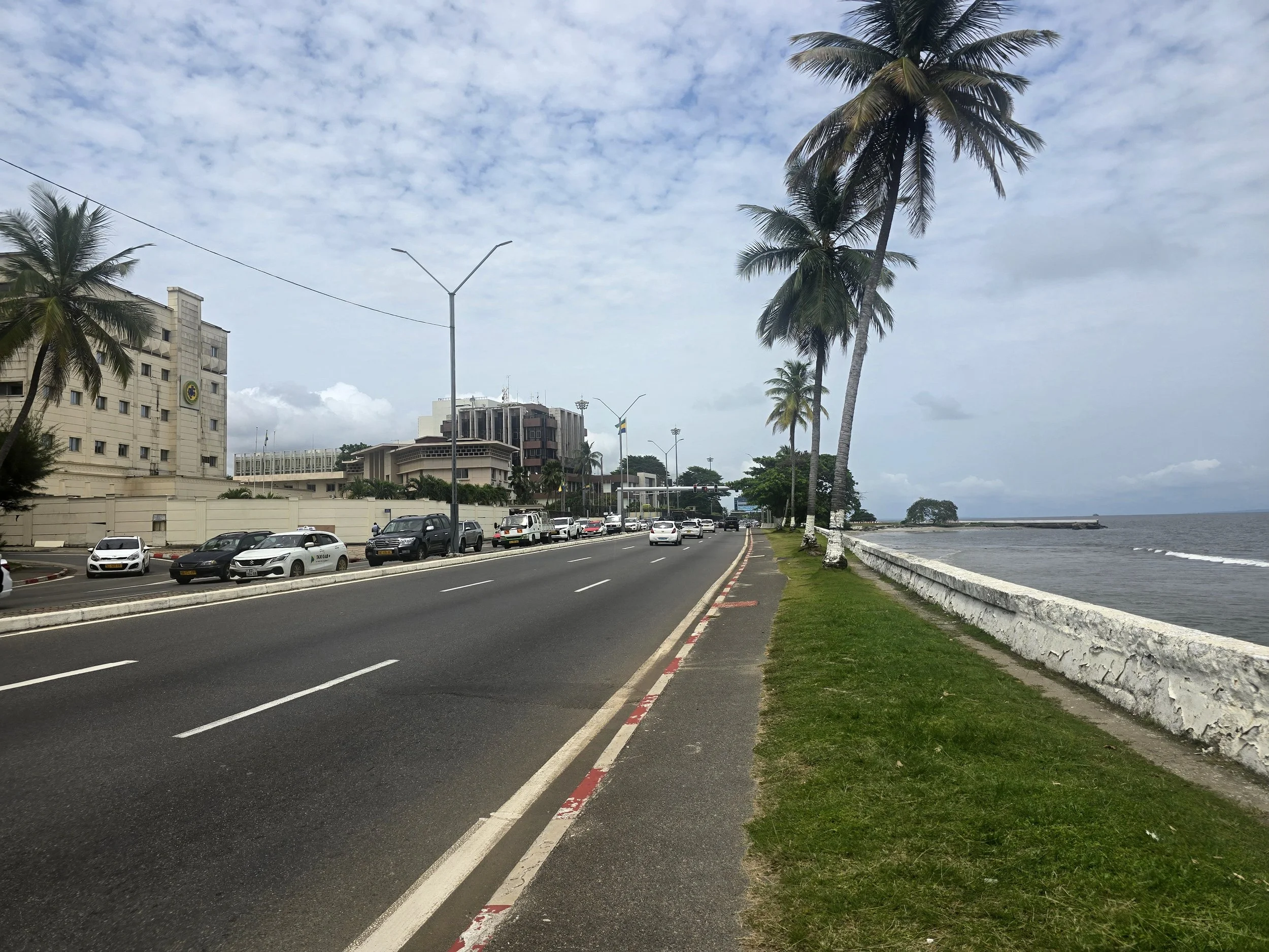
libreville, gabon
It took less than an hour to fly into the capital of Libreville, long enough to witness the endless carpet of forest below us and a feeling of relief that we weren’t navigating our way through it. Libreville, proved more pleasant than expected, once we escaped the airport; collecting our luggage took longer than the flight itself. Wide roads, lined with palms and flowering trees suggested a city designed by sensible civil servants with access to substantial oil revenues. It was clean and pleasantly functional provided you stayed clear of the overflowing pharmacies buckling under the demand for prescription drugs.
For more than five decades, Gabon was governed by two members of the same family. Omar Bongo and later his son Ali Bongo were widely criticised for corruption, authoritarianism and elite enrichment, but one decision the made has left a legacy. In 2002, Gabon created thirteen national parks covering roughly 10% of the country’s territory – an unusually ambitious conservation effort by any standard, let along in Central Africa.
The result is one of Africa’s most intact natural environments. Vast areas of rainforest remain protected, providing habitat for forest elephants, gorillas, chimpanzees, and countless other species. As the world has become increasingly concerned with climate change, Gabon has found itself in the unusual position of being valued not only for its oil but also for its trees, the forests absorbing more carbon than the country emits.
The downside is accessibility. Many of the parks are extremely remote and infrastructure remains limited. Reports from fellow overlanders swung between an inability to reach some of the parks or disappointment at the management, or lack of, when they did.
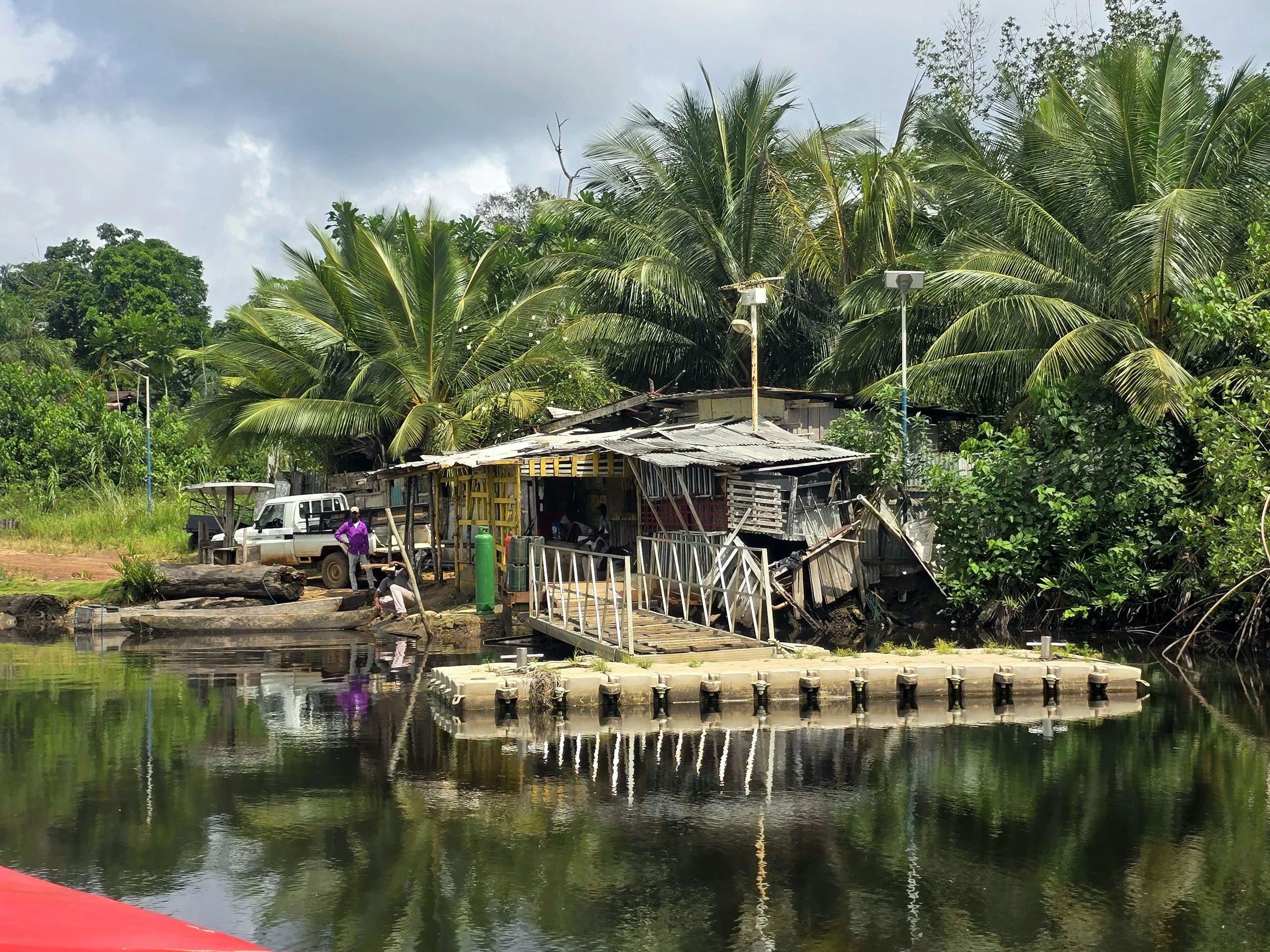
Without wheels, our own solution was considerably less adventurous. A ninety-minute boat ride from Michele Marina carried us across the Komo estuary, followed by a forty-five-minute journey in an open-sided safari truck to Chez Beti, a beachside rustic eco-lodge on the edge of the Nyonie region.
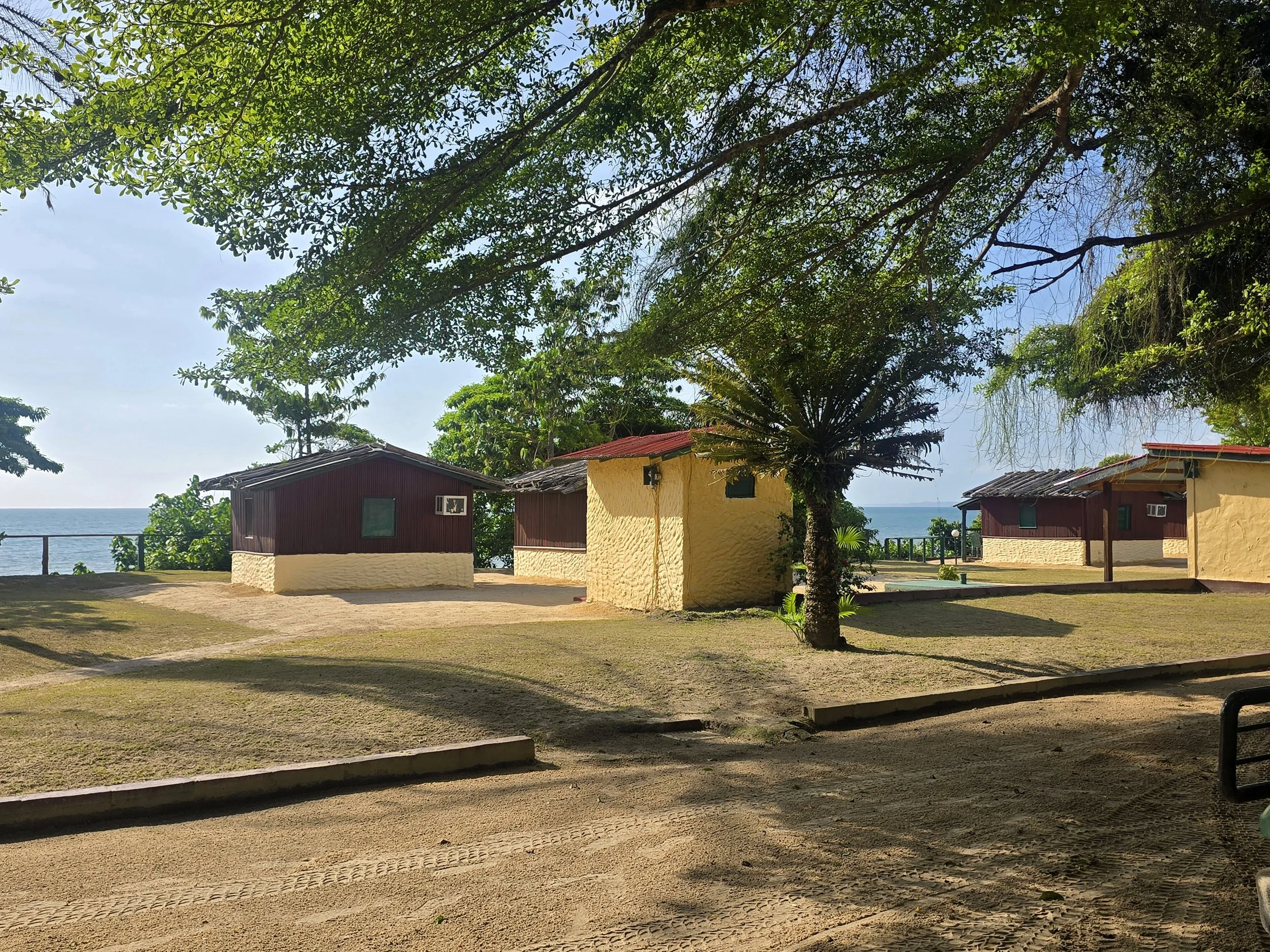

The lodge was run by Beti, a food loving Frenchman who embodied several national stereotypes simultaneously. Each mealtime, guests (mostly Gabon ex-pats) gathered around a communal table where excellent food, unlimited wine and generous spirits flowed with reassuring consistency.
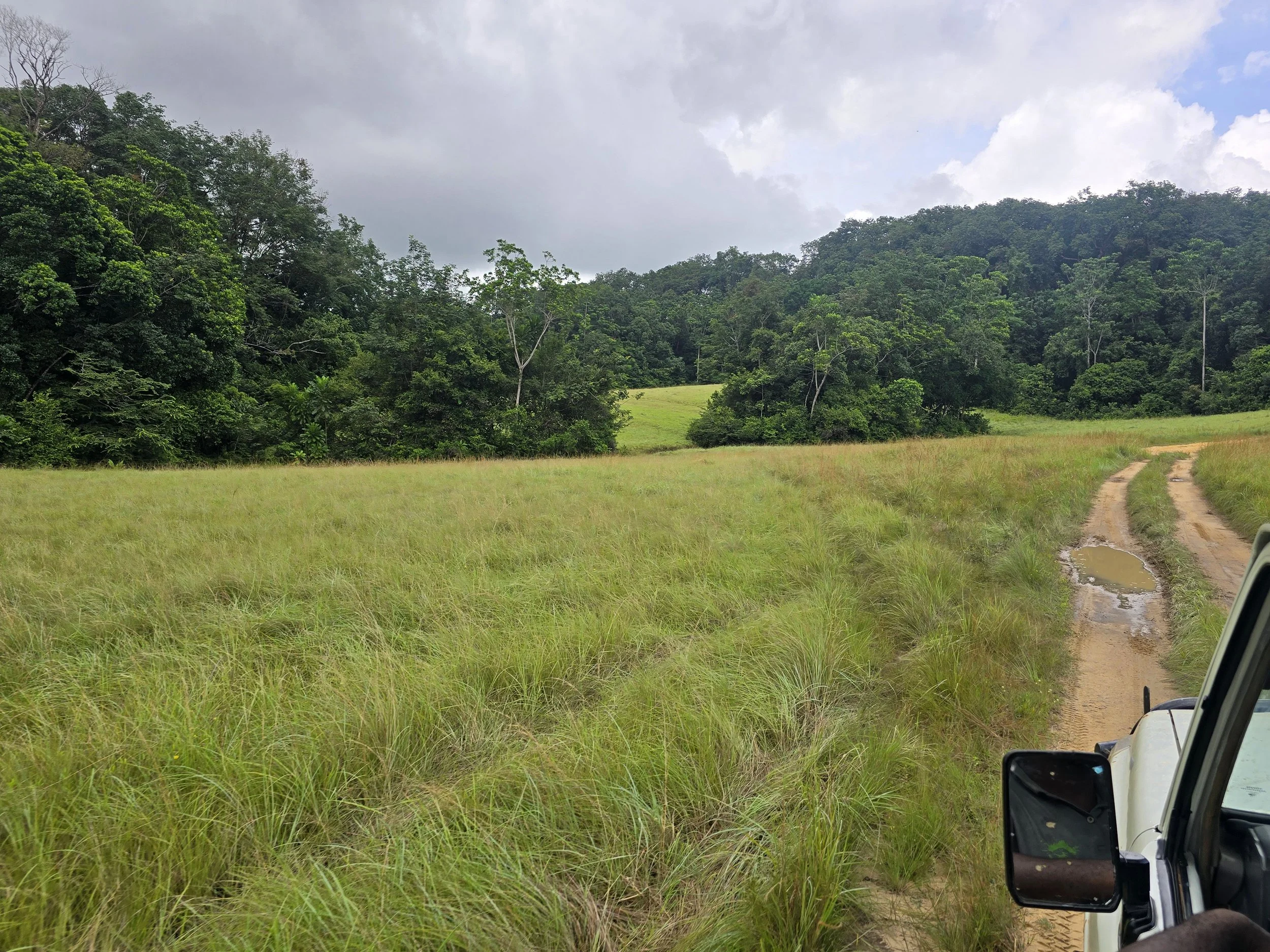
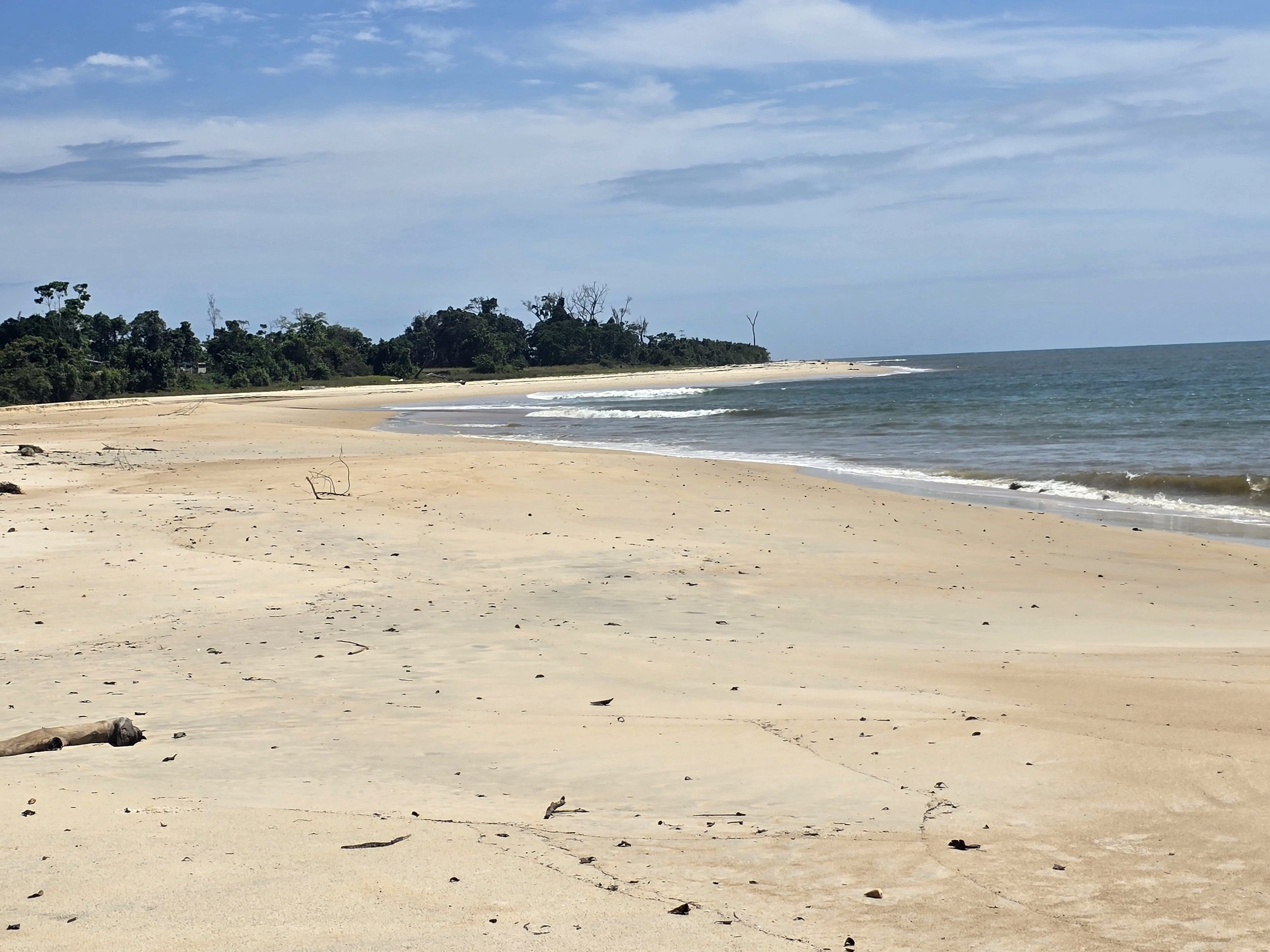
Wildlife sightings were mixed. Elephants and buffalo proved reasonably cooperative, gorillas and leopards remained committed to maintaining their reputations for rarity. It hardly mattered. On the edge of the Wonga Wongue National Park, the setting was extraordinary: pristine beaches, wide open savannah and dense equatorial forest all combined in a landscape that felt almost untouched. It would have been easy to stay longer but another flight awaited.
sao tome
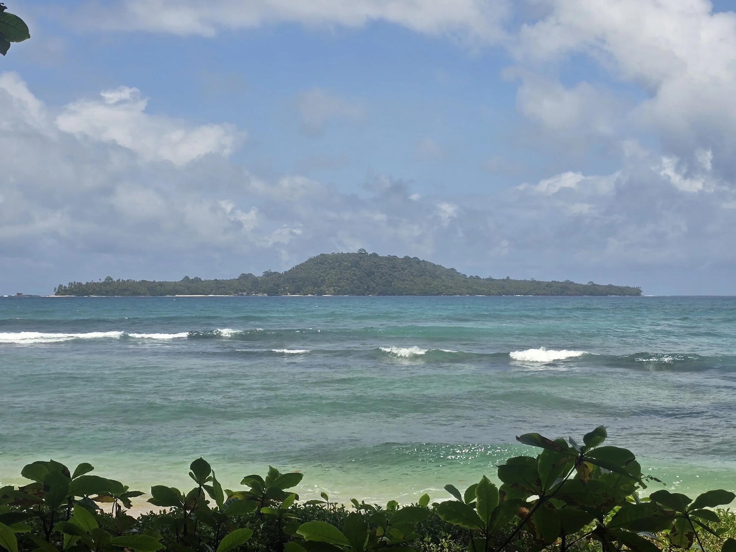
Some 200km off Gabon and almost exactly on the equator, Sao Tome and Principe form Africa’s second-smallest nation after the Seychelles. Having been assured that we could transit back through Libreville and onward to Pointe-Noire without the inconvenience of another visa application, we boarded the plane before anyone had the chance to reconsider.
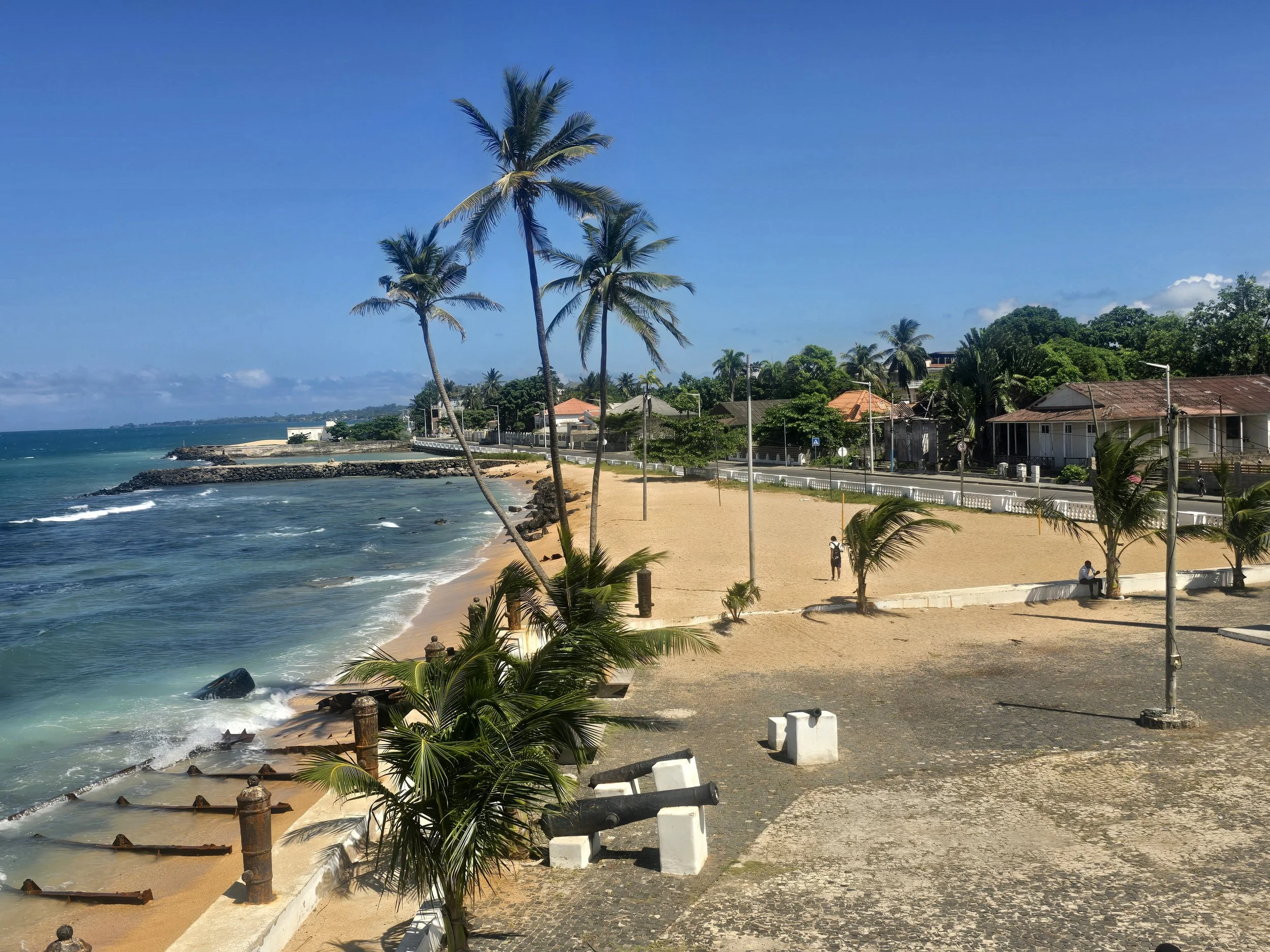
Landing on Sao Tome - the larger island, home to most of the country’s 200,000 inhabitants and named after the doubting apostle – we found a capital draped around a picturesque bay. Some colonial buildings, such as the Presidential Palace, retained a degree of faded grandeur; but most were dilapidated and boarded up. None of the ATMs were prepared to dispense cash, a recurring African problem for which Euros remain an effective cure.
ilheu das rolas, sao tome
The compact National Museum occupied a squat coastal fort and offered a concise history of the islands. Outside stood statues of the Portuguese explorers who arrived in 1471 to discover an uninhabited paradise and immediately set about importing sugar cane and slaves. Nearby was a bust of Amador Viera, who led a major slave revolt before being captured, hanged and quartered and remains one of the country’s national heroes.
Our self-guided tour was brief. One room celebrated cocoa, which transformed the islands into the world’s largest producer in the early twentieth century and earned them the nickname: “The Chocolate Islands”. Another displayed colonial furniture. A third, showed grainy photographs of tortured Black Africans, providing a less comfortable reminder that, even after slavery was abolished, plantation labour remained a decidedly unpleasant occupation
Scattered across the island are around 150 former rocas – vast colonial plantation estates that once functioned as self-contained miniature towns. Some have been restored as boutique hotels and restaurants, others are still inhabited, despite their crumbling state, by the descendants of indentured labourers, but most sit abandoned, slowly disappearing beneath the jungle they once displaced.
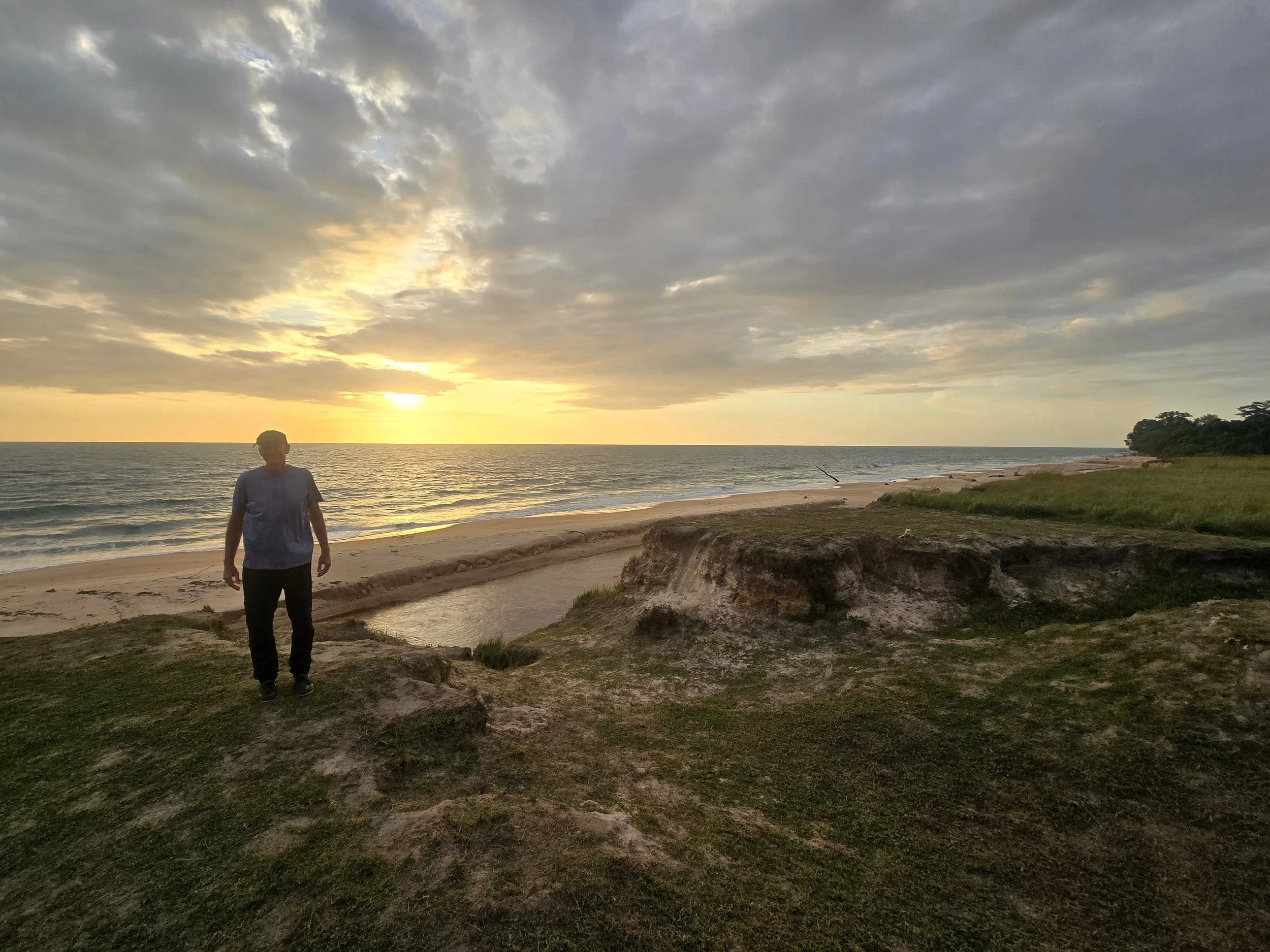
Driving around the island on potholed roads, we saw derelict villas, collapsing jettioes, baobabs, coconut palms and brilliant turquoise bays where fishermen bobbed in dugout canoes. The further south we travelled, the more the island seemed to relax. By the time we reached the southern tip, the local philosophy of Leve Leve - “take it easy” - seemed entirely logical. After sufficient quantities of sweet palm wine, it was difficult to argue for any alternative.
another equator marker
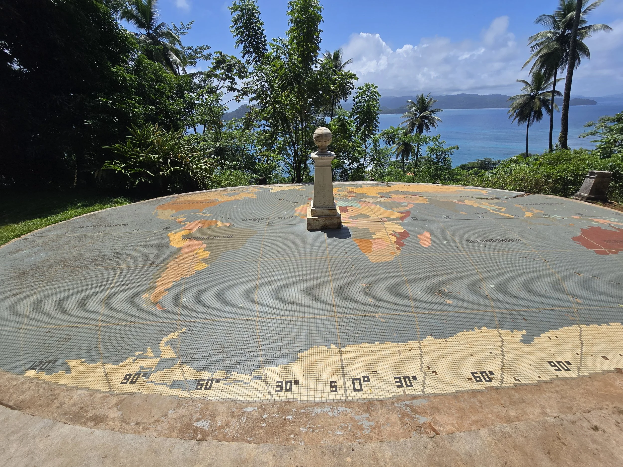
A short boat trip over the crystal-clear waters of the Atlantic deposited us on the sandy shores of Ilheu das Rolas, a tiny, 2-square kilometre islet straddling both hemispheres. Here a short but sweaty climb led to the Equator Monument, a giant mosaic world map built by Portuguese naval officer and explorer Gago Coutinho.
Before becoming one of the first people to fly across the South Atlantic in 1922, Coutinho had also completed the first recorded ascent of Pico do Sao Tome. Rising to 2,024 metres, the peak supposedly resembles a clothes iron, although this is difficult to verify since its summit spends much of its life concealed beneath a dense cloud layer known locally as leite de vaodor – flying fish milk.
pico sao tome
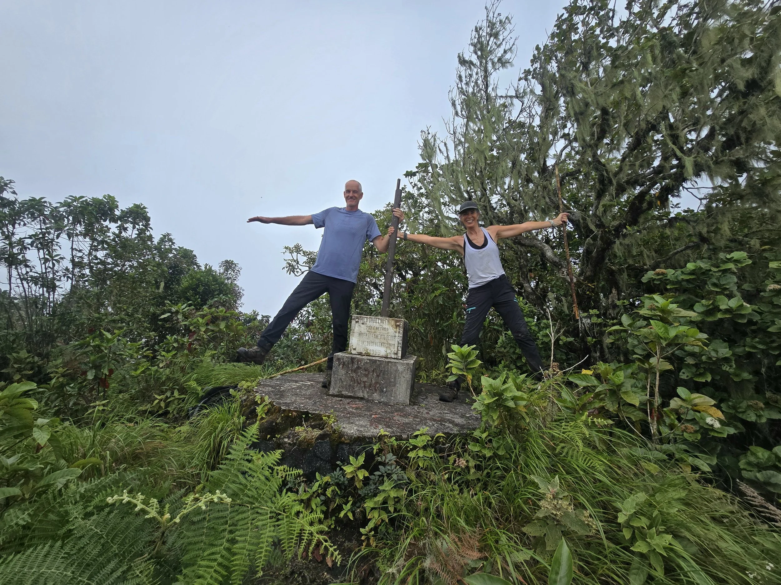
Naturally, we decided to climb it. Two local guides arrived at our lodge the following morning, slightly late but cheerful enough to be forgiven. The standard trek takes two days, with a night spent camping near the summit. Going against sound recommendations, we elected to climb and descend in a single day.
The first couple of hours passed pleasantly enough through cocoa and banana plantations before the trail entered primary rainforest. Giant ferns, tangled lianas, orchids and towering trees closed in around us. The Mona monkeys crashing through the canopy overhead were a much more reassuring sight than Sao Tome’s infamous three metre Cobra Preta, whose bite reportedly gives victims roughly two hours to find anti-venom before fatal paralysis sets in.
We reached the summit shortly after midday. The final approach,m a scramble along a narrow ridge, clinging to roots and negotiating steep drop-offs. After all that effort, the summit rewarded us with a chipped concrete marker and absolutely no view whatsoever, the flying fish milk lapping at our feet.
tiny plane to principe
Our descent coincided with heavy rain. The degree of protection provided by the forest canopy wasn’t sufficient to prevent all of us sliding downhill in a series of increasingly undignified manoeuvres. With latitude coordinates of 0° 16' 10'', it was pitch black by 6pm and our last hour was an undignified stumble by phone torch. Only once we were safely back at the lodge, opening a bottle of vinho verde, did we conclude that the one-day excursion had been a good idea.
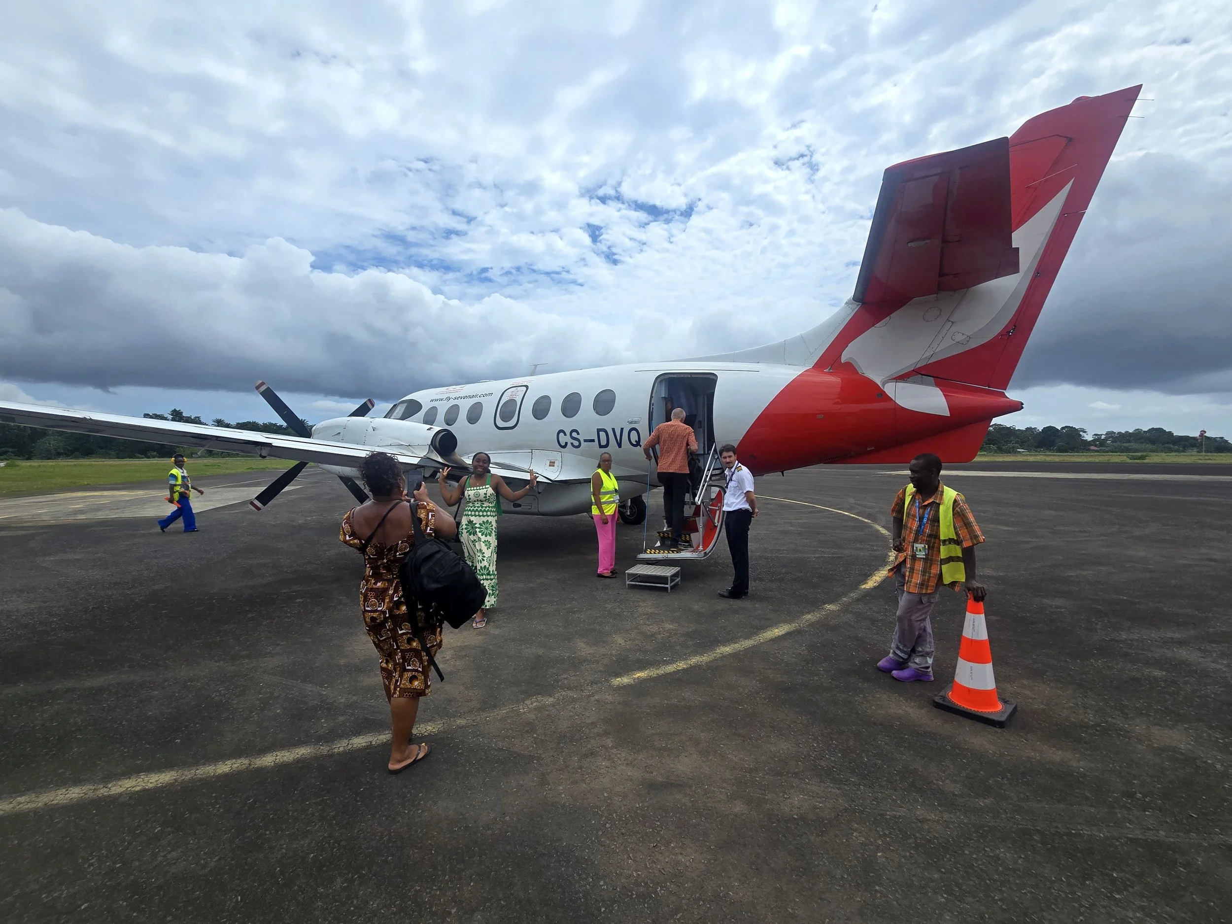
Any ambitions for further strenuous hiking were abandoned the following morning. Instead, we flew to Principe, the smaller island, 160km to the northeast. Home to fewer than 9,000 people, it is only 15 km long and possesses an airport so compact that disembarkation, immigration and exiting of the terminal took less than five minutes.
sundy praia, principe
Our accommodation was at one of several resorts owned by South African tech entrepreneur and astronaut Mark Shuttleworth. According to local lore, after spotting Principe’s green dot from his rocket, ‘the Man in the Moon’ decided to live there. His company HBD Principe - “Here Be Dragons” – now employs most of the population.
Back in Pointe Noire, no miracle had materialised and Bob was still seriously underpowered. Having exhausted all the mechanics within a decent radius there was nothing for it but to continue – slowly. Our route now would take us into from the ROC into Cabinda (Angola), across a sliver of the DRC and finally into Angola proper.
fuel shortages
Cabinda is one of Africa more peculiar geographical arrangements: a small piece of Angola that isn’t actually connected to the rest of Angola. Marooned between the two Congos and sitting atop an inordinate quantity of oil, it is a highly militarised province. Armed soldiers were managing long fuel queues and stopping part way across a sandy plain for a pee we were a bit alarmed to hear gunfire close by. Five minutes later we passed a group of guys in army fatigues apparently on maneouvres, although with one of them with his pants around his ankles, the nature of the exercise remained unclear.
camping drc
The Democratic Republic of the Congo is large enough to be its own continent. Nearly four times the size of Western Europe, it contains well over 100 million people, hundreds of ethnic groups, countless languages and enough minerals to make multinational corporations weak at the knees.
The east of the country remains highly insecure, with armed groups ensuring it features prominently on most foreign ministries’ lists of places best admired from elsewhere. Our intention was therefore simple: hug the western edge and escape into Angola as efficiently as possible.
Our route led inland and we re-entered rainforest-clad hills. Progress was again slow which meant that we had to spend the night beside the road not far from the border. Apart from trying to decipher a road tax system involving the purchase of multiple tickets which were randomly collected at armed checkpoints, our passage through western DRC was gratefully uneventful. The border, however, was another matter.
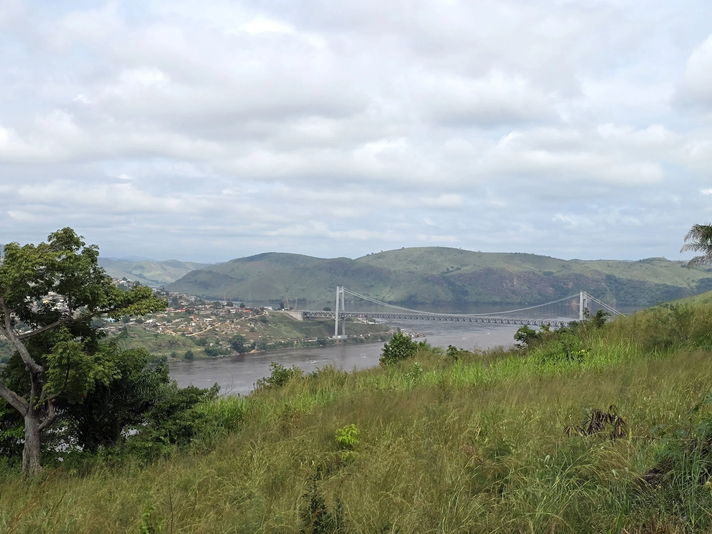
matadi bridge, drc
We had the choice of two possible crossings into Angola: Matadi/Noqui and Lufu/Luvo. The latter involved a longer detour but promised better roads. Both required passage through Matadi, the last major navigable point on the Congo River. Still undecided, we crossed the Matadi Bridge, a 520 metre suspension span that held the title of Africa’s longest bridge of its type for twenty-five years before Mozambique’s Maputo-Katembe Bridge stole its crown.
Prepared for the well documented chaos of Matadi, it appeared that we had arrived on one of its quieter days and we arrived at our crucial junction far sooner than anticipated and, making the sort of snap decision that usually precedes an inconvenience, ignored the turn towards Noqui and continued straight ahead.
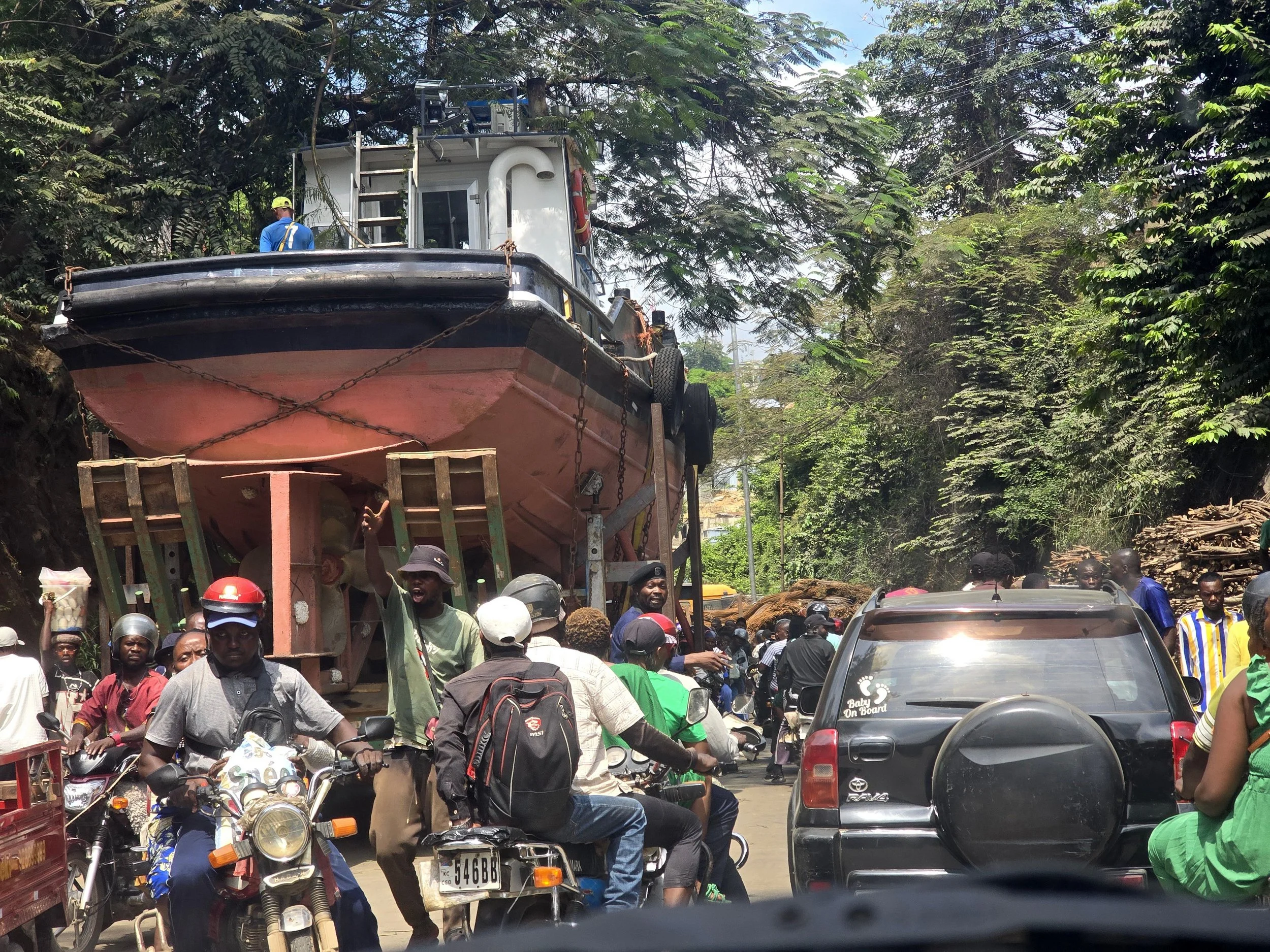
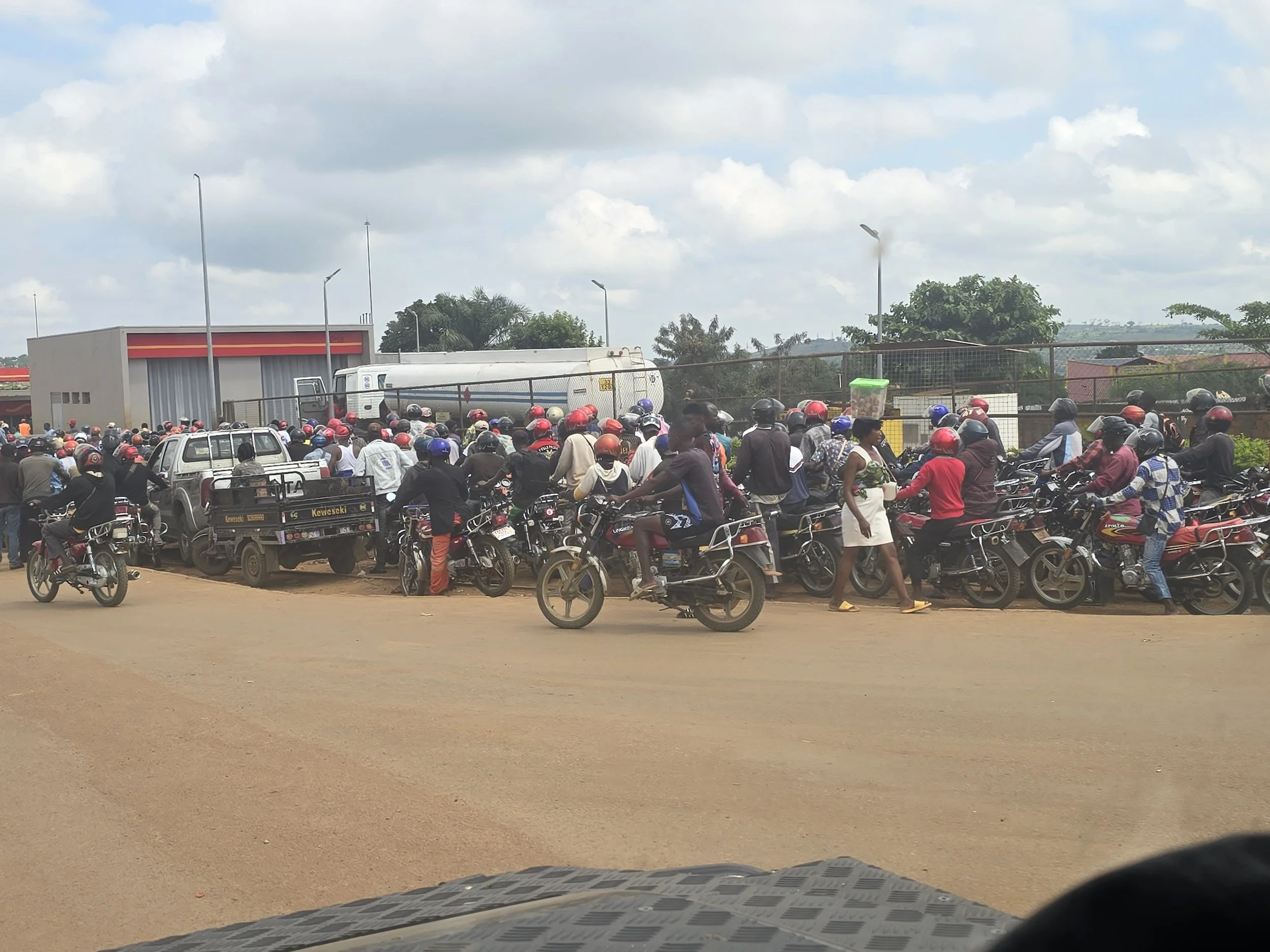
matadi traffic
Five minutes later we were stationary, literally swallowed up by an impenetrable mass of trucks, cars and enough motorbikes to fill several football stadiums. Previously wide, level roads, had narrowed into steep streets and the traffic stretched uphill as far as we could see. We progressed in inches, enduring regular abuse from motorcyclists for offences that appeared entirely imaginary, and performed one breath-holding hill start after another. We thought the worst of it was over when we managed to get past the enormous boat that one truck was trying to get to the top of the hill but it took another couple of hours until everyone fell away and we were once again alone, surrounded by the forest.
Judging by the queue of freight trucks outside immigration, Lufu-Luvo was clearly a busy commercial crossing. But, immediately noticed, formalities were completed quickly providing some vindication for our choice. Then, just as we were preparing to drive through the barriers separating us from Angola, an armed guard appeared and instructed us to wait.
All traffic was halted. As was the growing crowds of pedestrians gathering near the barriers. Before long, men draped in flags and shouting through loudhailers arrived, prompting considerably excitement amongst the assembled masses. Several surges towards the border followed, each repelled by a collection of police and army armed with rifles and sticks.
The immigration office was being closely guarded and pressed up against the outside wall looked to be an optimum position as we repeatedly attempted to persuade officials that, as entirely uninvolved foreigners, it would be better if we were allowed through. Regardless of whether or not our requests were understood, the answer remained a firm no.
After about an hour, whatever demonstration, rally or disagreement was going on, appeared to lose momentum. Not hanging around for a resurgence, or permission, we climbed back into Bob and rolled quietly towards the middle of the concourse just as the barriers were lifted. Angola here we come!