Benin & Nigeria

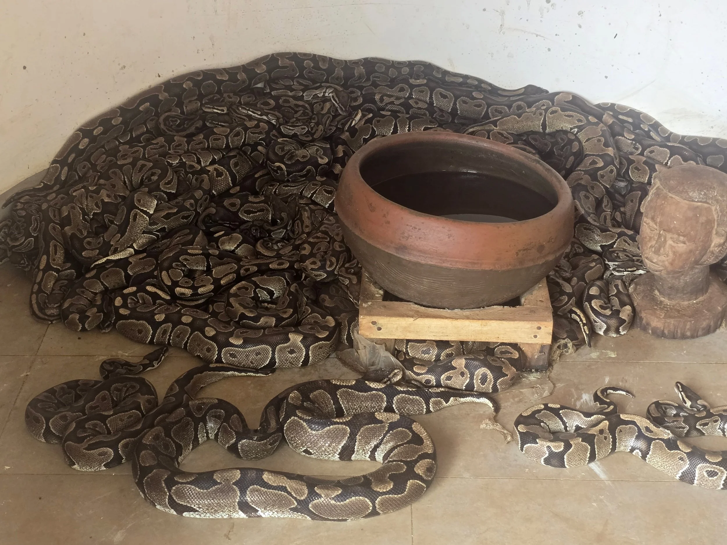
sacred pythons, benin

Our timing at the Tohoun border into Benin was a little unfortunate.  We pulled up behind a bus heaving with locals but, being embarrassingly white, were quickly ushered into the VIP room where we sat on a cracked sofa listening to the dying floor fan as our passports were processed and numerous ledgers laboriously filled in. 

It was a three-hour drive to Cotonou, not the capital (that honour belongs to Port Novo), but very much the economic centre.  From here we flew to UK for routine medical check-ups and to acquire a mini Starlink.  We had chosen to fly out of Benin due to the ease of re-entry; a refreshingly efficient evisa platform at a cost significantly lower than some of its neighbours.  As it turned out there were other advantages that we hadn’t been aware of.

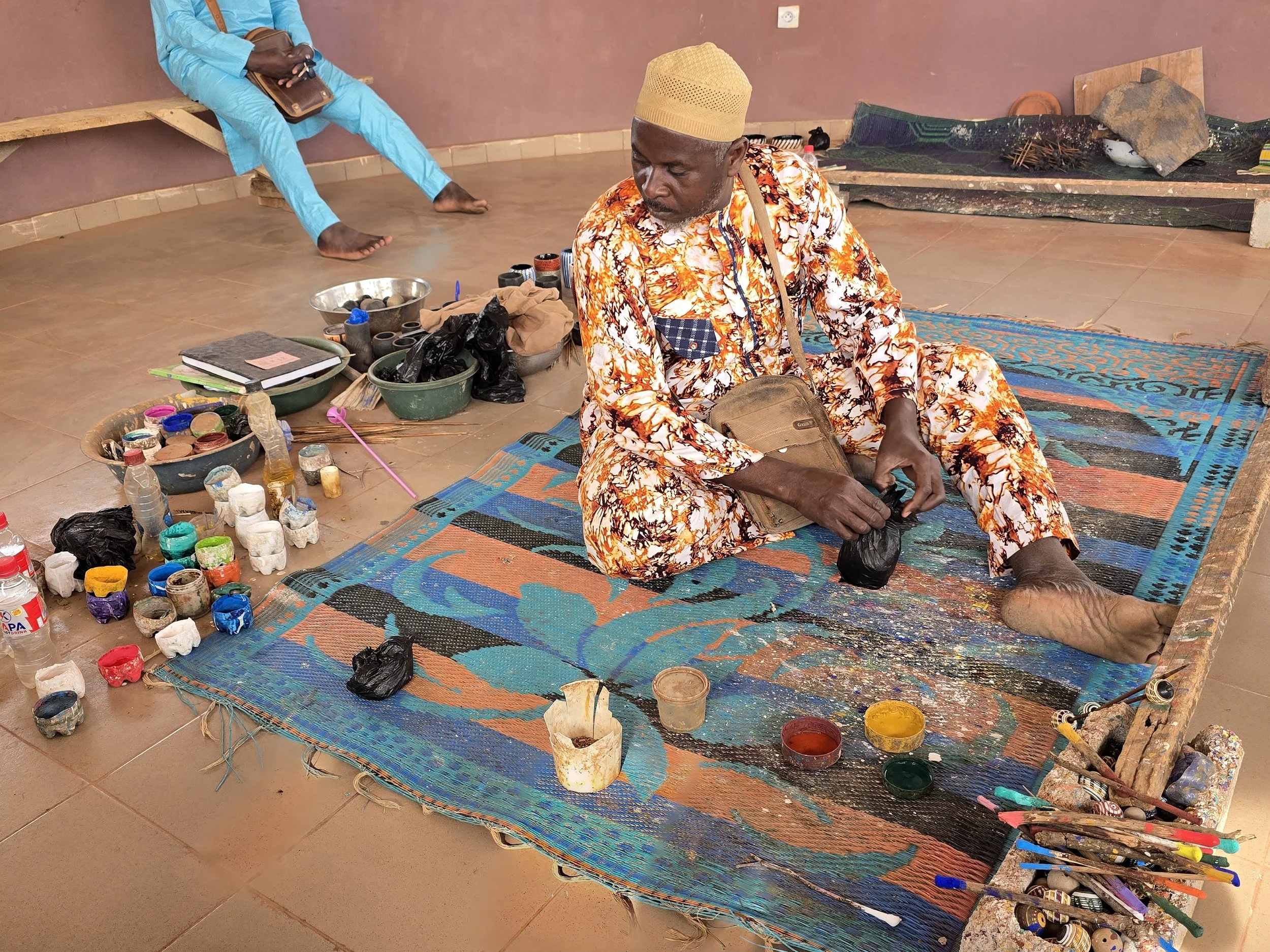
voodoo fettish market

Since taking office in 2016, President Patrice Talon – who made his fortune in cotton and apparently has more money than most people could spend in several lifetimes – has pushed economic reforms and modernization.  Roads have improved, the port has expanded, industrial zones have appeared and more than 1,600 km of solar street lighting is well underway.  The renovated airport handles fewer than half a million passengers a year and was so quiet that, on our return, had we not left one of our bags to continue a leisurely solo tour of the carousel, we would have been sat in a taxi within ten minutes of landing.  The taxi drive just 10 minutes to the main hotel area.   

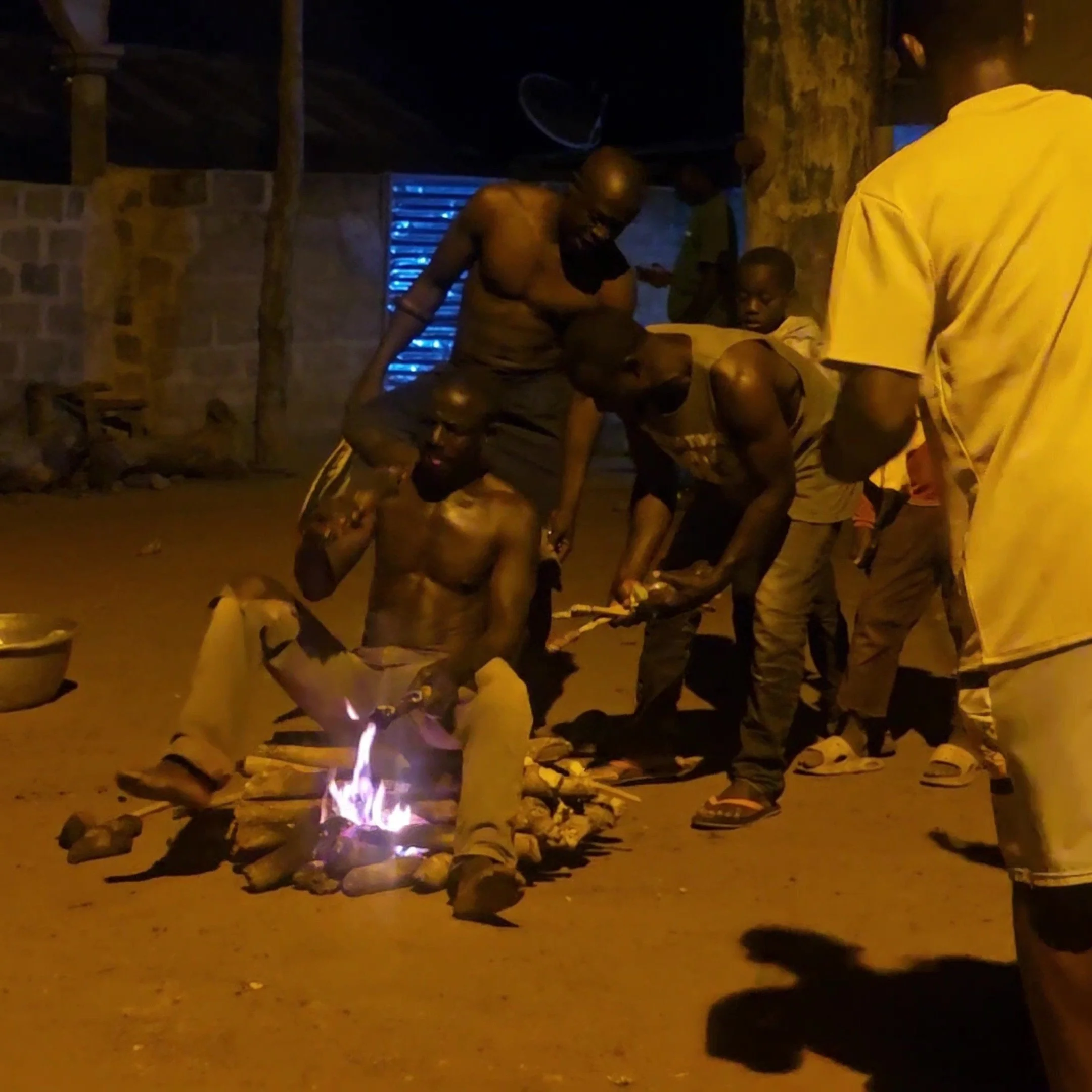
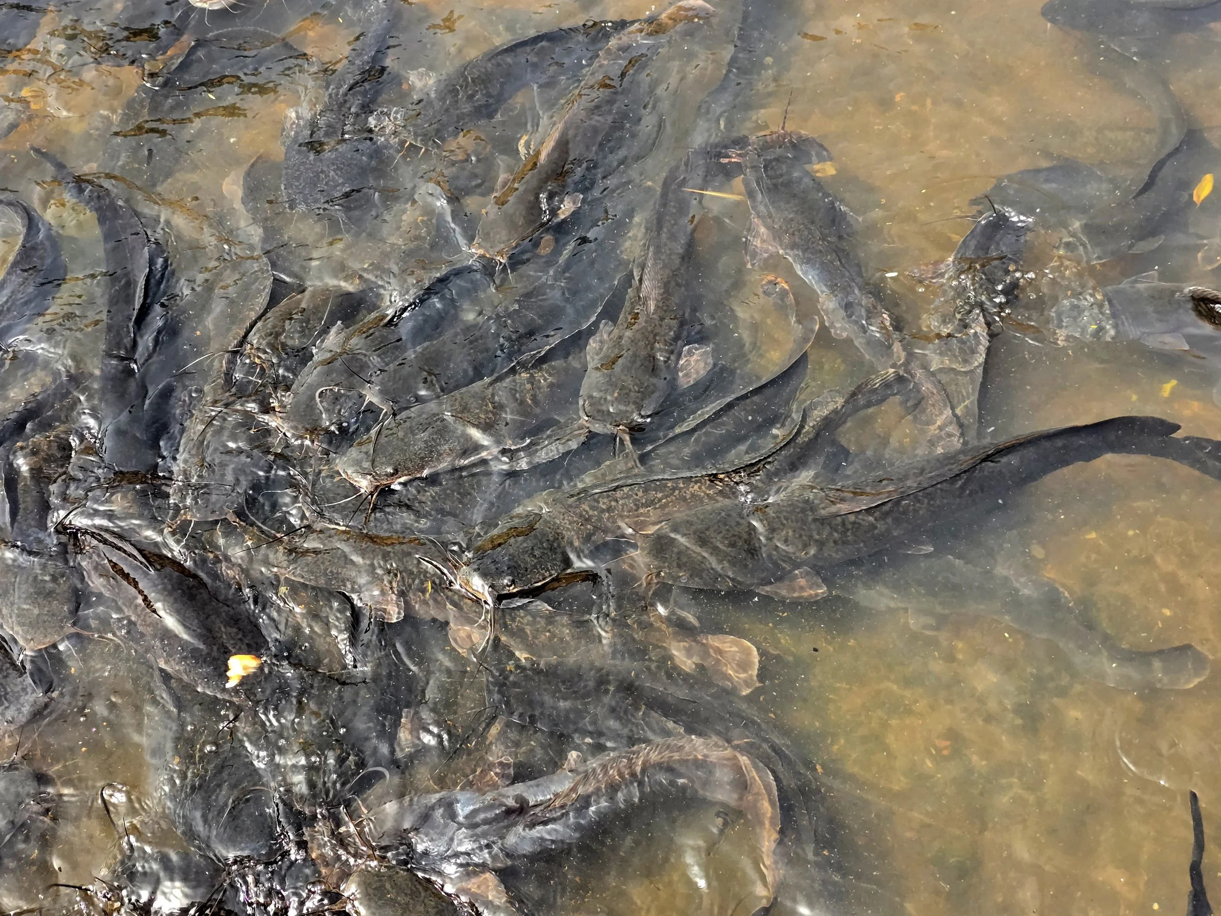
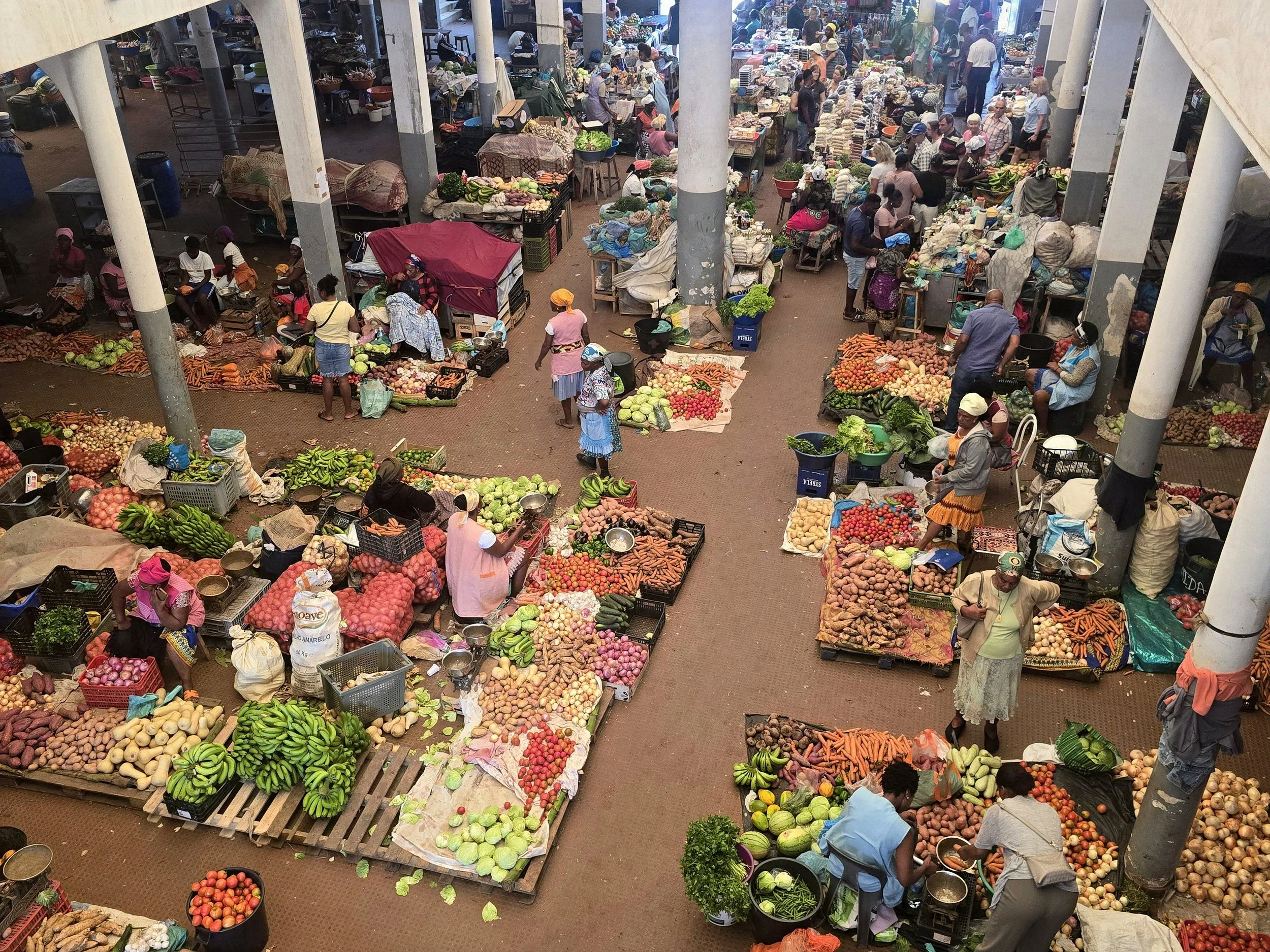
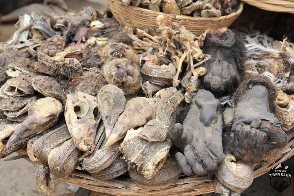
Modernisation aside, Benin has long been “the spiritual centre of Vodum”.  More than a religion, Vodun is a worldview encompassing art, medicine, music and philosophy.  A  trip to the local market just as likely to be for a dehydrated bit of crocodile snout, a hippo’s foot or a pigs’ penis as for a couple of onions and a kilo of rice.  Whether voodoo dolls exist remained unclear, but a temple writhing with sacred pythons and a reading from a Fa priest proved an effective introduction to a religion followed by over 60% of the population.
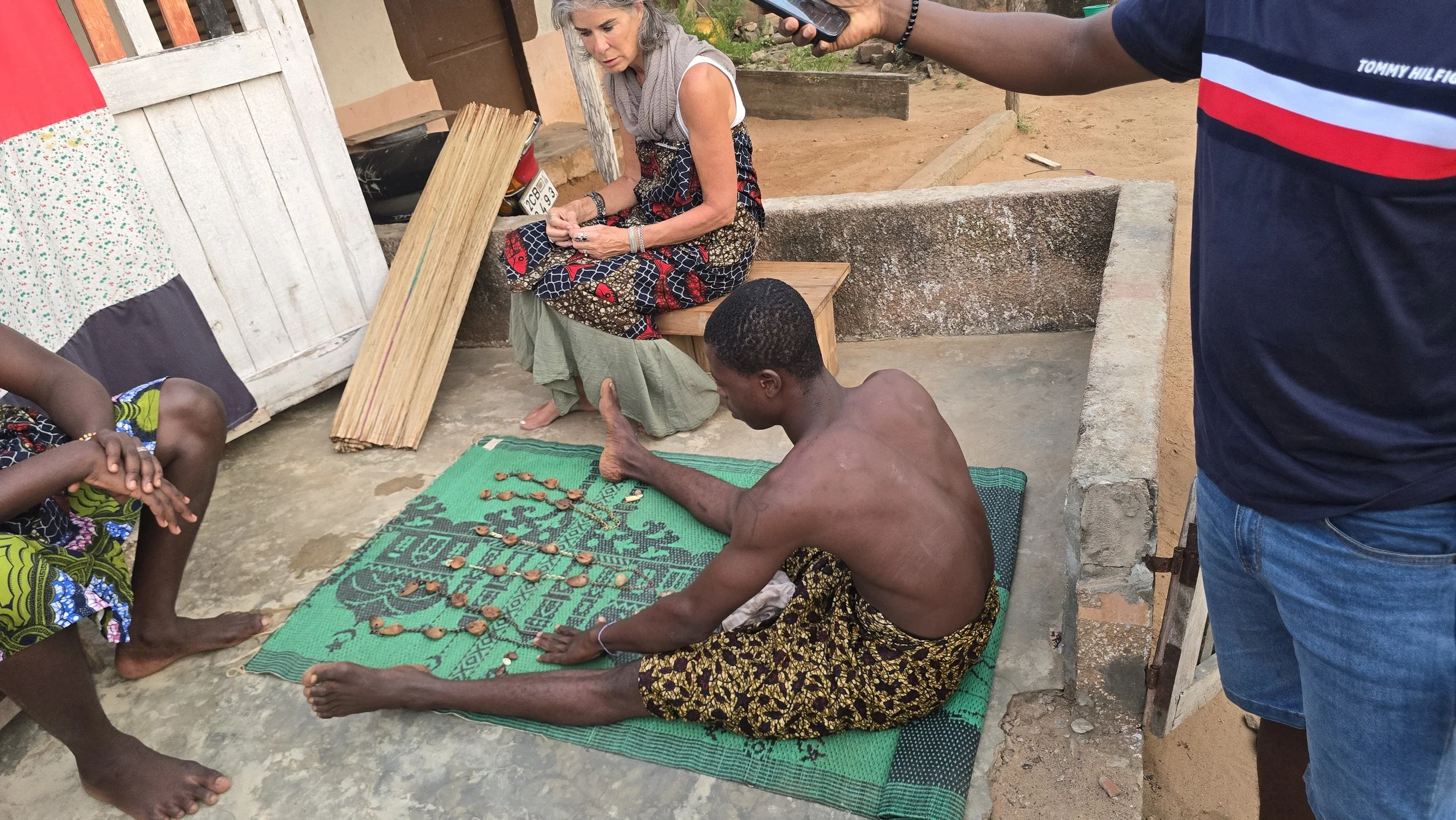
fa priest reading

Sitting outside a small, whitewashed hut, I watched as an apprentice priest swirled his strings of eight wooden beads while murmuring invocations.  The lay of the beads once cast onto the ground were supposed to reveal answers to any problem I might have.   Perhaps I should have paid for the fully qualified version as, after several inaccurate attempts at identifying what my problem was, it was suggested that the best way forward would be to pay for some chickens, soft and hard drinks (presumably enough for a community party), after which a blessing could be bestowed upon me.  Sensing an attempt to take advantage of my deep-rooted issues, I declined as politely as possible and we quickly withdrew before any dolls could make an appearance. 
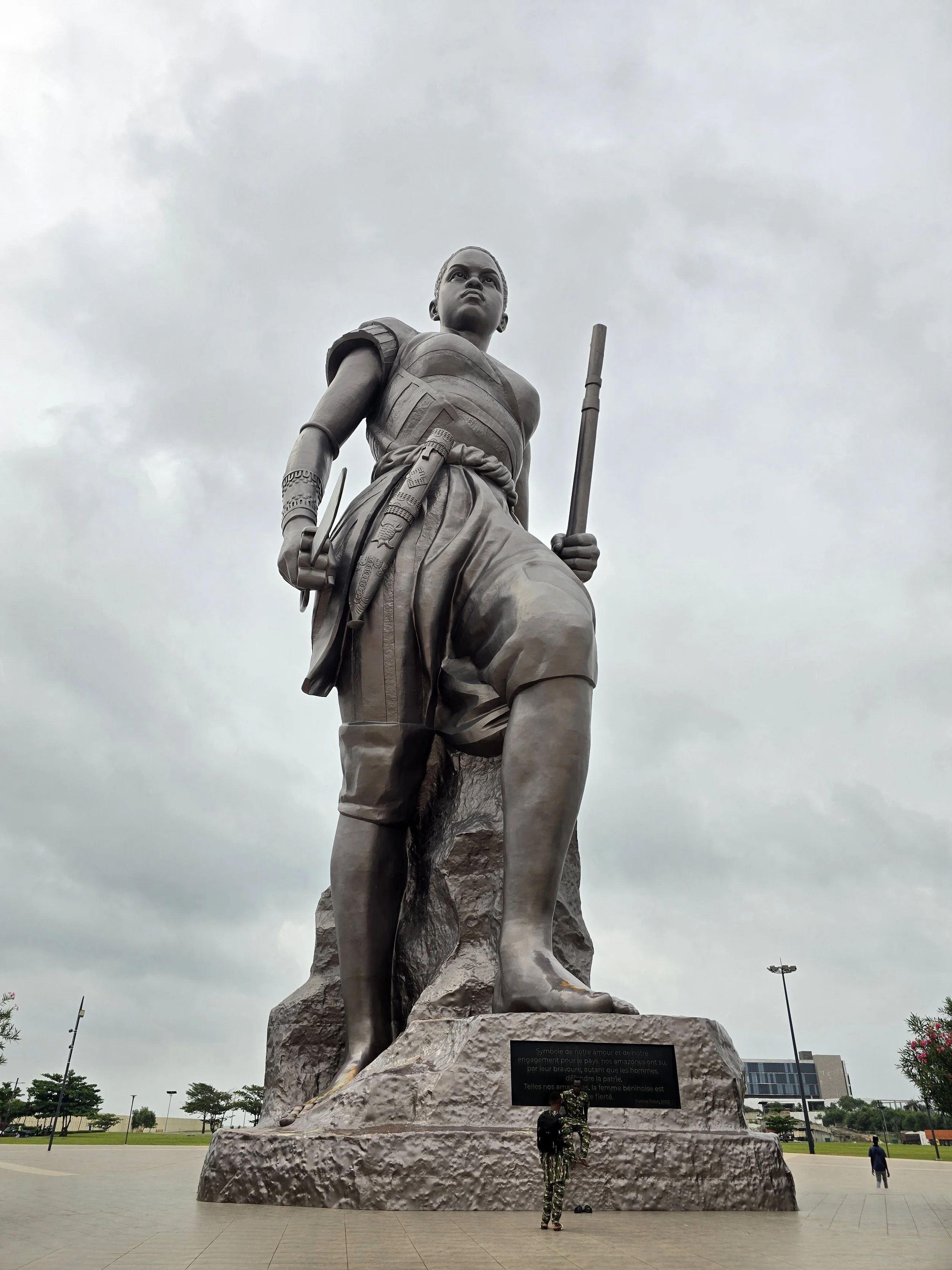
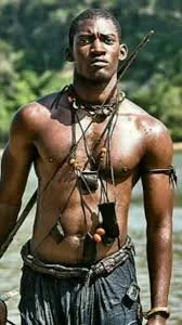
amazon soldier

As part of the on-going modernization, a large modern square now stands where an estimated 1 million slaves were sold before being shipped overseas.  Bronze sculptures (not yet unveiled) do their best to portray the horrors that took place under the watchful eye of Dom Francis de Souza, the most powerful slave trader on the West African coast.

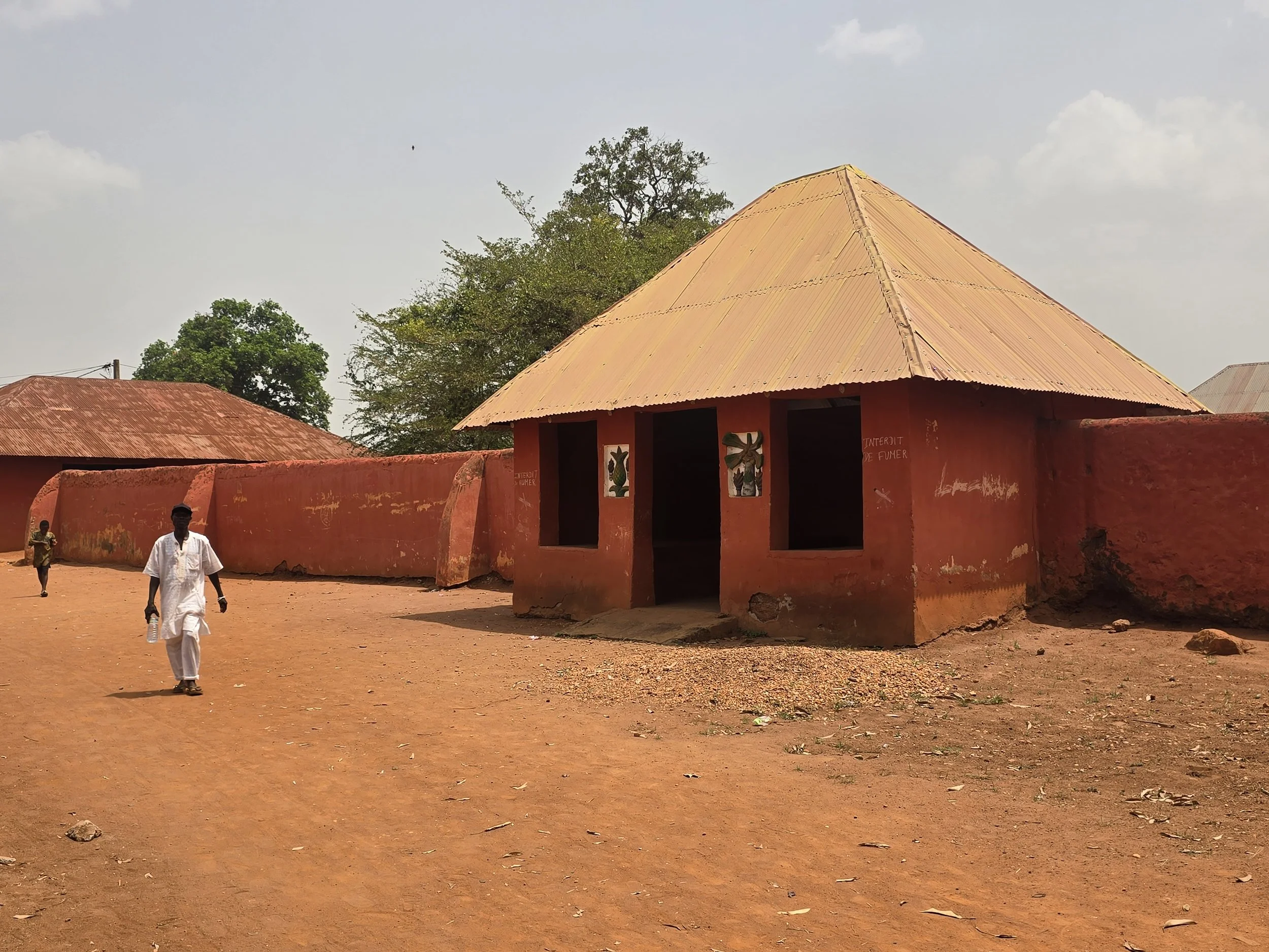
dahomey palace, abomey

The slave trade was prolific in Benin, fueled by the powerful Kingdom of Dahomey which supplied victims from regional wars.  Between the seventeenth and nineteenth centuries the Kingdom dominated the region.  From the capital at Abomey, a succession of kings ruled from a sprawling complex of mud palaces that covered an area of 40 hectares and housed a court of around 10,000 people.  Two surviving 19th-century Unesco-listed palaces are still there, as is the arena where the elite corps of female soldiers’ - the “Amazons” - trained. 

Twelve kings ruled over roughly 250 years and, if the stories are accurate, displayed some unusual eccentricities.  Harems overflowed with thousands of wives, servants were neutered, thrones were mounted on the skulls of defeated chiefs, and a royal flywhisk was assembled from a human cranium attached to a horsetail.  Kings were buried with two wives and considerable treasure, the grave diggers were killed to protect the burial location and if the executioner failed to remove a head with a single swipe he was also dispatched.

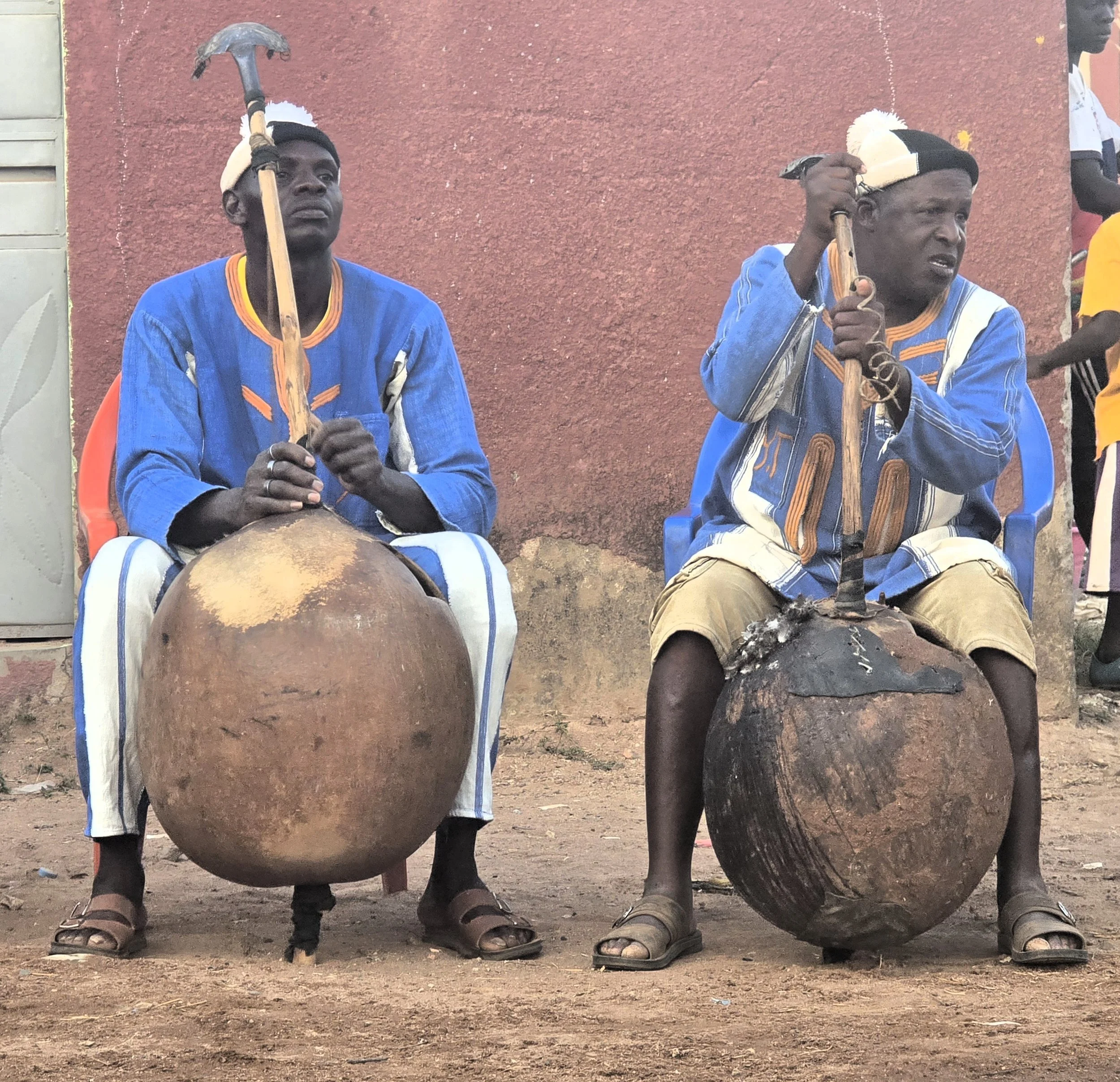
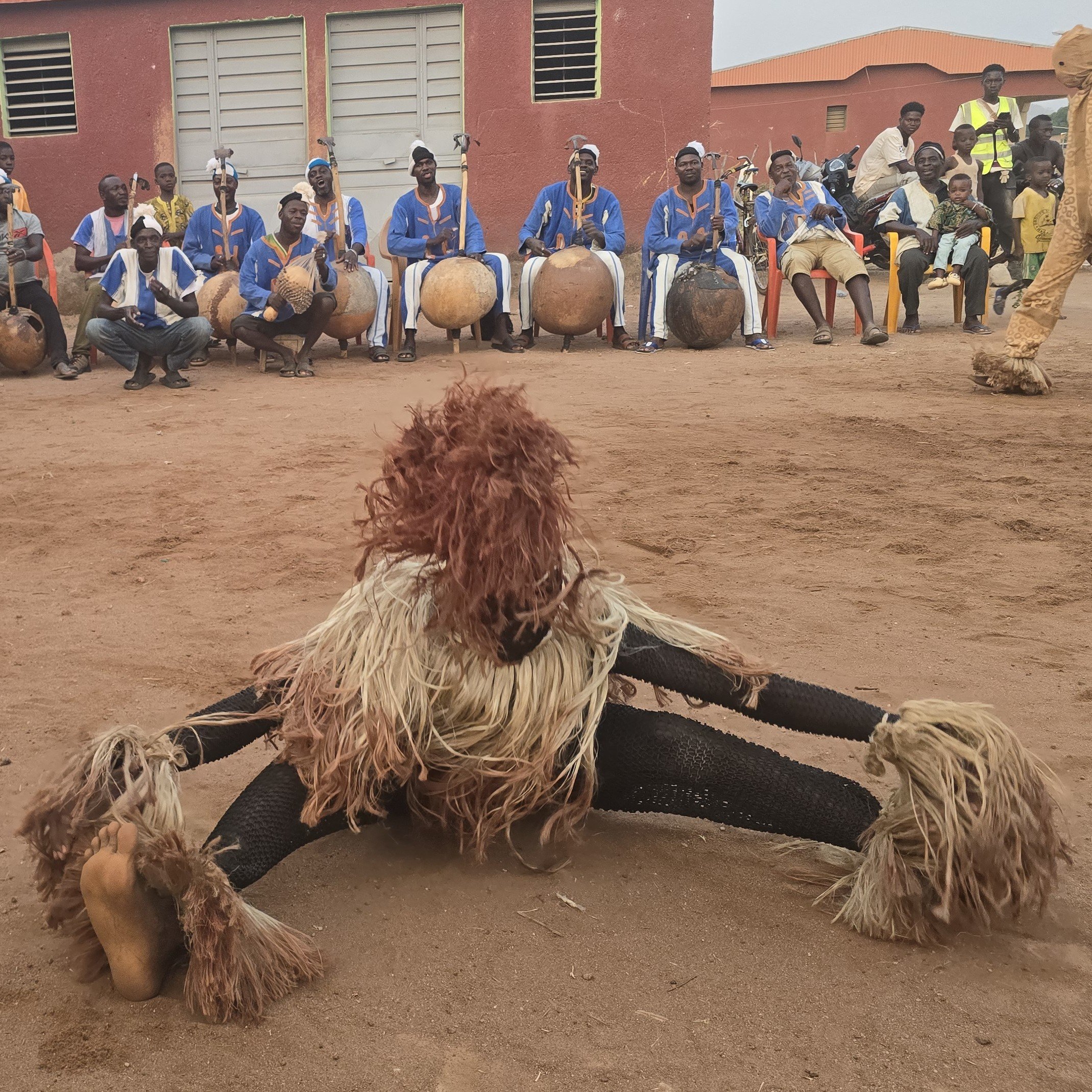
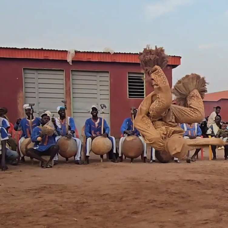
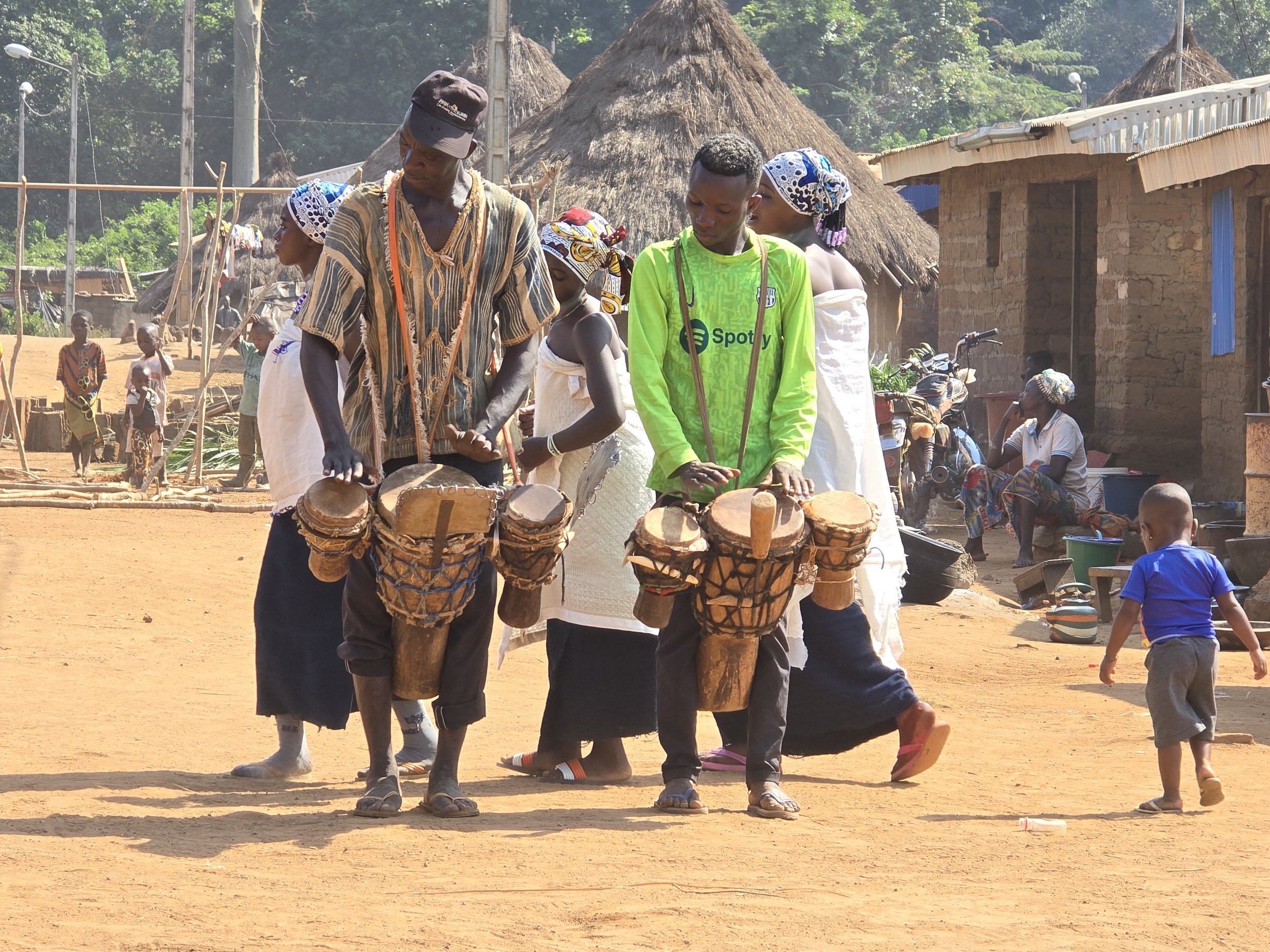
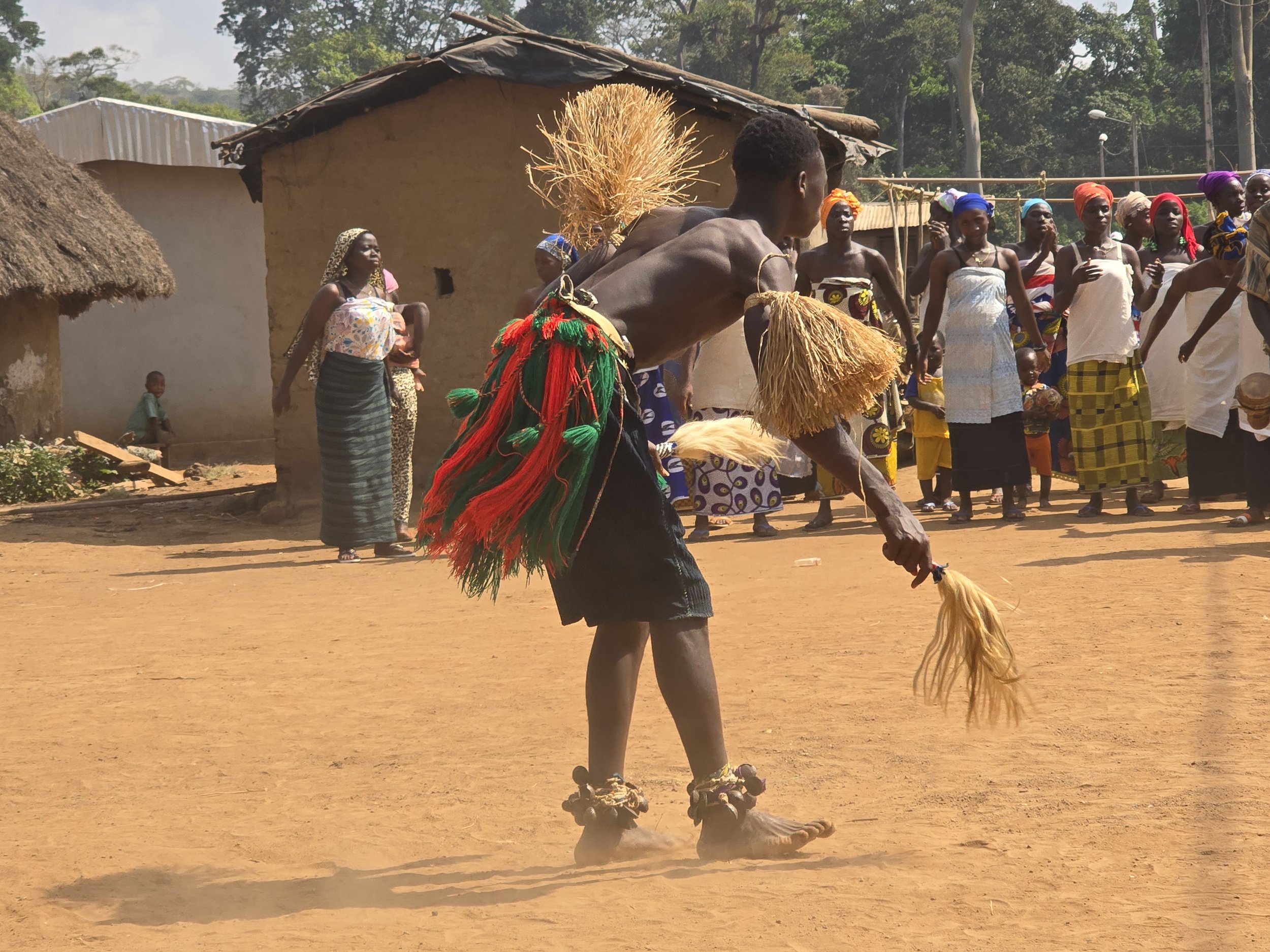
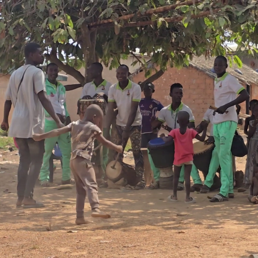
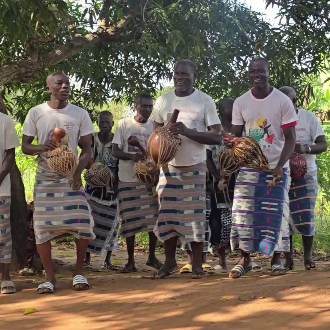
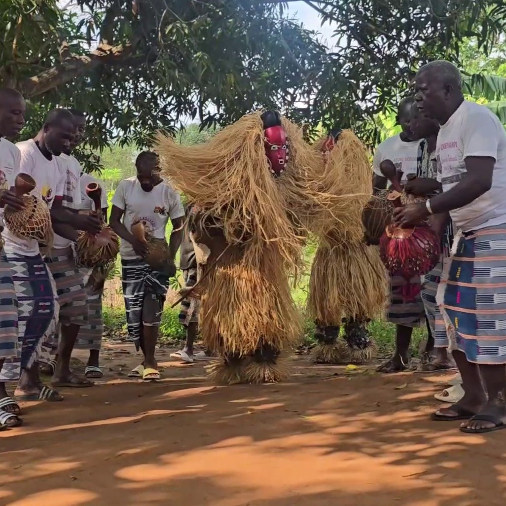
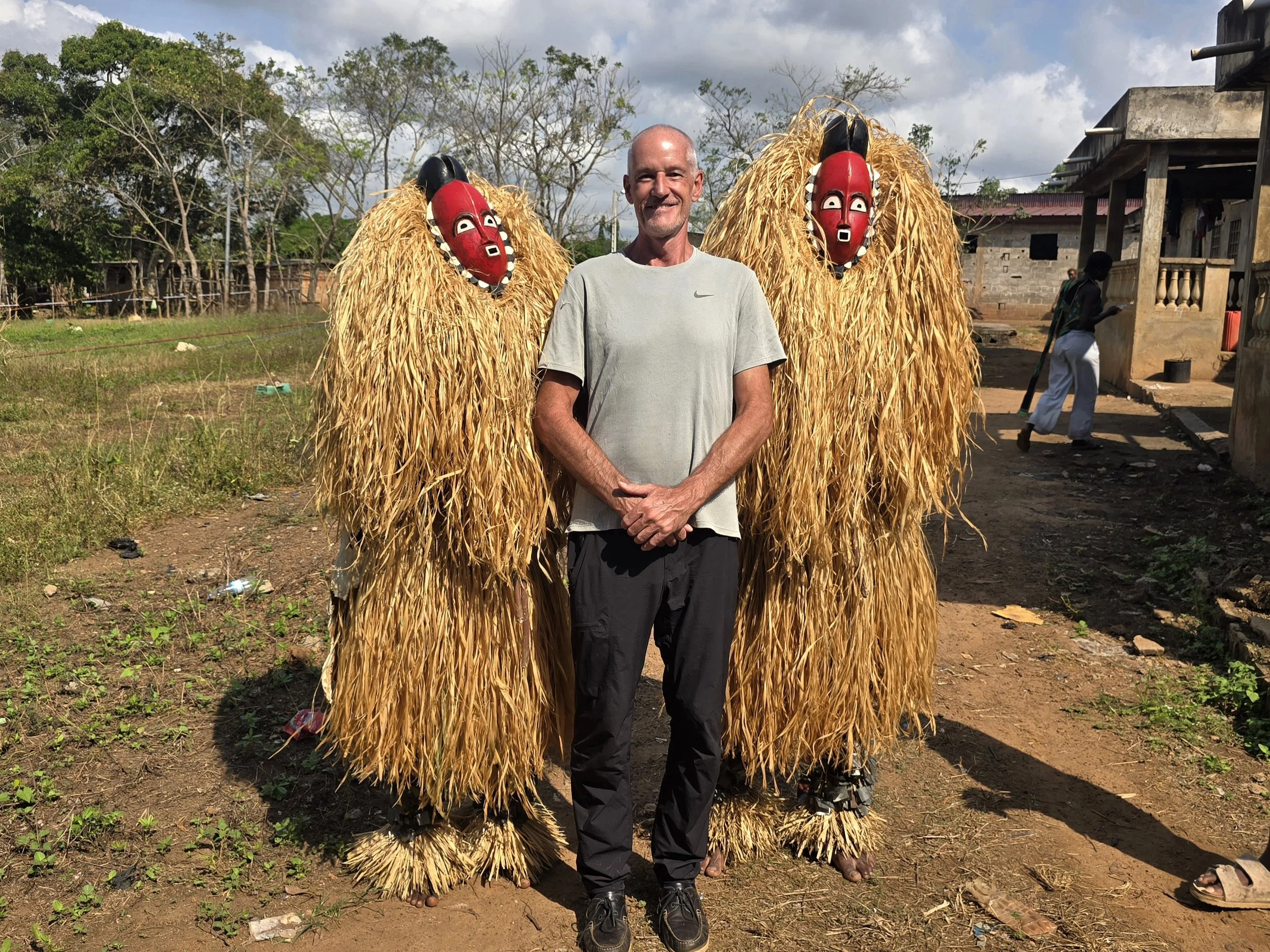
Each year, the coastal city of Ouidah comes alive for the annual Voodoo Festival, a multi-day spectacle of music, masks and ritual.  This had finished weeks before we arrived but, with the help of a couple of local guides, we were able to attend some private performances.  The best known and most memorable of these was the Zangbeto.  Masked figures, completely concealed inside towering cones of raffia, serving as a spiritual police force, protecting against evil, crime, and social disorder.   

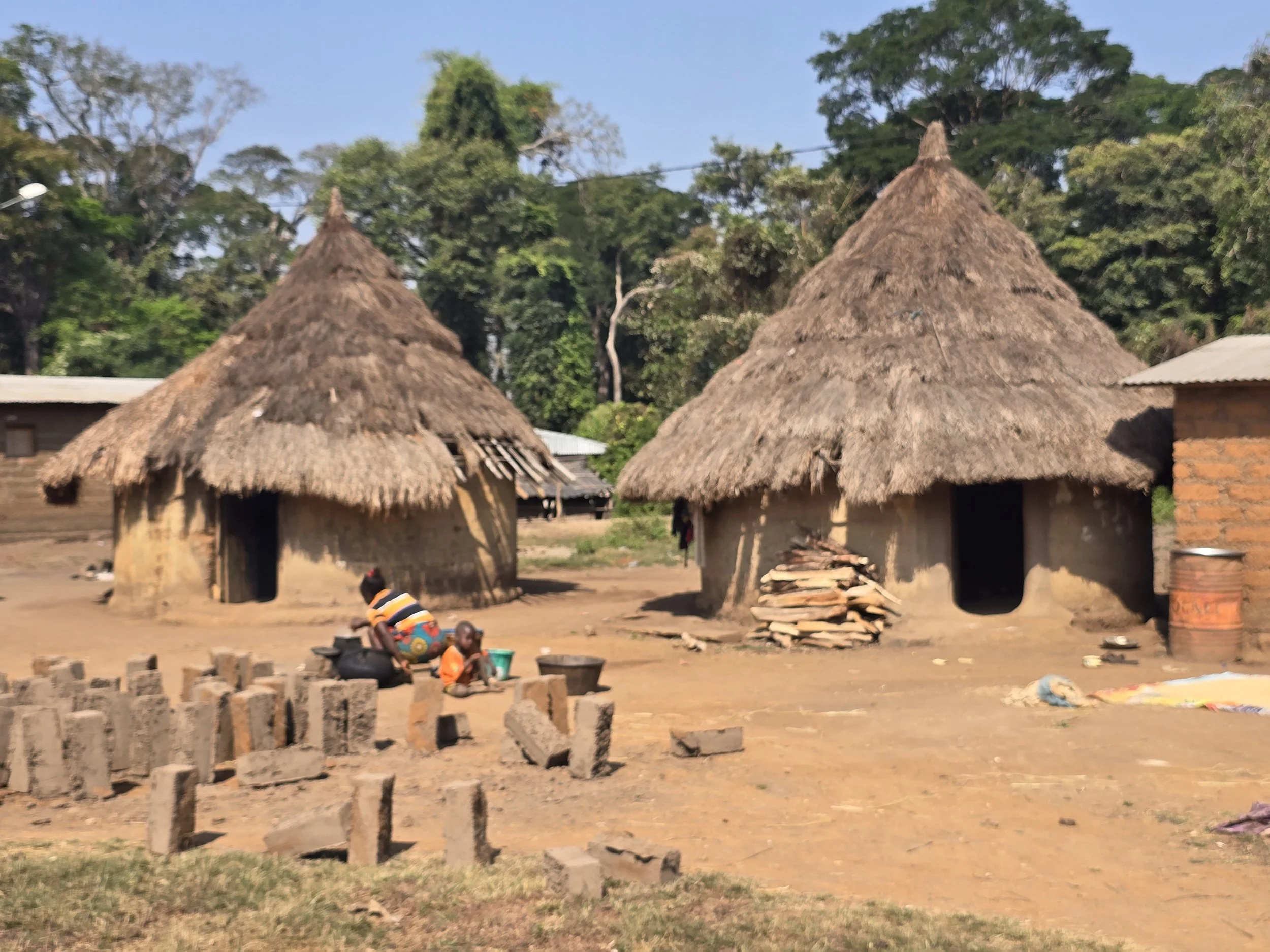
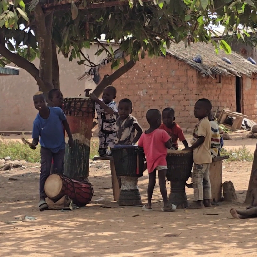
The Ogu community had set up a row of chairs for us on one side of a large sandy square, the musicians were bunched up to the right of us, the village children impatient and excited on our left.    
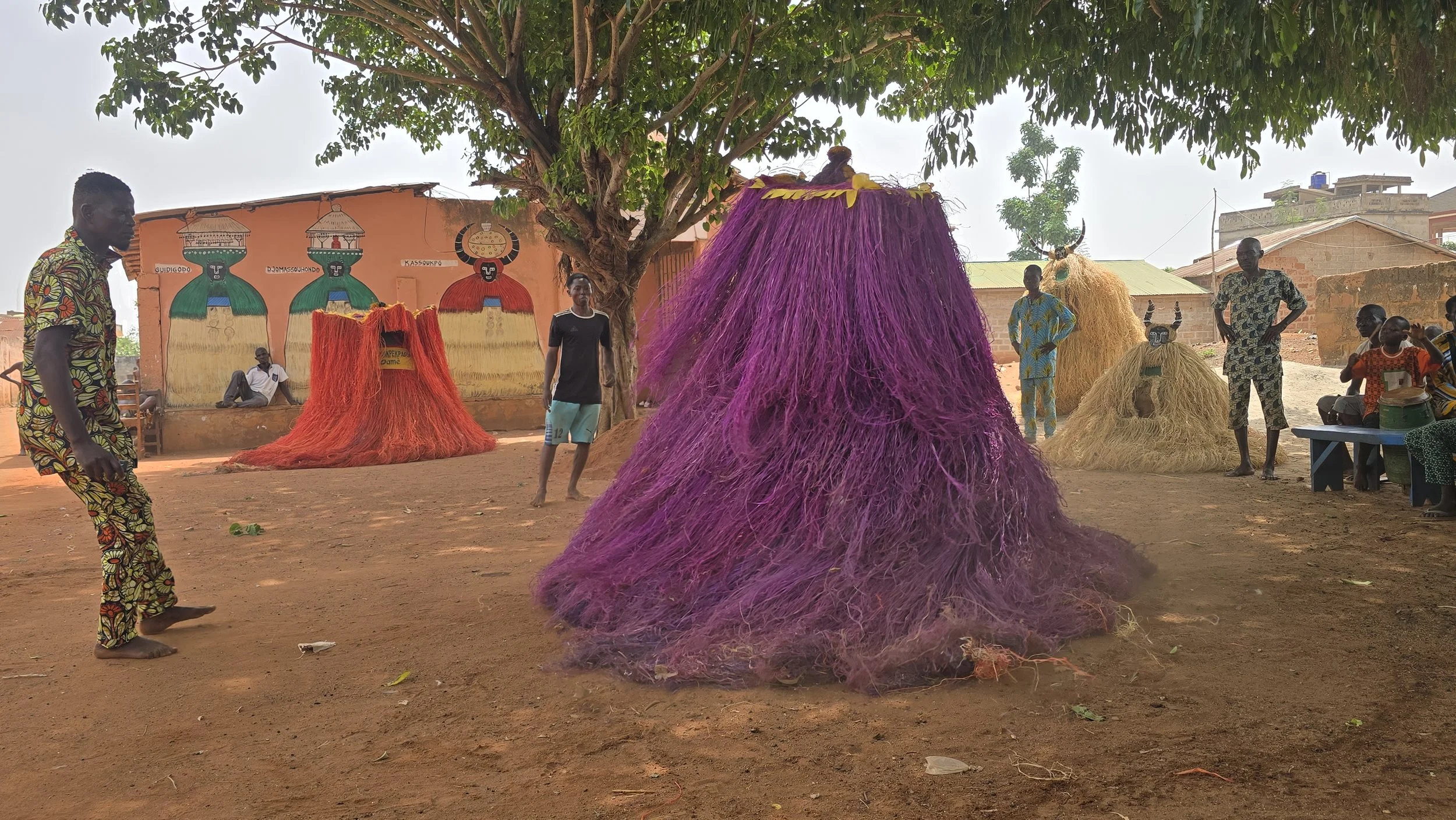
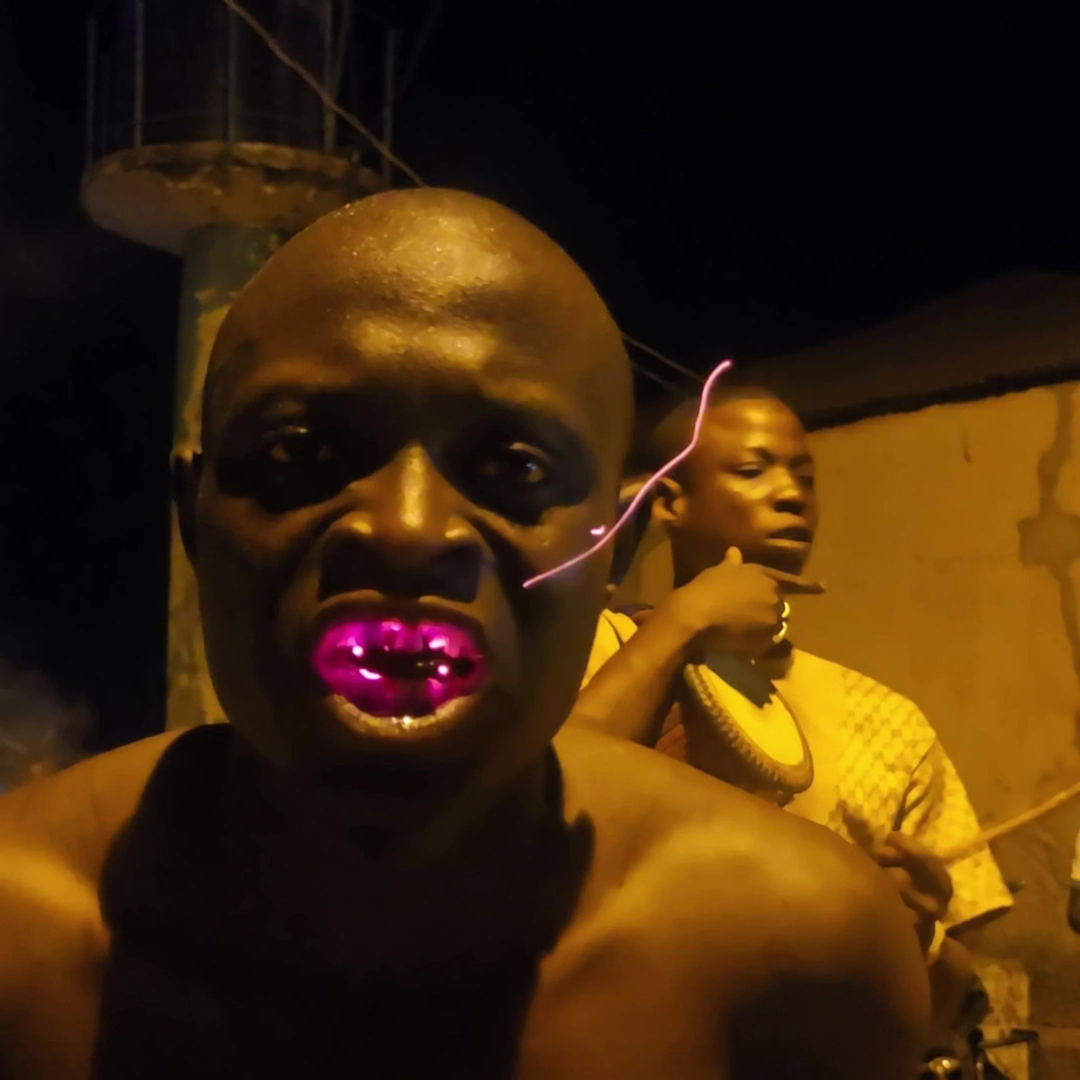
zangbeto

Five Zangbeto whirled into the arena.  Fuelled by intense rhythmic drumming, the hypnotic spinning of the giant haystacks was regularly interrupted as they charged towards the children.  Screaming pandemonium then ensued until the spirit returned to the arena.  But, the highlight of any performance is the reveal.  As the drumming stops, attendants tip the heavy costumes over to show the interior and the form the spirit has taken.  We were treated to a small statue of a man with an impressively vibrating penis, a spinning ball, and finally – to general satisfaction – a live baby crocodile. 
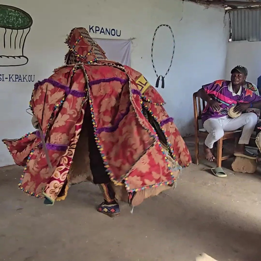
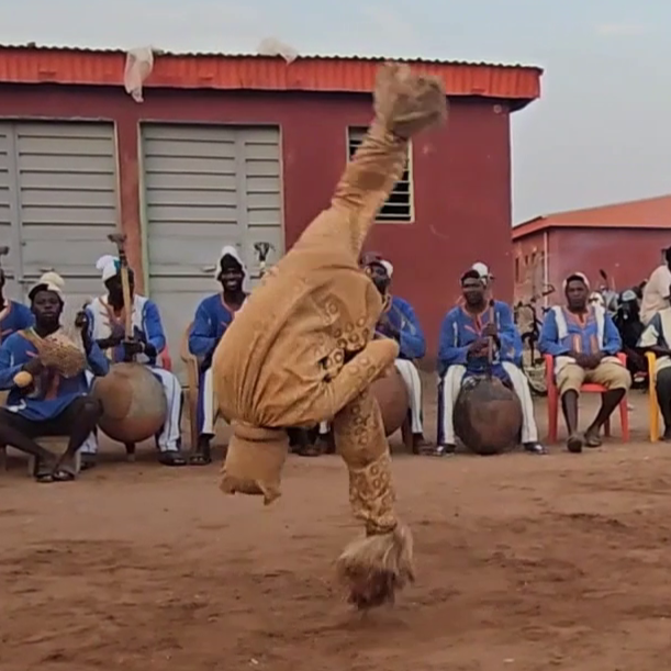
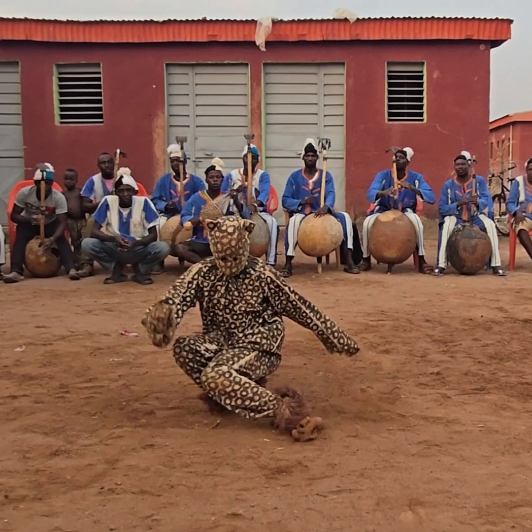
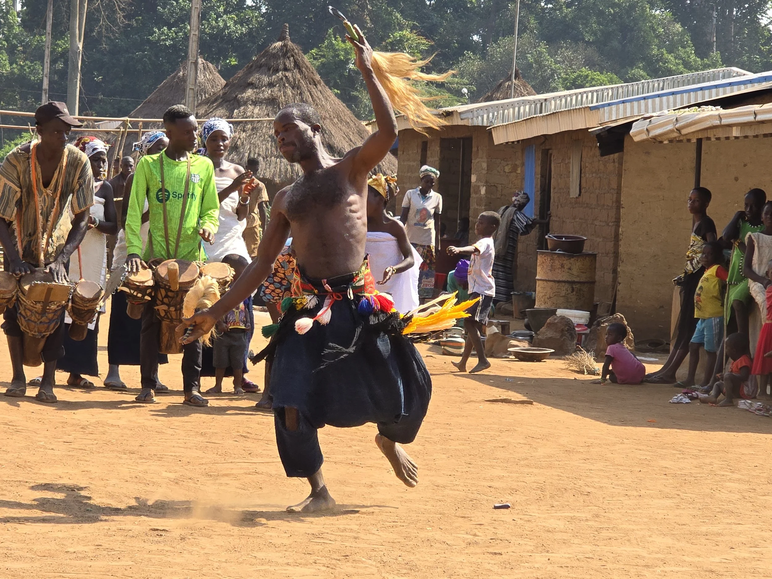
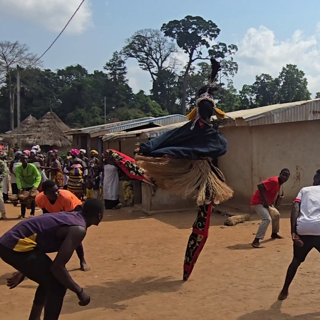
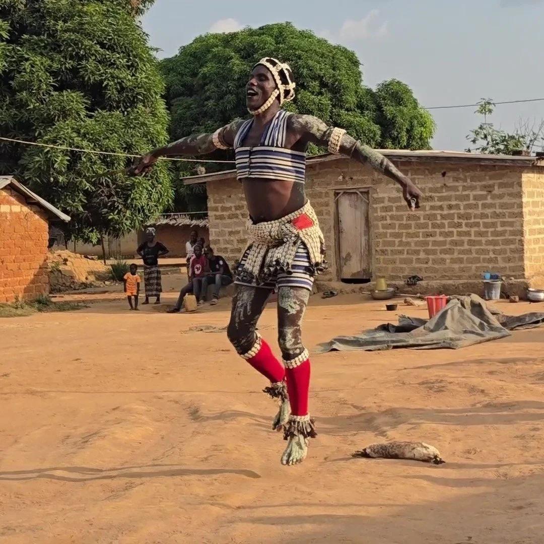
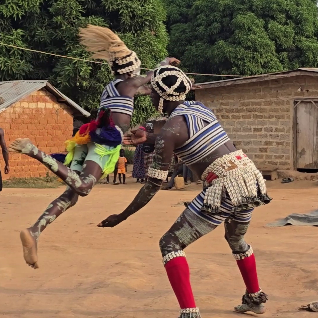
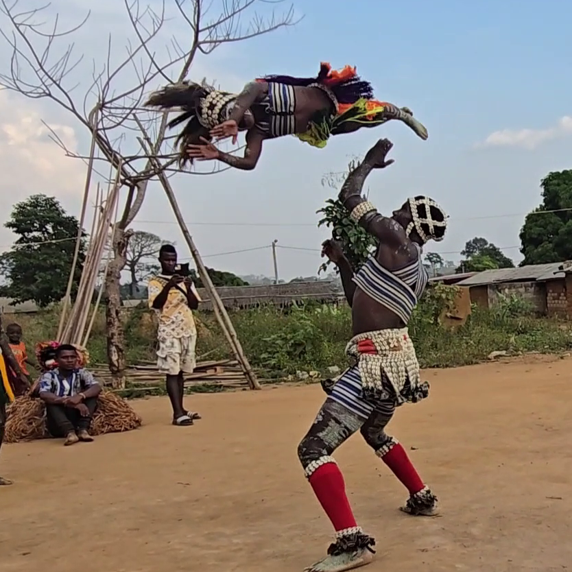
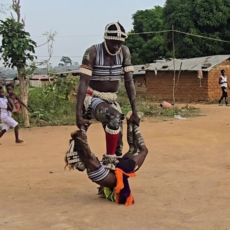
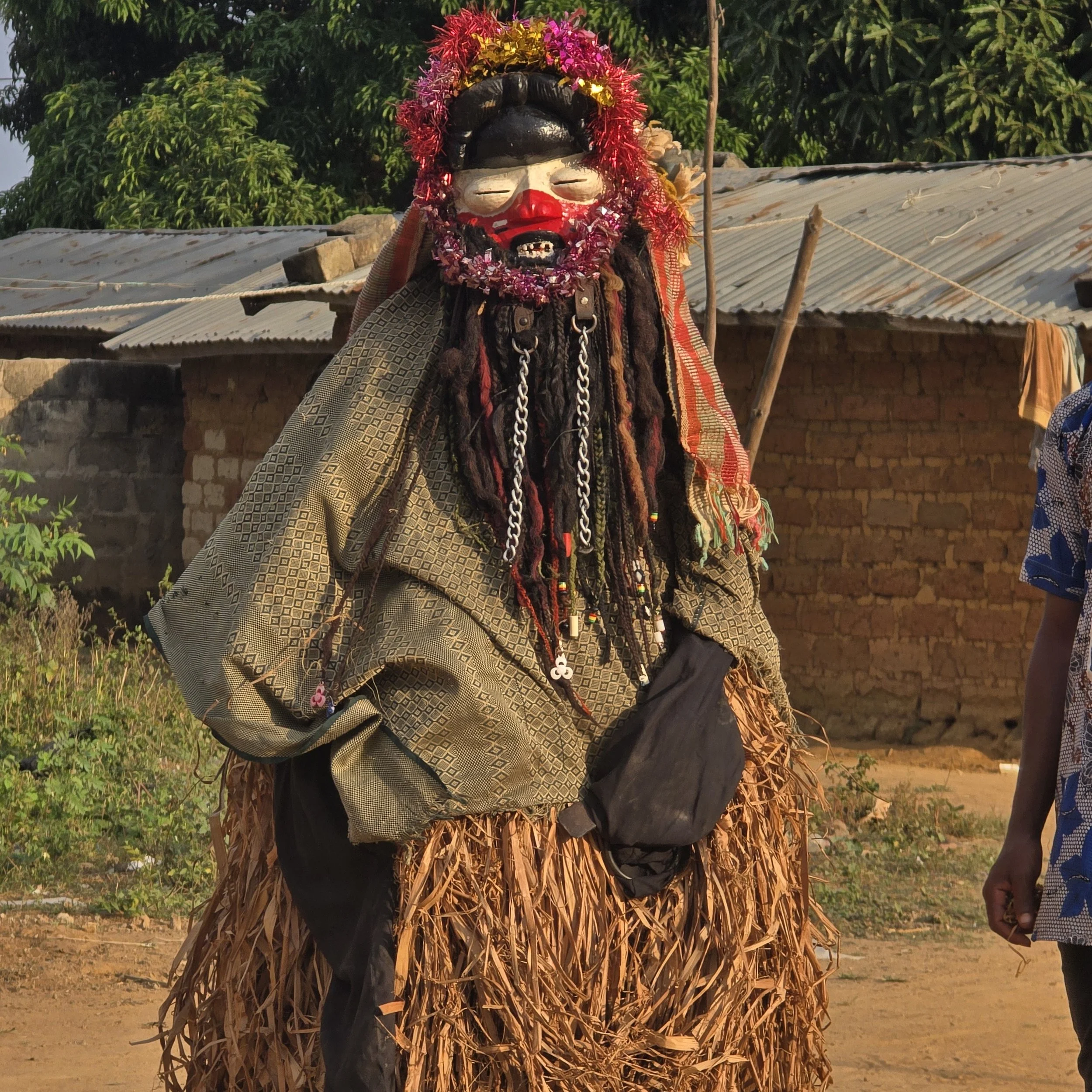
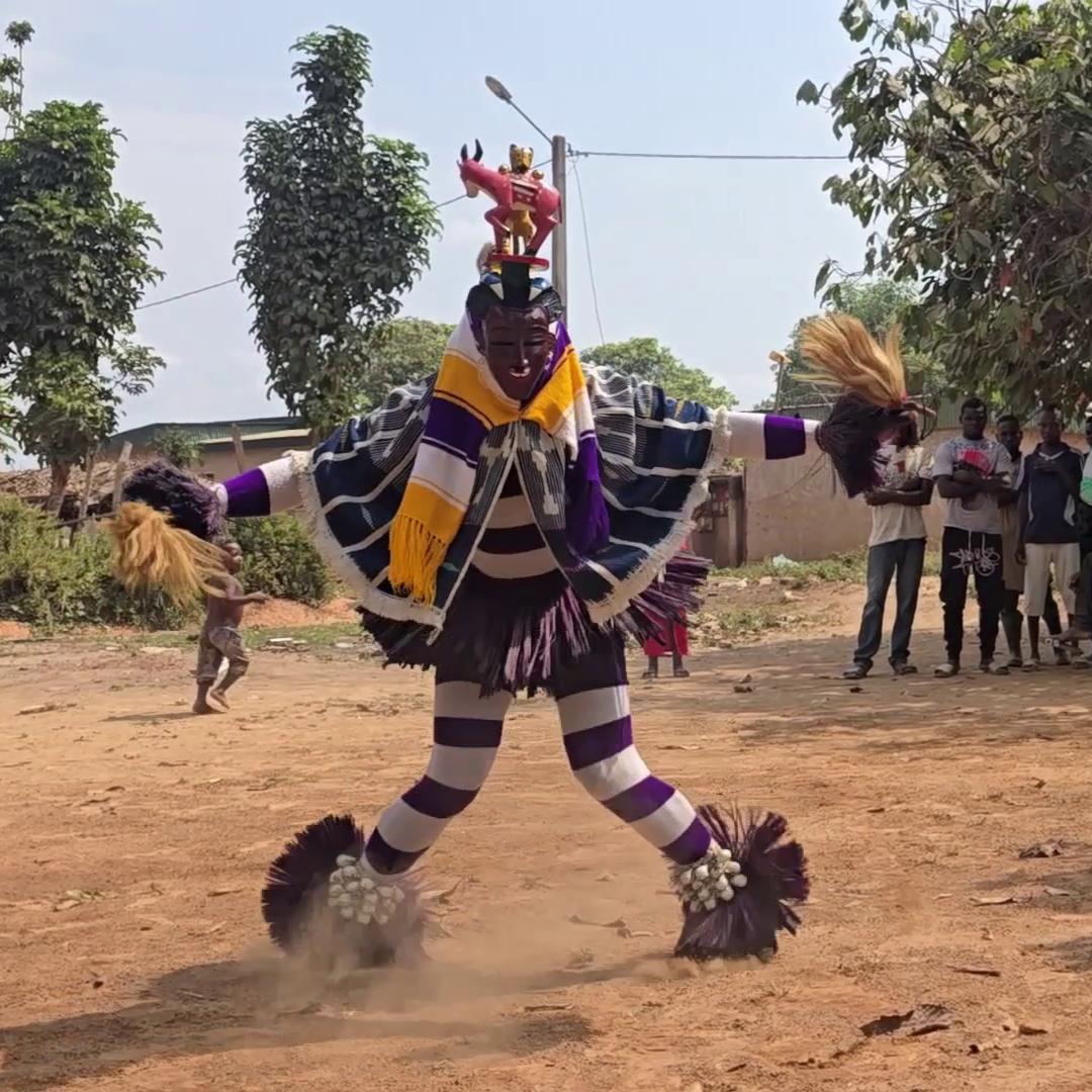
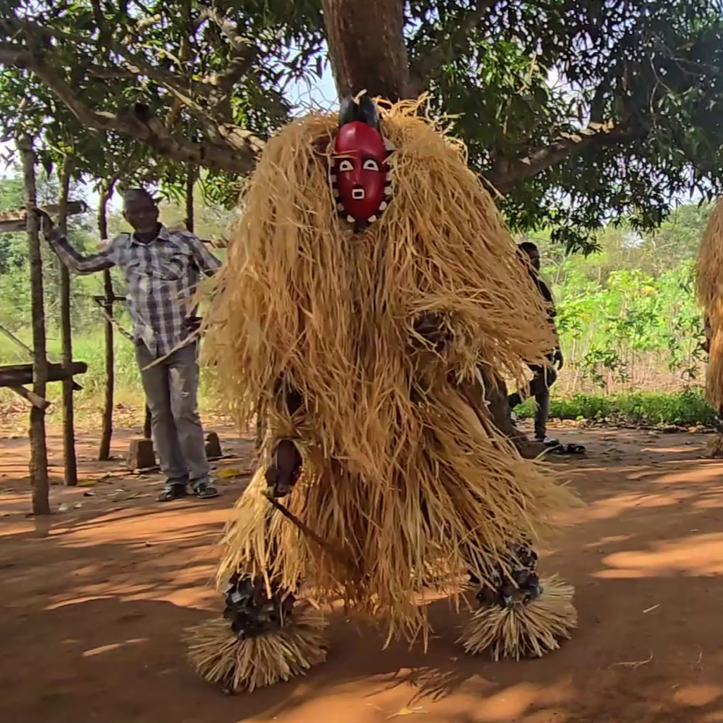
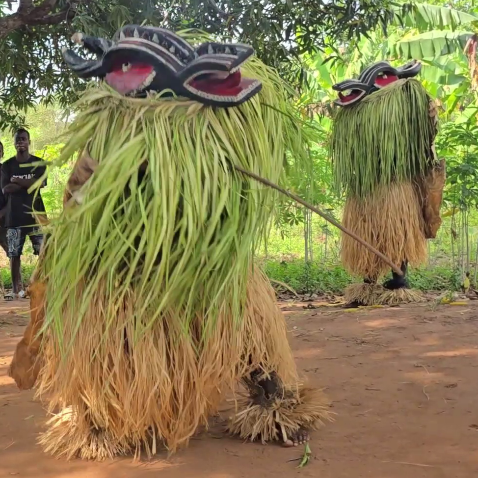
egungun

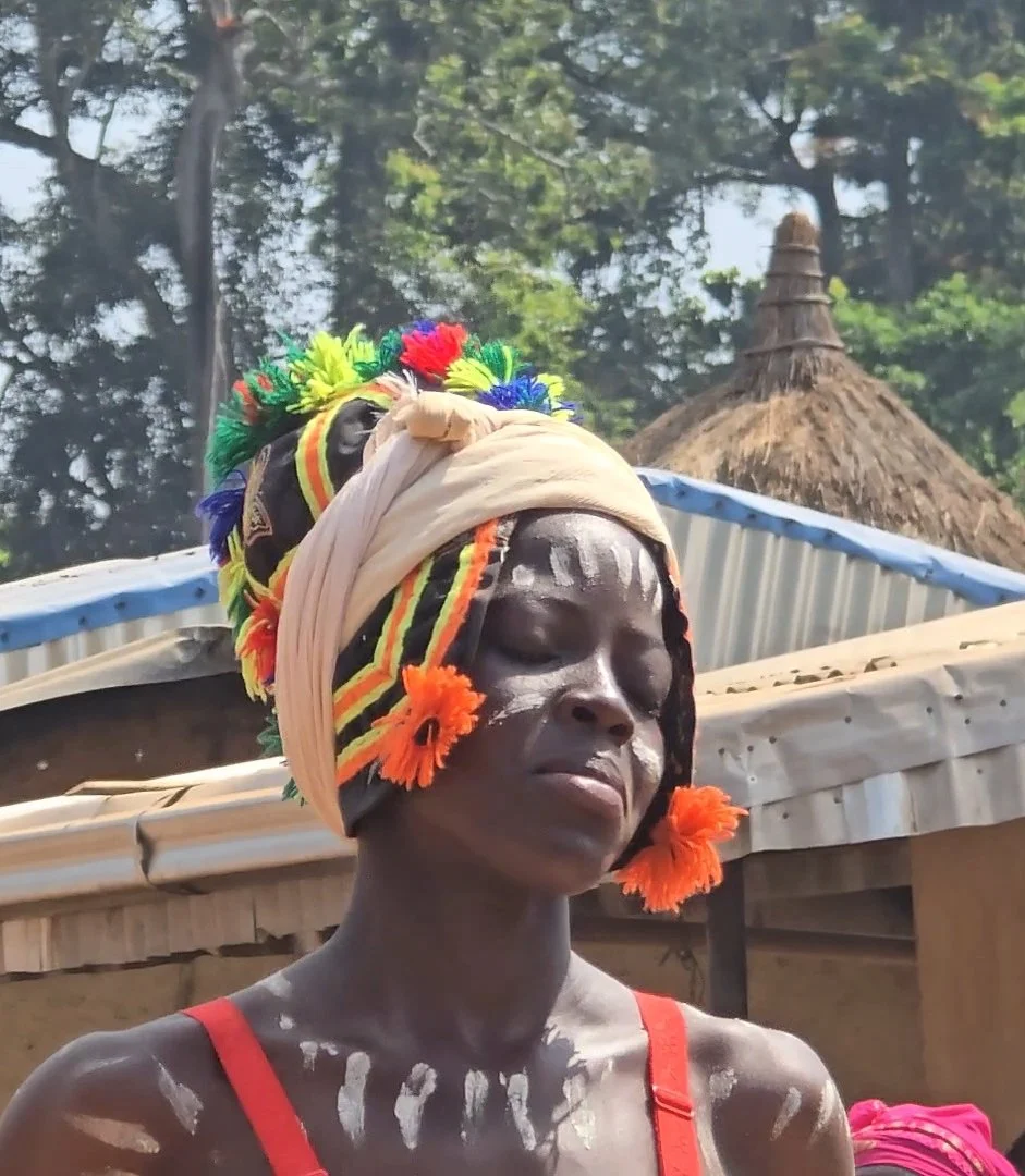
The Egungun – a secret society of the Yoruba people – also received us in their small village hall.  Concealed under layers of vibrantly coloured fabric, male dancers entered the building, mediums serving as a bridge between an ancestor and their descendants.  Rapidly spinning towards a trance-like state, their costumes fanned out creating a “breeze of blessing” and purifying the air in readiness for the spirit.  The arrival of the ancestor certainly upped the ante as direct contact is forbidden and said to bring certain death.  The claustrophobic space, which now housed three overly-excited Egungun, a dozen musicians and ourselves pressed hard against the side wall, shrank as the only salvation between us and eternity was a small man with a stick, running up and down in front of us, attempting to beat back any twirling ancestor from coming too close.

The man with the stick was multi-tasking.  He was also responsible for preventing the Egungun escaping.  With a reputation of becoming violent and menacing, loose on the streets the Egungun are feared due to their penchant for harassing and beating people as they run amok.  After several attempts to exit through the open doorway, the spirit finally succeeded and as the man with the stick raced from the hall in pursuit, it seemed a good time to leave. 

Across this part of West Africa there has been no shortage of imagination when it comes to communicating with spirits.  Each masquerade has been entertaining, but as we get closer to Nigeria the atmosphere has felt a little heavier and more intense.  Perhaps it is pure imagination, or maybe it is simply the knowledge that we now face one of our biggest challenges yet.   

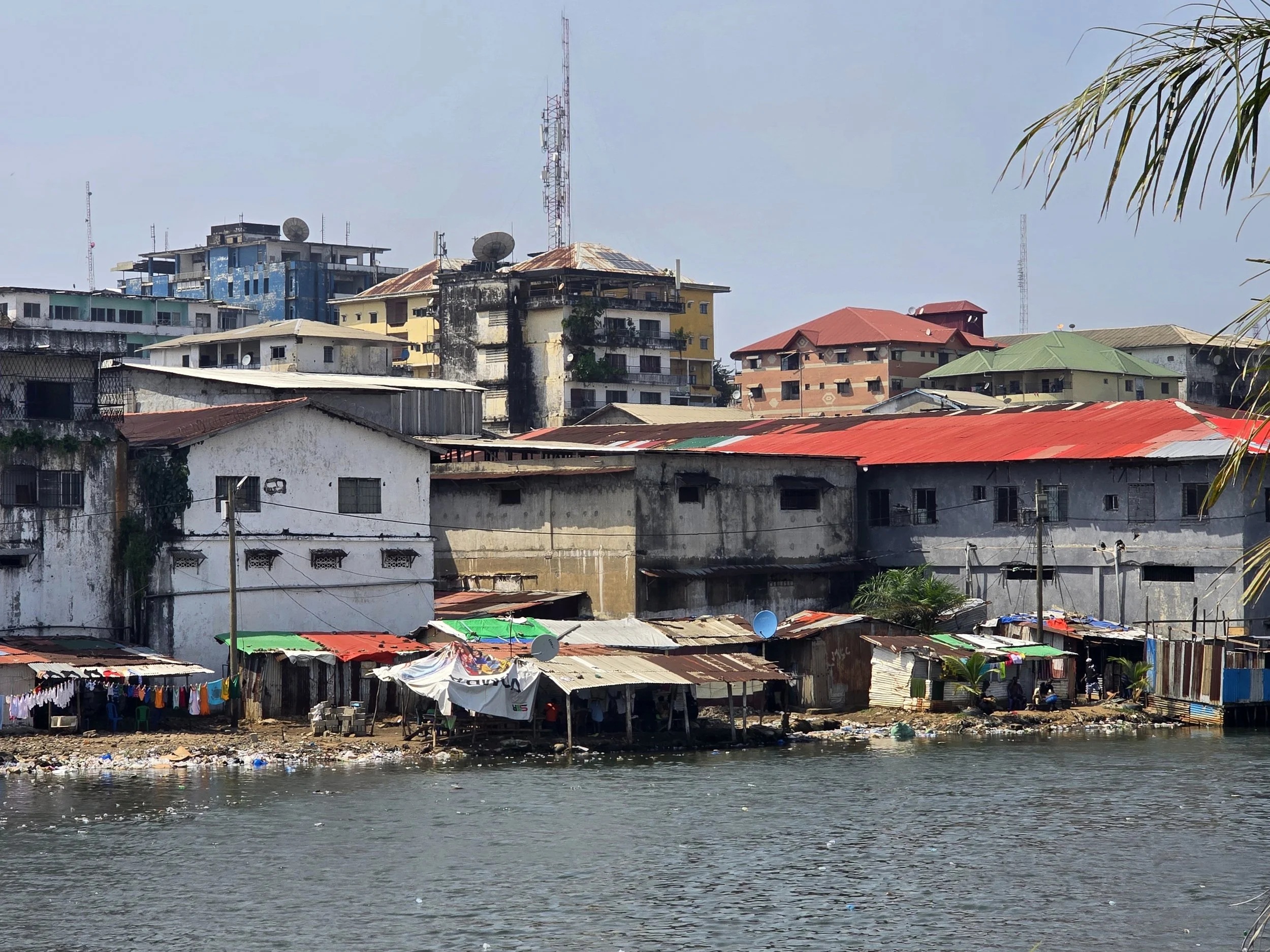
Nigeria - the nemesis of many overlanders and, for us, the final country of Western Africa.  A nation of enormous human momentum pushing against finite land, fragile infrastructure, and unevenly shared wealth.  It is often viewed as the most challenging country to cross, not because it’s uniformly dangerous, but because it combines a few risk factors in one very large and very busy country.

The main concern is security.   Boko Harem has been operating long-running insurgency in the North-East, kidnappings by loosely structured armed gangs are commonplace in the North-West, recurring violent clashes between farmers and nomadic herders are ongoing in the north, and militancy and unrest is ongoing in the south.  Avoiding these areas results in a clear corridor through which the country can be crossed.

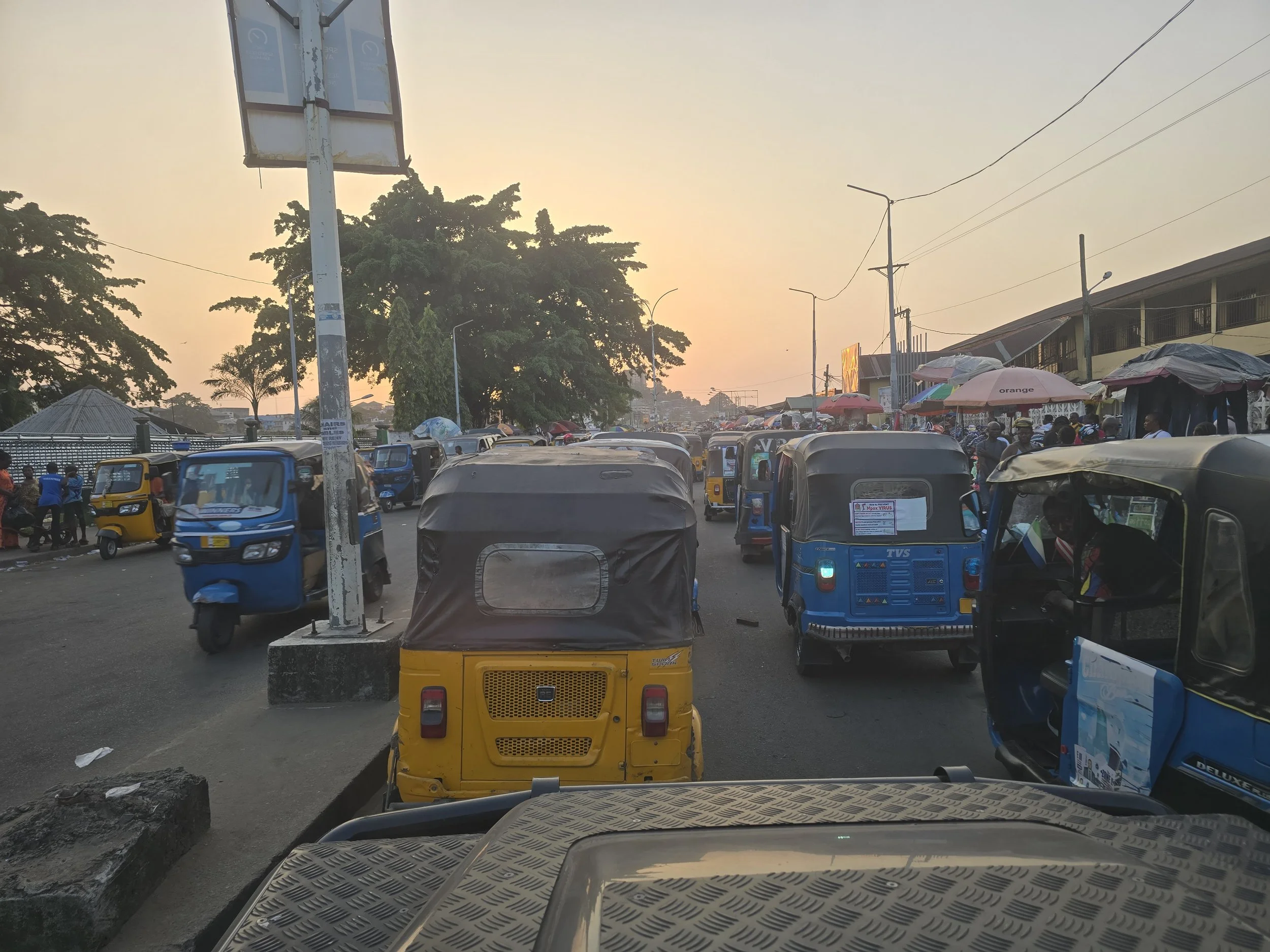
With a route identified, there are other aspects that need consideration.  Nigeria is the most populated country in Africa and the 6th most populated worldwide.  Twice the size of California (the most populated state in US with 40 million people), over 234 million (equivalent to 2.92% of the total world population) live there.  Imagine then, the sheer volume of traffic; according to the 2025 Mid-Year Traffic Index, the capital Lagos is ranked the world's most congested city.

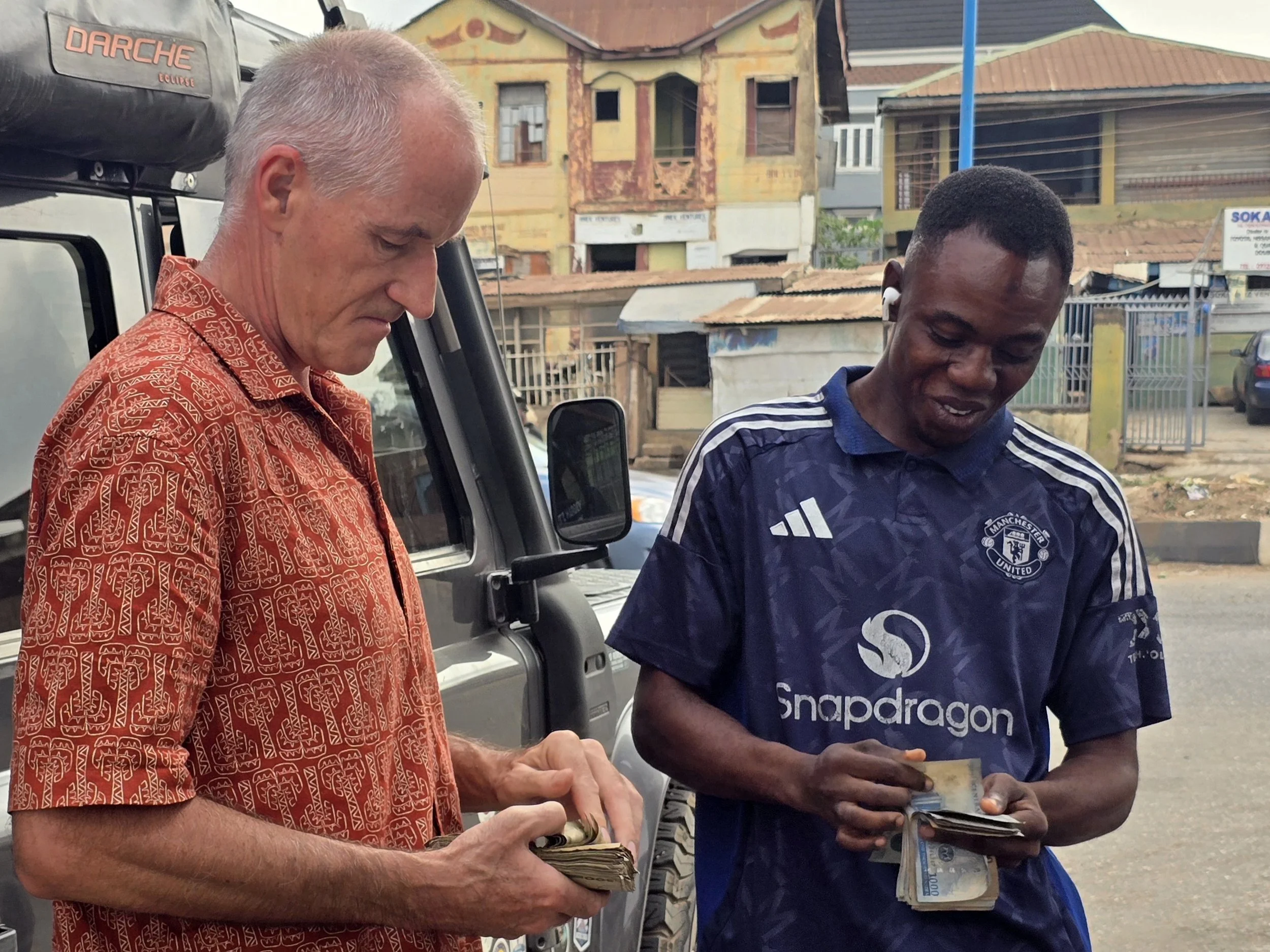
cash is king, nigeria

Less concerning, but worth taking on board are checkpoint frequencies, fuel shortages, and extremely limited card payment facilities.  Cash is king; the Nigerian Naira is issued in note denominations of ₦5 (US$ 0.0037) to ₦1,000 (US$ 0.74).  ATM’s have daily limits of ₦20,000 (US$ 14.79), but they are hard to find and often out of service. 

On the plus side, Nigeria recently launched its new e-Visa system for short-stay visas.  Prior to May 2025, the visa had to be applied for from the applicant’s home country, supported by copious amounts of paperwork including a mandatory letter of invitation.  Although one of the more expensive visas at US$ 275, online approval was almost instantaneous, so one less thing to worry about.

The big question for us was how did we want to travel across this complex, intense country.  We have read many blogs where the approach has been to drive pretty much non-stop during the day, stopping at night in guarded compounds, the objective being to cross as quickly as possible.  This was certainly an option, but we wanted to get a sense of the country and its people despite the limited opportunities.

Not needing anything that Lagos may have had to offer, we shunned the main Seme-Krake border crossing, opting instead to enter Nigeria at the border at Idiroko, a border long synonymous with smuggling that proved to be fast and friendly; the only delay being the examination of our Malaria tablets.  From there we took reasonably good roads to Abeokuta and Olumu Rock.

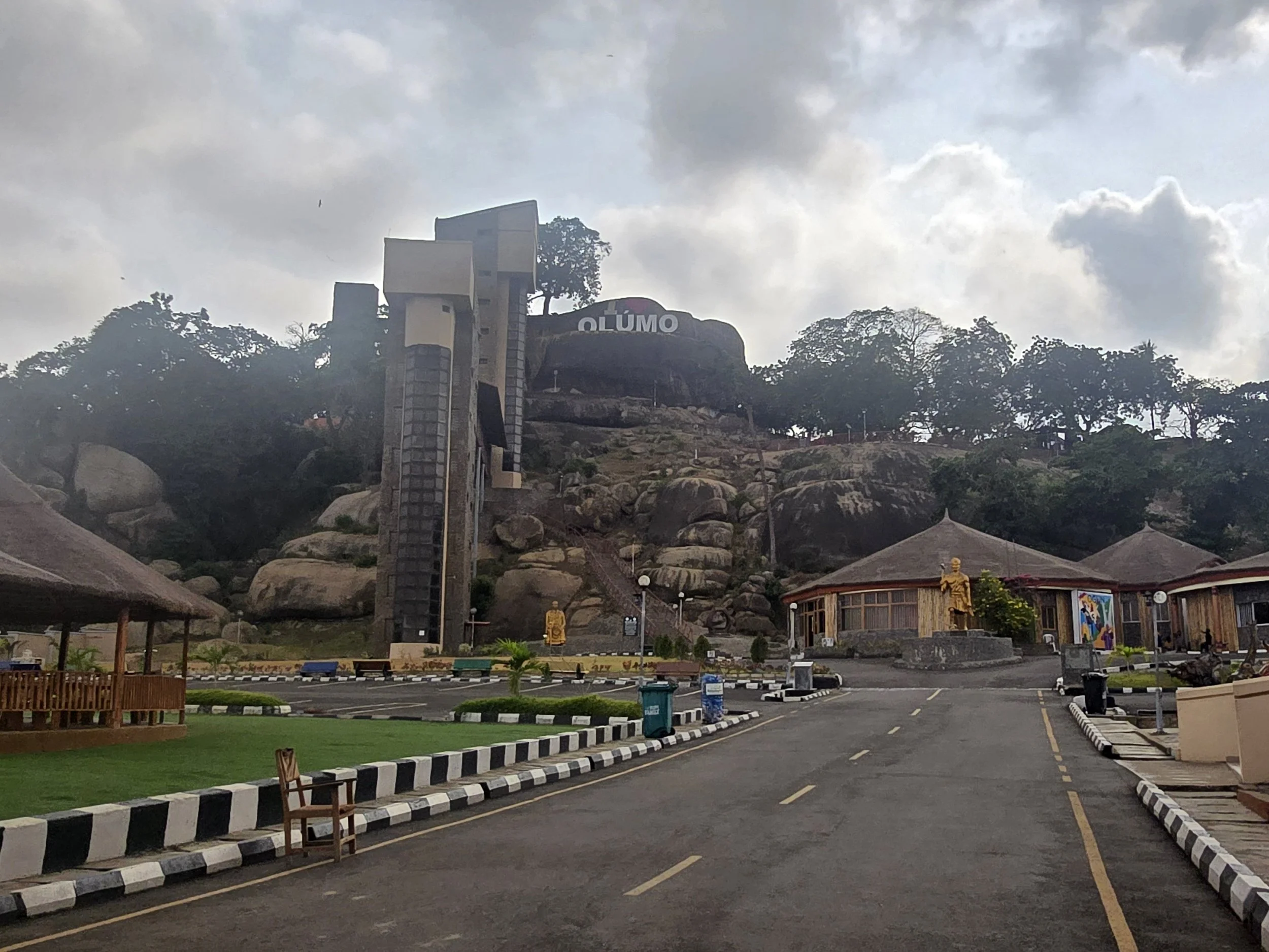
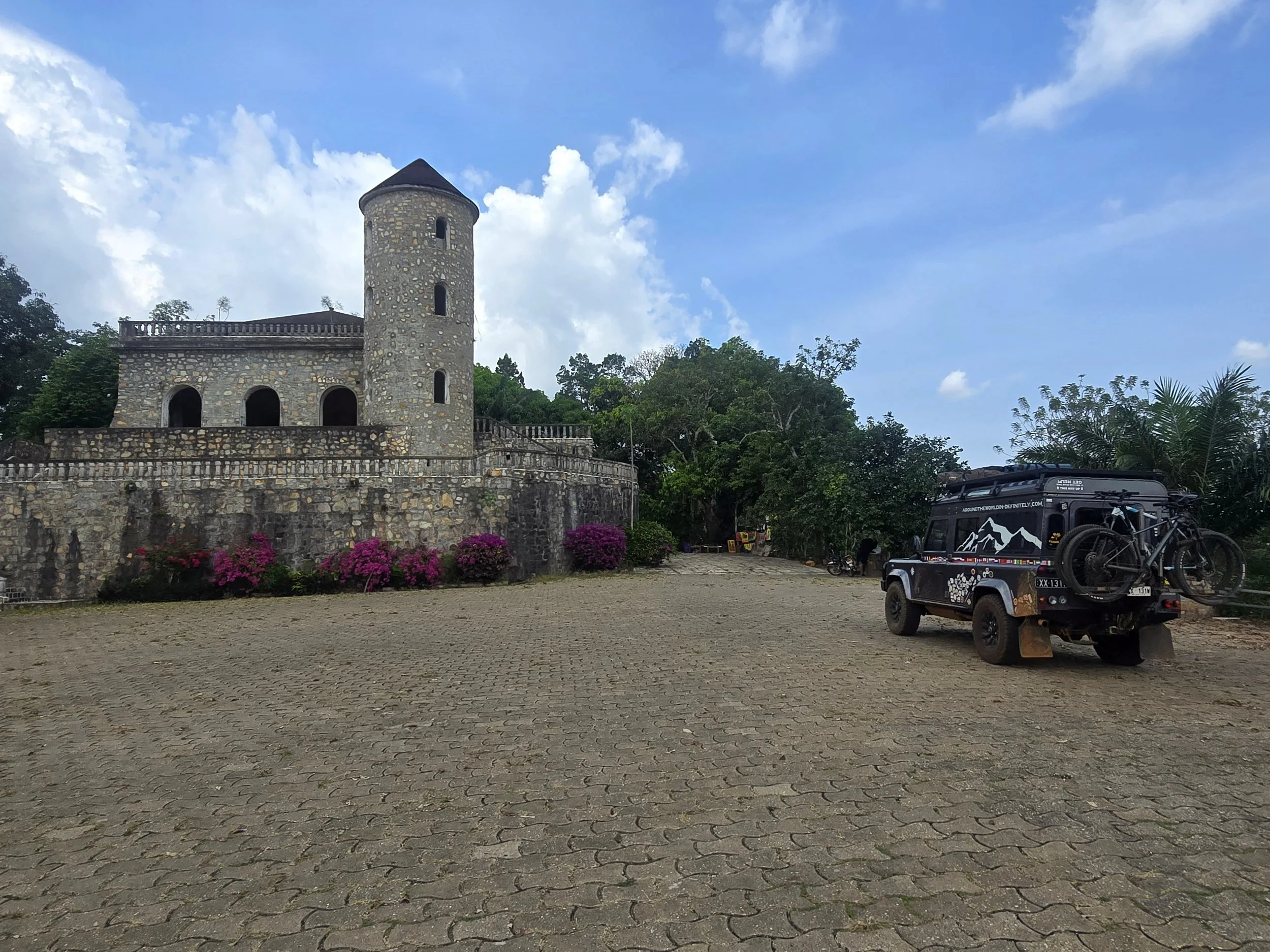
olumo rock, abeokuta

If Nigeria ever decided it needed a natural lookout tower, Olumo Rock would be the obvious choice.  Rising out of the city of Abeokuta like a giant misplaced boulder, it looks as though someone dropped a small mountain and forgot to tidy up.  Long used by the local Egba people as a fortress and hiding place during intertribal wars, spiritual significance is still maintained with shrines and a resident priestess who maintains traditional practices.  It also gave the city its name: Abeokuta roughly translates to “under the rock.”  Not subtle, but accurate.

Traditionally, reaching the top involved scrambling up narrow paths and squeezing through crevices, an option that is still available alongside an optional staircase and, slightly improbably, an elevator inside the rock which does take a little of the siege mentality out of the experience.  At the top you’re rewarded with a slight breeze and the quiet satisfaction of doing something other than driving.   

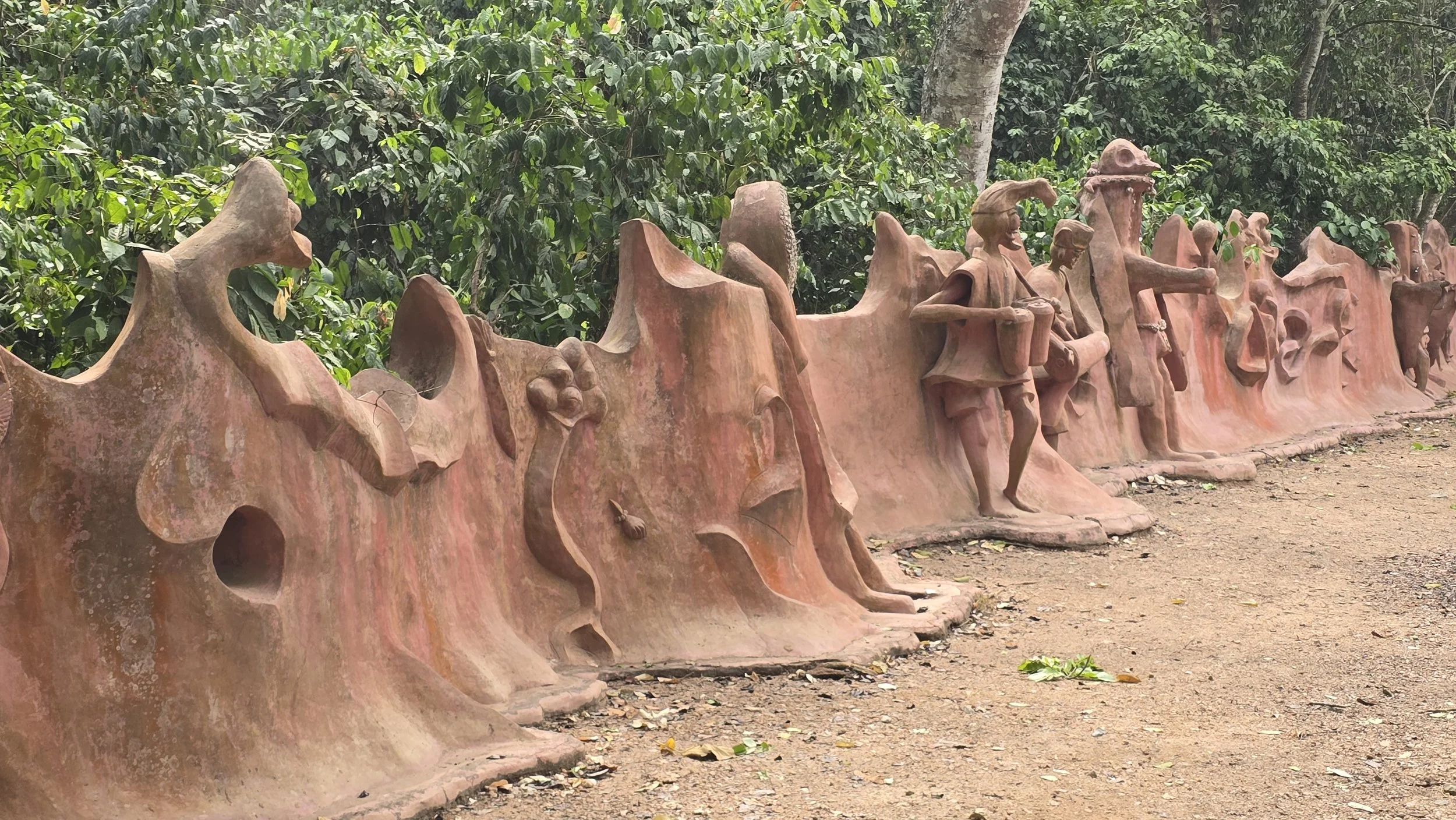
sacred grove, osun-osogbo

With tourist sites virtually non-existent, our next stop was the UNESCO World Heritage Osun-Osogbo Sacred Grove, one of the last surviving patches of sacred forest in a heavily populated area.  It sits on the edge of Osogbo along the banks of the Osun River, and for centuries has been dedicated to Osun, a Yoruba river goddess associated with fertility, protection, and water.  Within the forest are winding footpaths through thick vegetation that lead to an abundance of shrines, clay sculptures of gods and spirits, and earthen altars and offerings. 

Whether fortunate or not, our timing didn’t align with the Osun-Osogbo Festival, when thousands of Yoruba undertake a spiritual pilgrimage to gather in the forest. 

Tales of the never-ending chain of checkpoints turned out to be accurate but rarely were we asked to stop.  On approach, barriers were removed and we were waved through with huge smiles – Nigeria is certainly not lacking in friendly people.  The only incident where we were “asked” for money was when we slightly over-ran a red light, easy to do as it was a rather surprising addition to a road infrastructure that was chaotic at best.

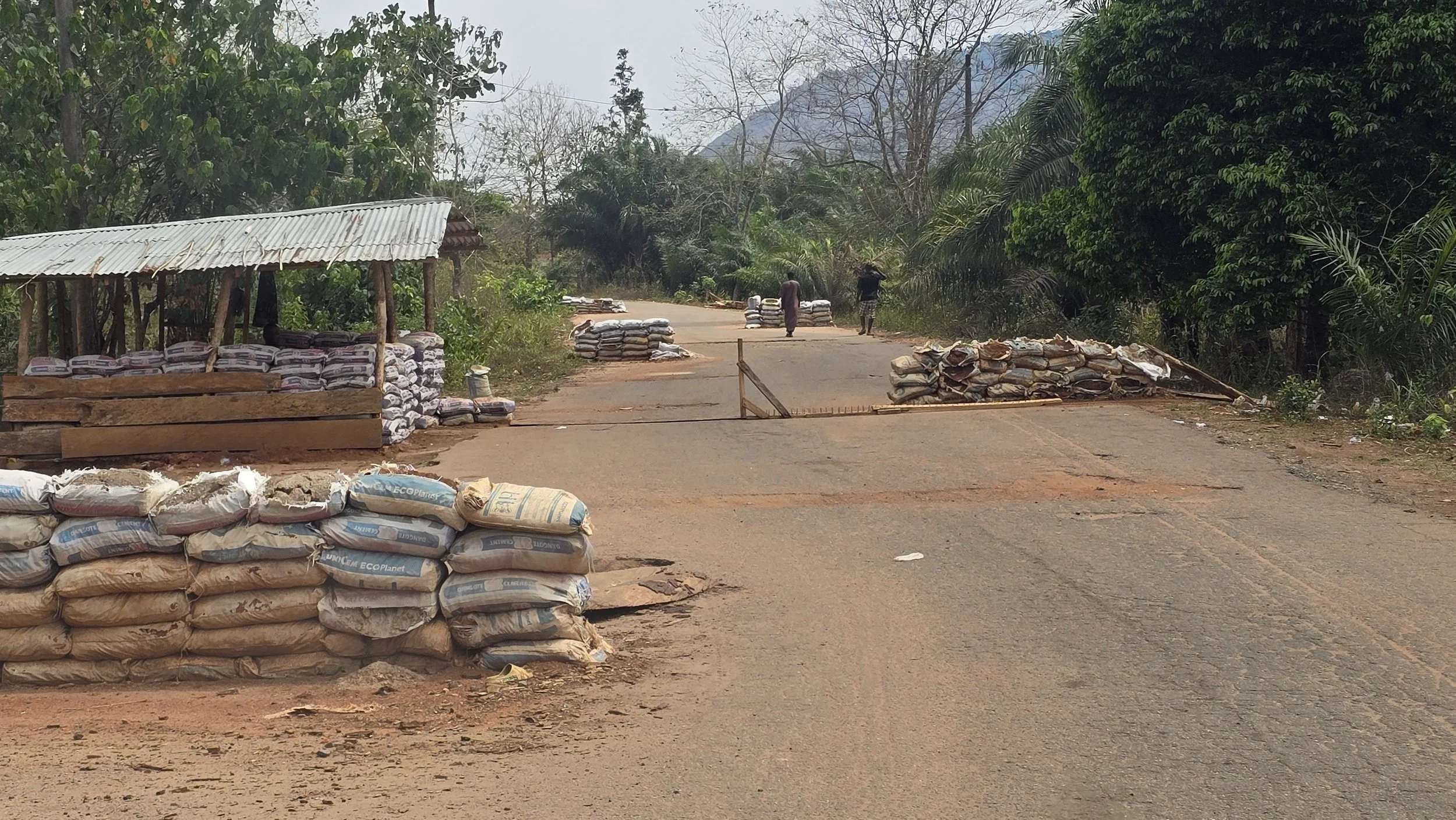
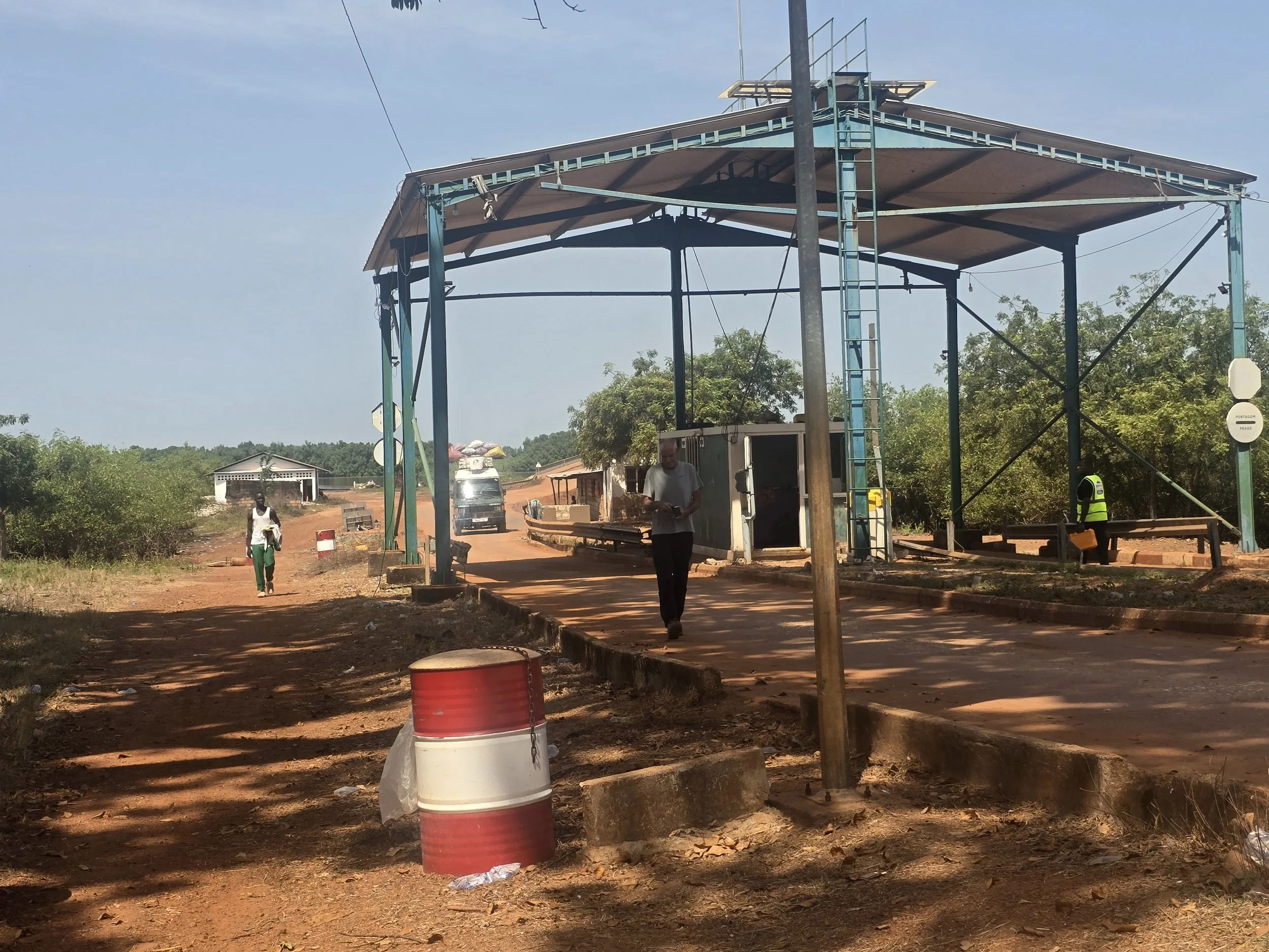
nigeria’s many checkpoints

Straddling an invisible line, it took about 20 seconds before we were surrounded by young men.  A thick plank of wood was wedged under the front tyres and blocks of concrete were pushed up against the rear.  A uniformed “official” then appeared wanting to get into the car.  This was a novel one for us but given that we didn’t want to stay where we were for the foreseeable, Ian jumped out, the official jumped in and I was ordered to drive down a side road and reverse into a clearing off to the side.  In all of our African travels we have tried very hard not to go along with dubious requests for money, a practice that overlanders coming through after us would not appreciate.  However, in this case, wanting to get the guy out of Bob as quickly as possible, we handed over the equivalent of 8 Euro and order was restored. 
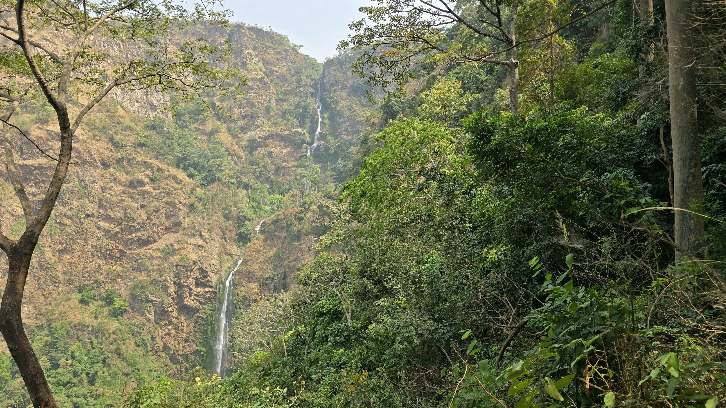
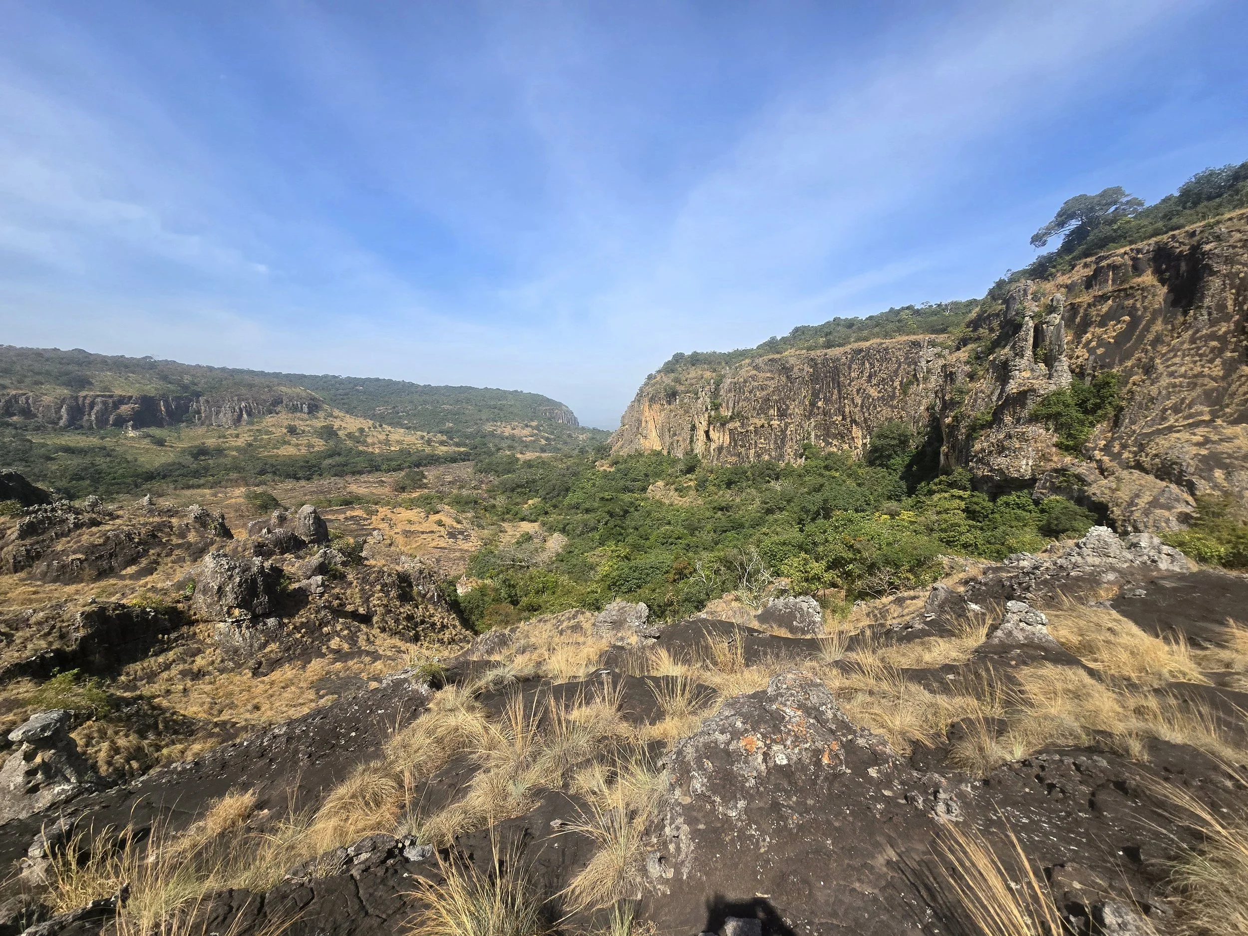
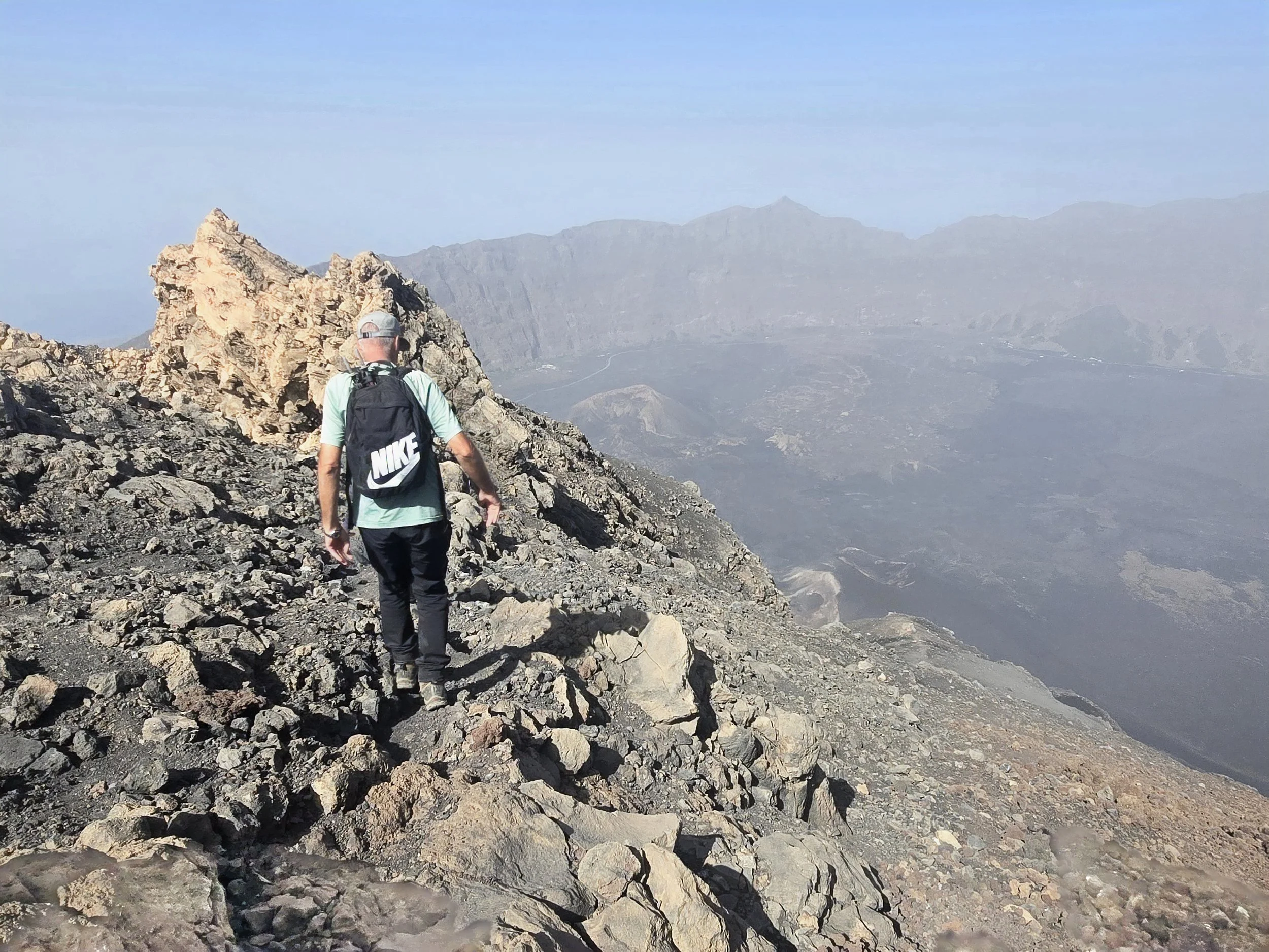
idrane hills

Still on the subject of checkpoints, we have dealt with ropes, sandbags, tyres, oil drums, metal barriers and lengths of wood.  Nigeria had a couple of new approaches.  One was a large tree trunk on wheels, the other a plank of wood – also on wheels – with long, vicious, metal spikes sticking out.

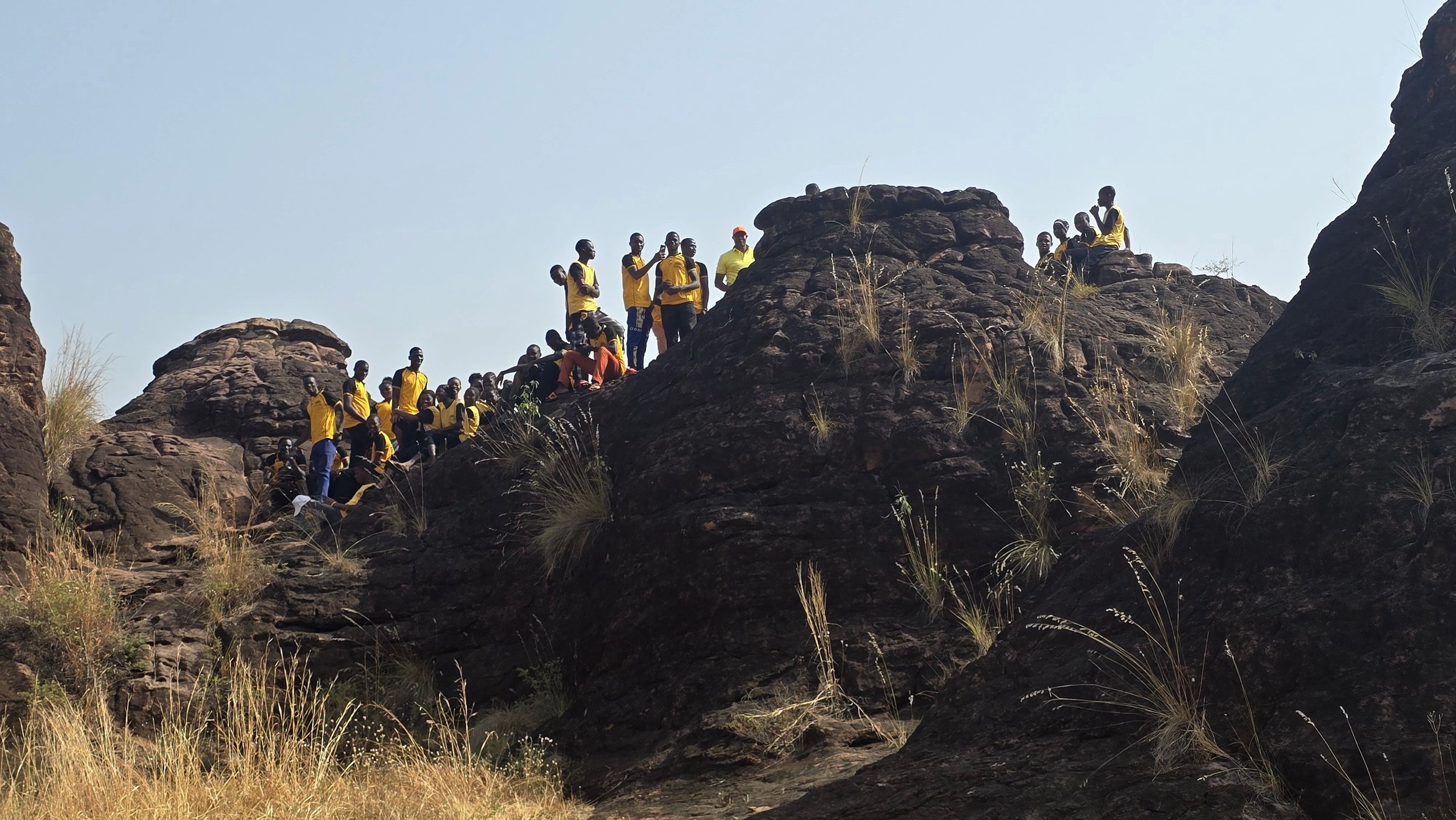
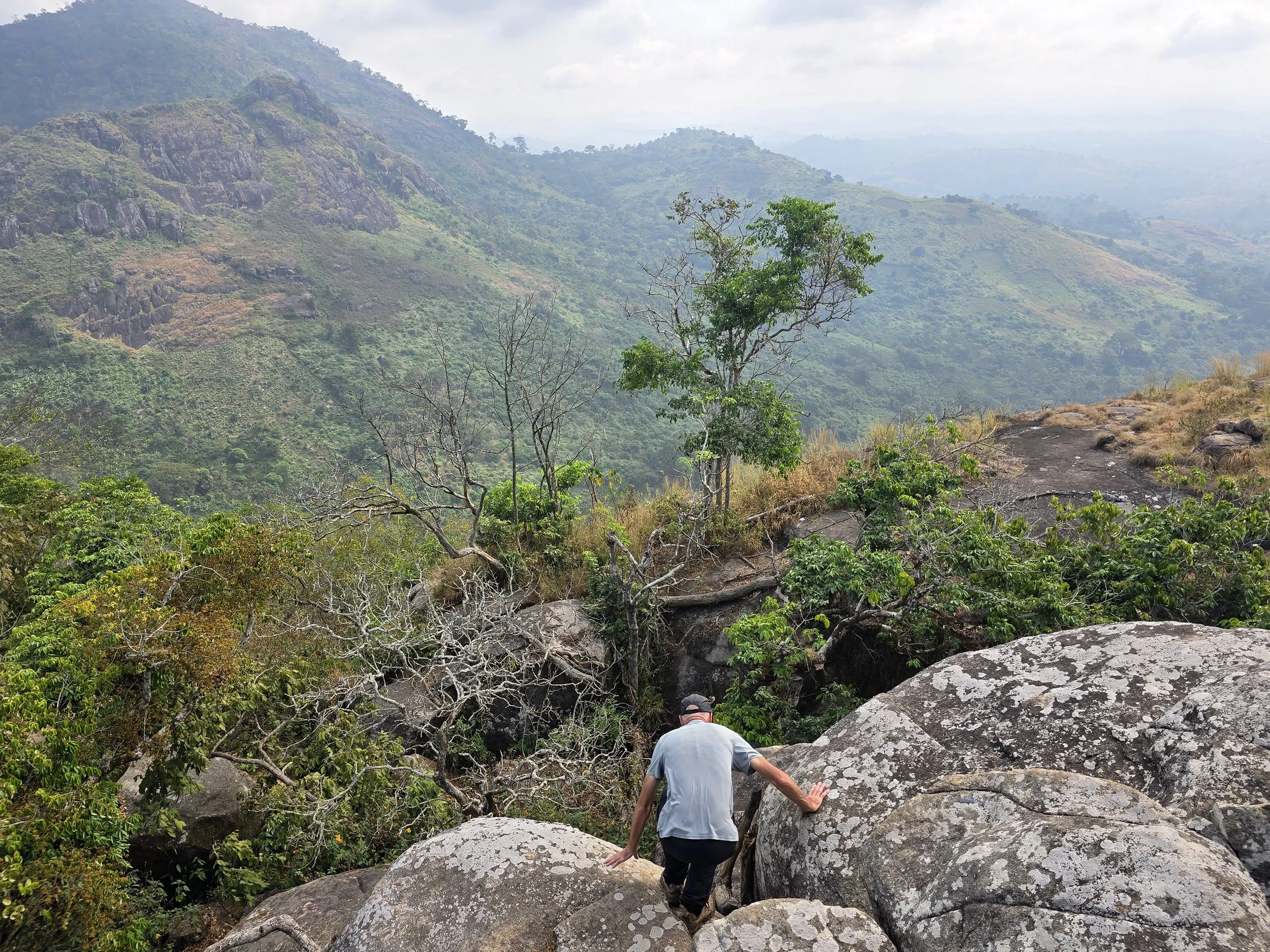
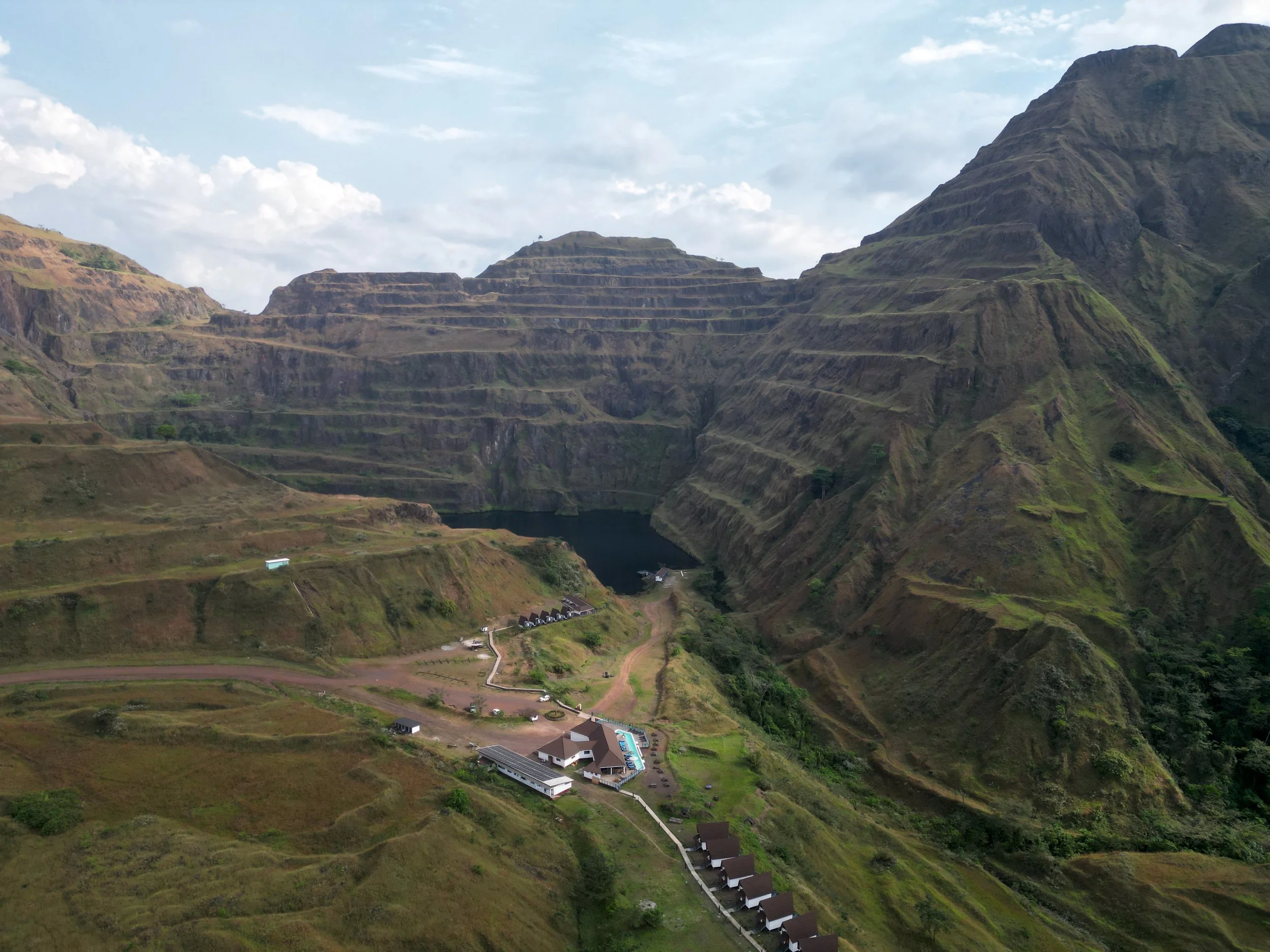
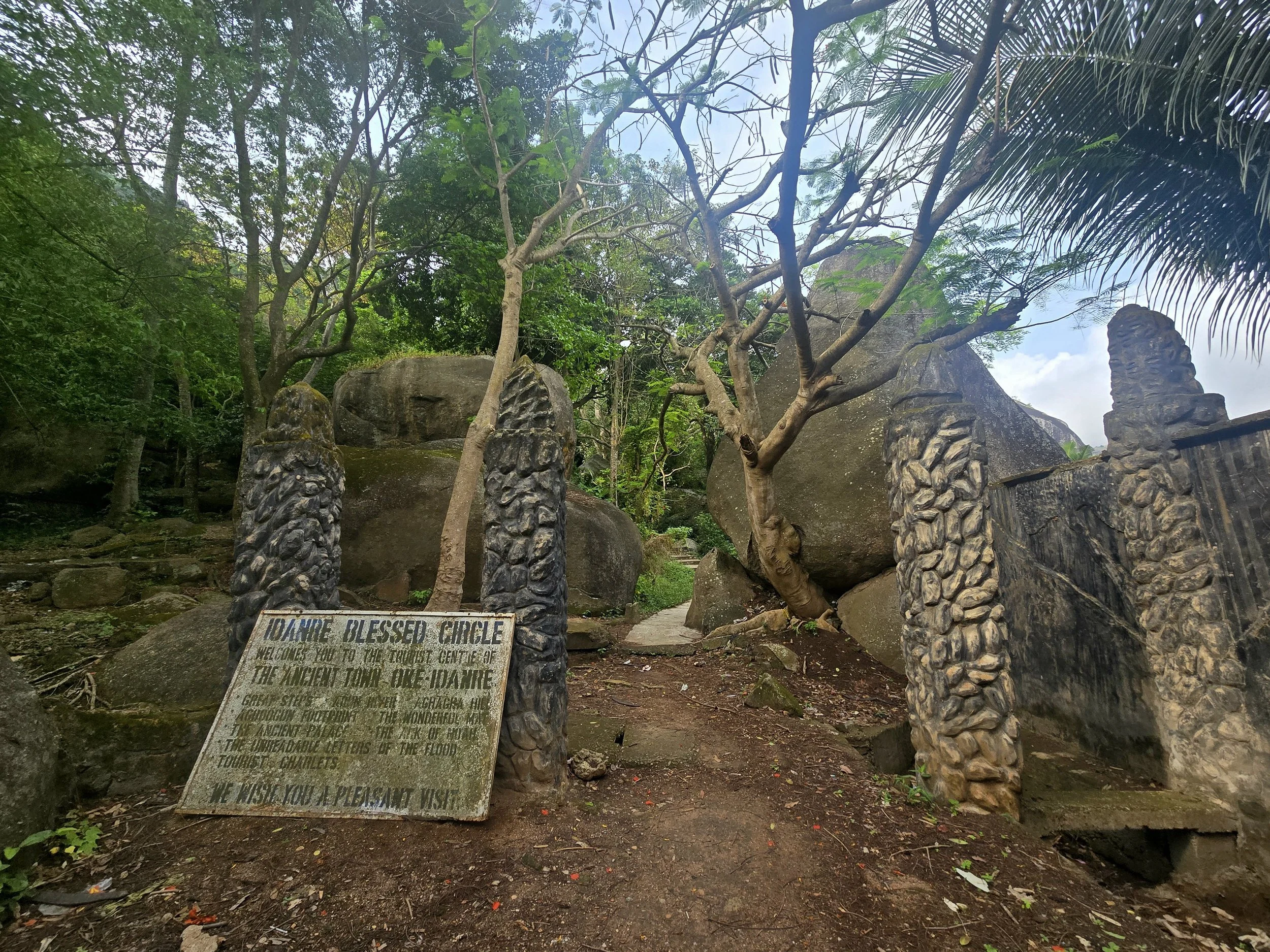
Clutching at straws for points of interest, we detoured to the Idanre Hills, a cluster of steep granite domes around a town bearing a slightly forgotten feel with run-down and abandoned guesthouses, underused viewpoints and a climb of 682 steps to the inspirationally named hilltop settlement of Oke-Idanre (Idanre on the hill).  The two-day detour and stay in the Presidential Suite of the Goshen Trust Hotel – which didn’t include toilet paper or a toilet seat – was questionable, but this was one of the country’s highlights …..

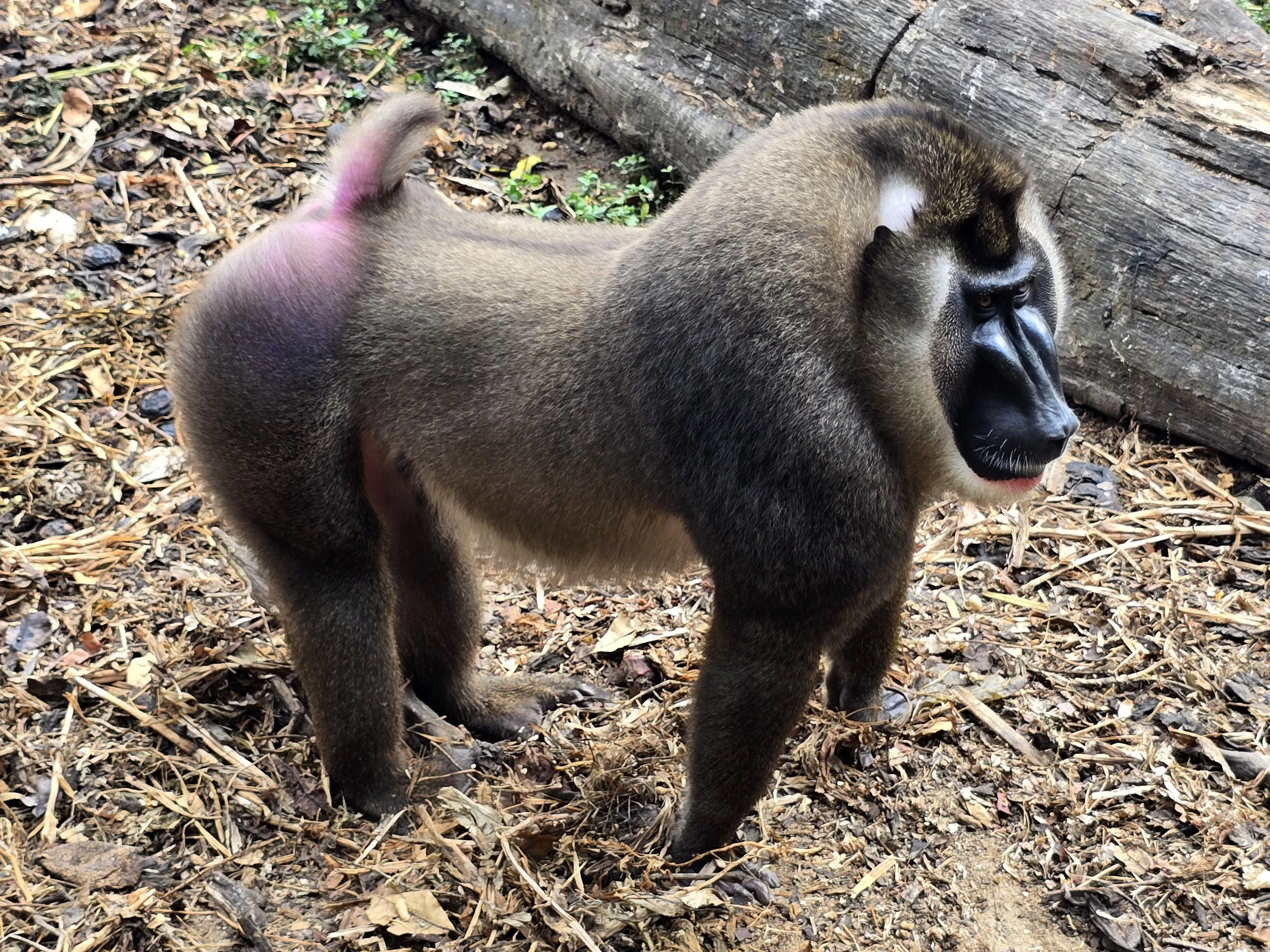
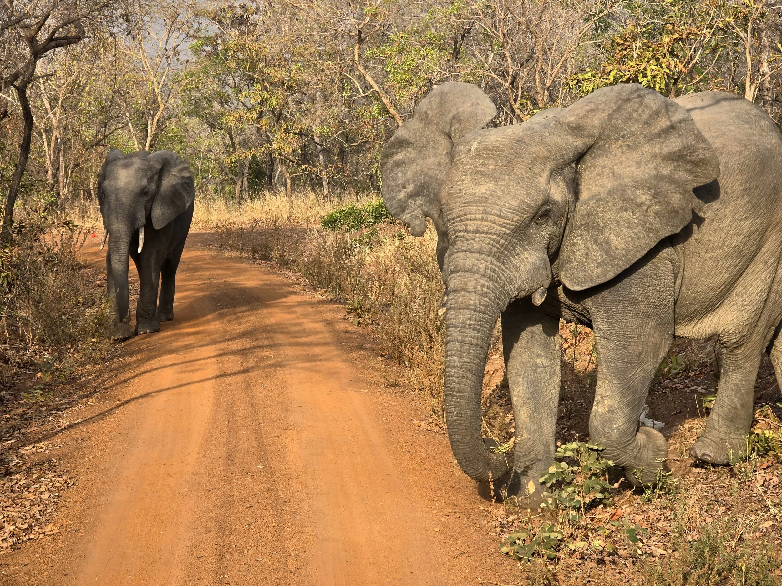
drill primates, afi mountain ranch

….. which was thankfully topped by the Afi Mountain Drill Range, a wildlife conservation centre in the Cross River forested highlands of Nigeria, near the border with Cameroon.  The drill monkey is one of Africa’s most endangered primates with less than 4,000 left globally, over 600 of these at the ranch; the only place in the world to see drill groups in their natural habitat.  Heavily hunted for bush meat (along with the Cross River Gorilla whose numbers are now less than 300), the Pandrillus Foundation functions as a rescue centre, breeding and rehabilitation site, and a research base for primate behaviour. 

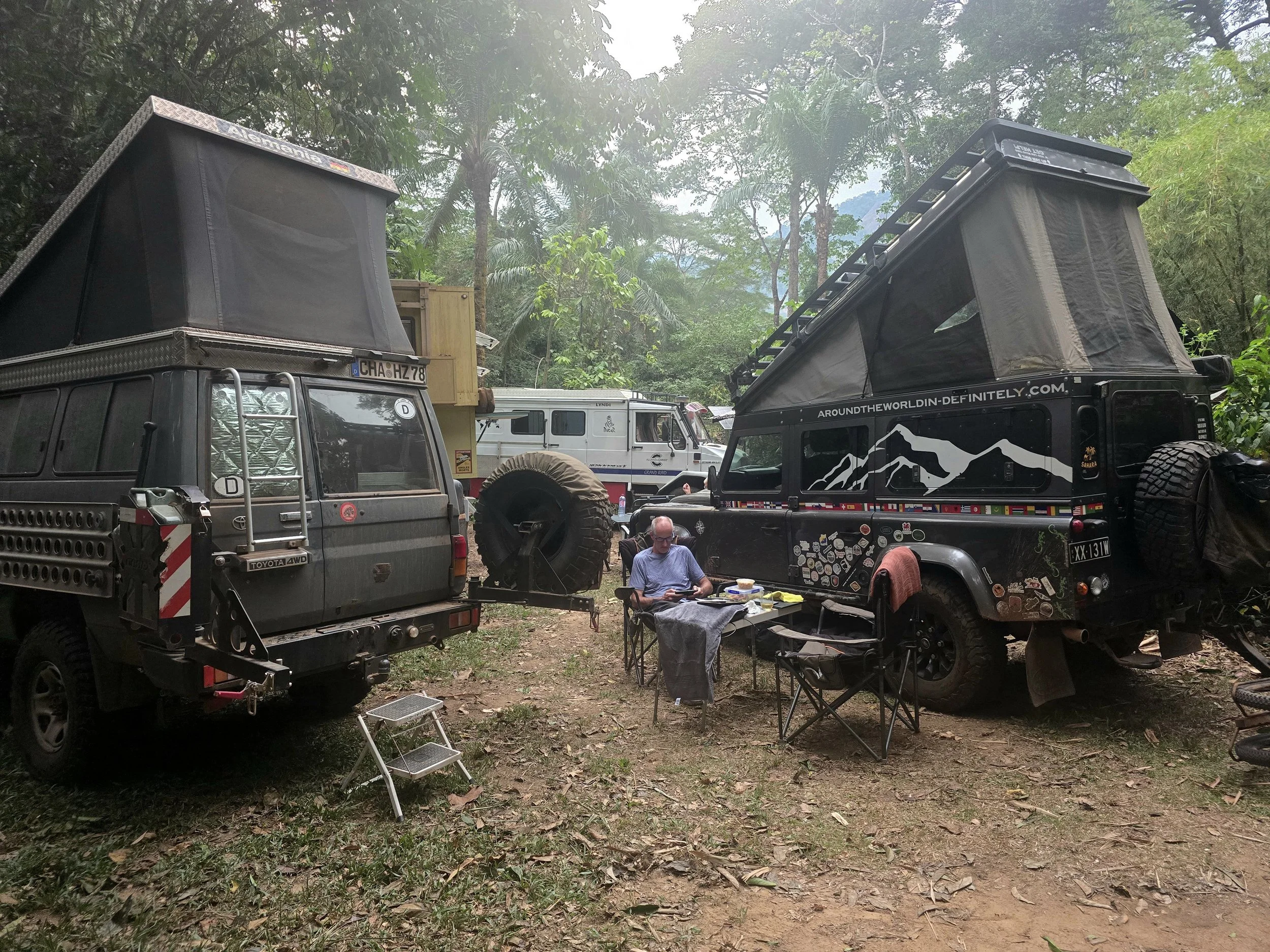
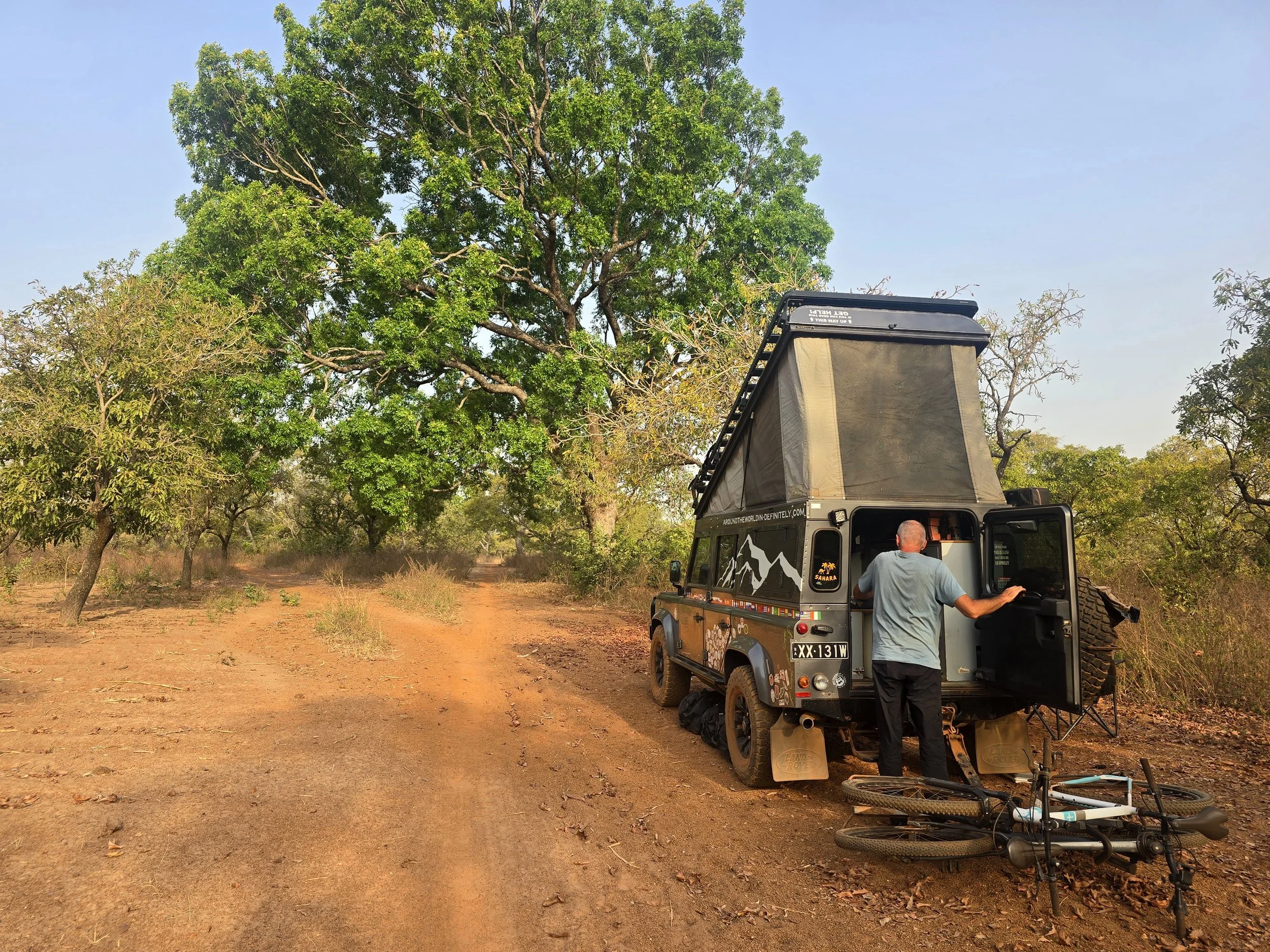
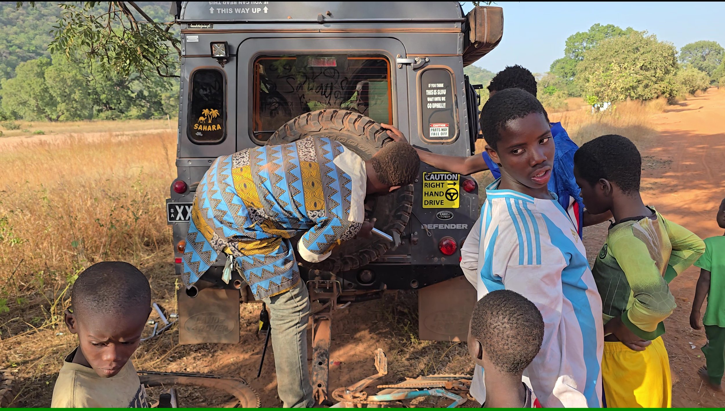
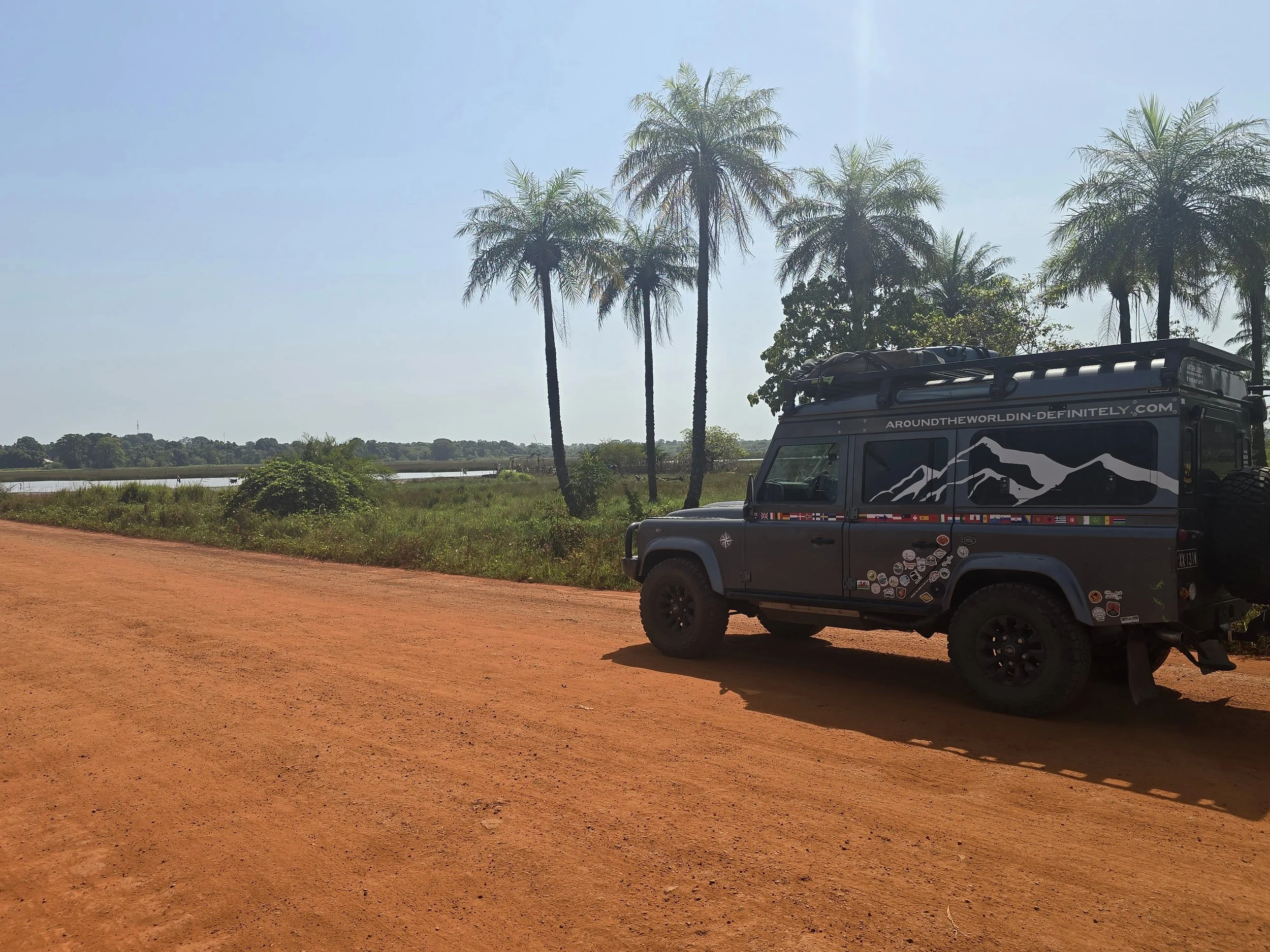
rare sight, other overlanders

Accessed by a truly awful dirt track, the only visitors tend to be overlanders who are welcomed with opened arms on the one hand and relieved to be away from the chaos of Nigeria on the other.  Indeed, it was here than we met other overlanders (all German) and where the main topic of conversation was how to get out of Nigerian and into Cameroon.

With many of the borders closed or unsafe, overlanders are left with two options.  A military convoy leaves the border town of Ekok (usually on Wednesdays and Saturdays) driving 280km through the troubled area of Anglophone Cameroon to the southern town of Kumba.  The alternative is over the Mambilla Plateau, a mountainous region that acts as a natural border between the two countries, via the notorious Banyo track - 145km of challenging 4x4 driving.    

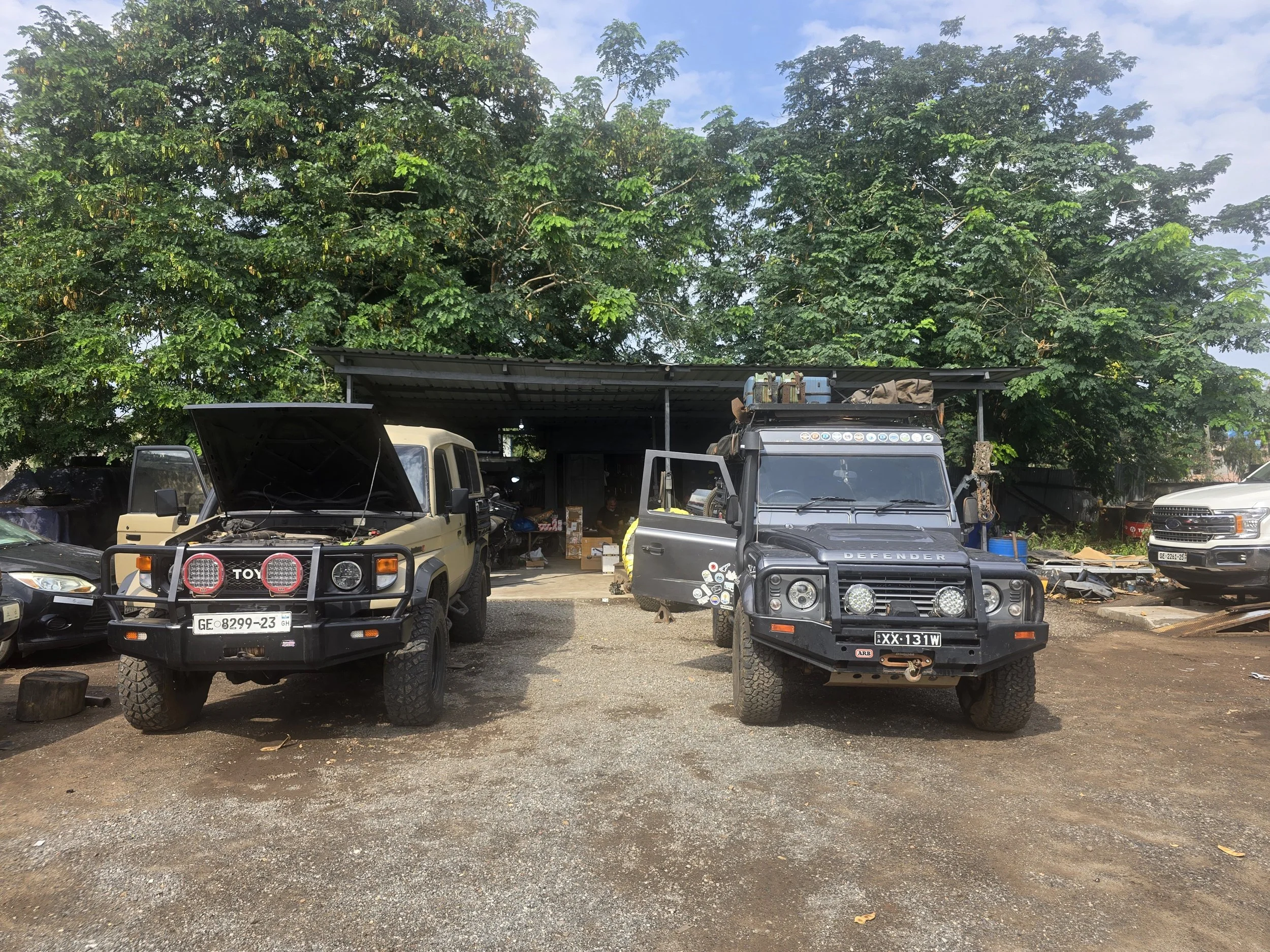
My guess would be that less than 20% of overlanders take the Banyo track, many being deterred after hearing accounts from other overlanders who have been generous enough to share their horror stories via Utube!  Having trawled the internet ourselves whilst weighing up the pros and cons of both routes, the Banyo track ultimately came out on top.  We would be escaping the intense heat and non-stop cacophony that is Nigeria; some fresh mountain air combined with some peace and quiet was too hard to resist.  Our new Starlink Mini was mounted and working, a recent half-day 4x4 driving instruction back in the UK had brushed up my low range and diff lock skills and Bob was feeling great after recent repair work in Accra.

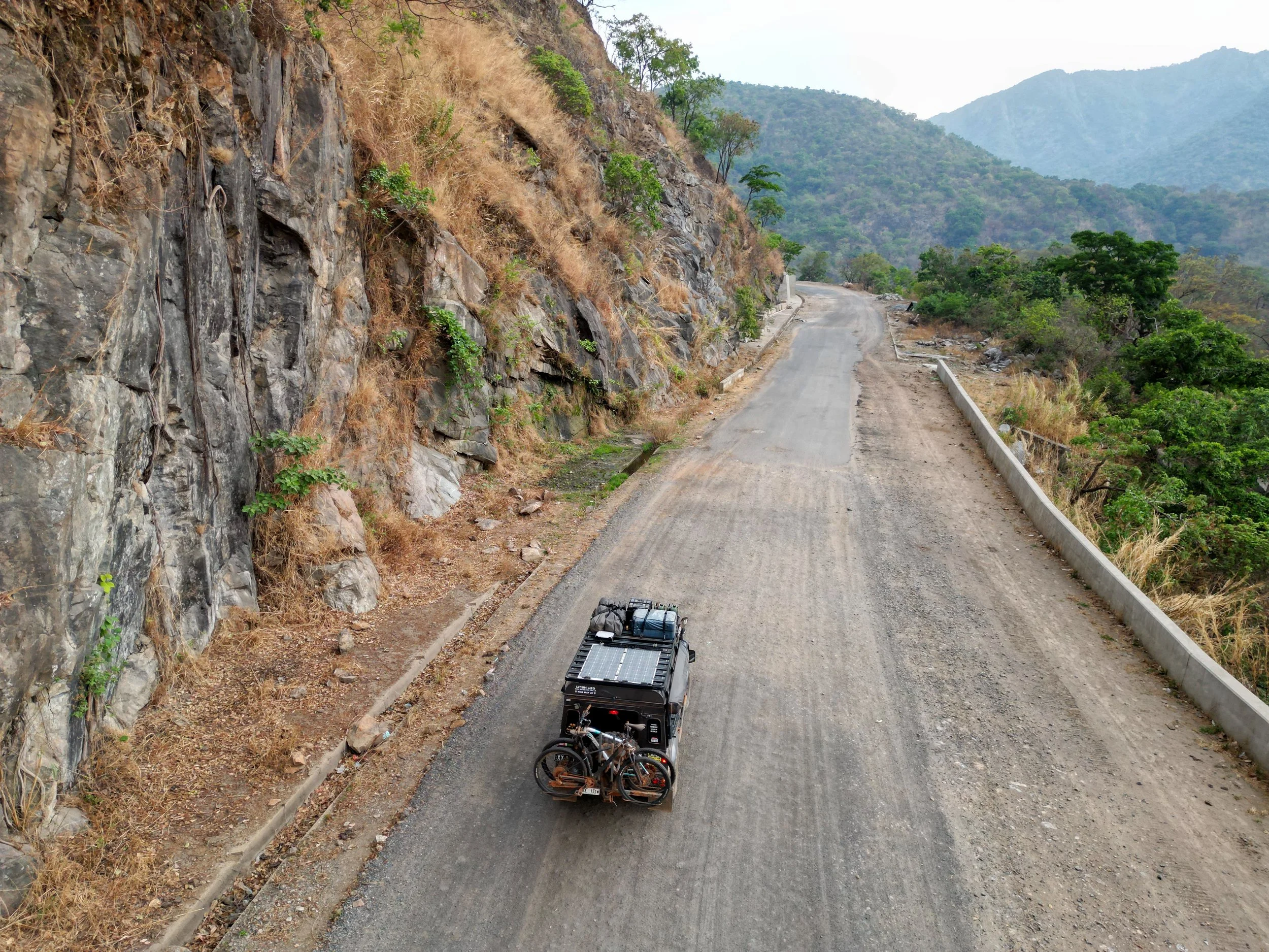
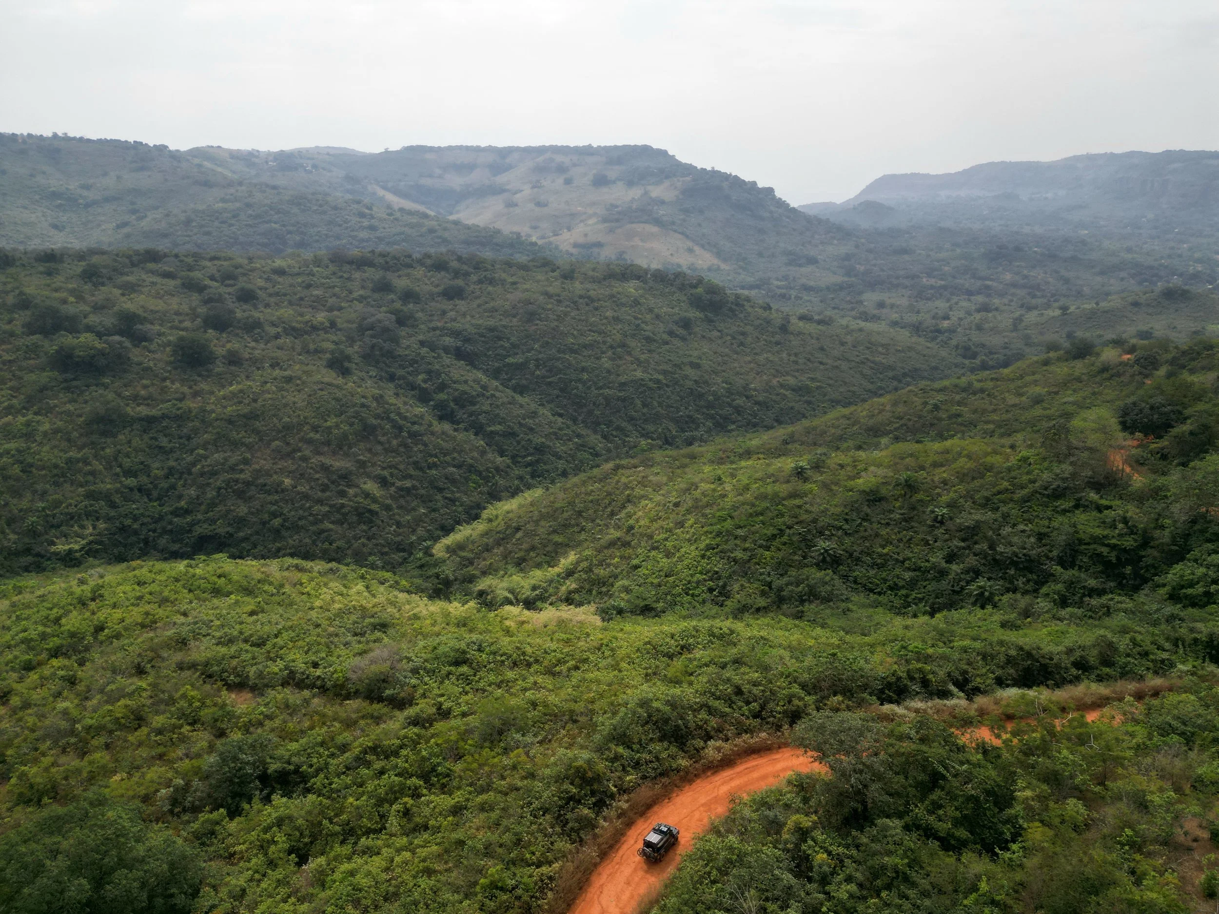
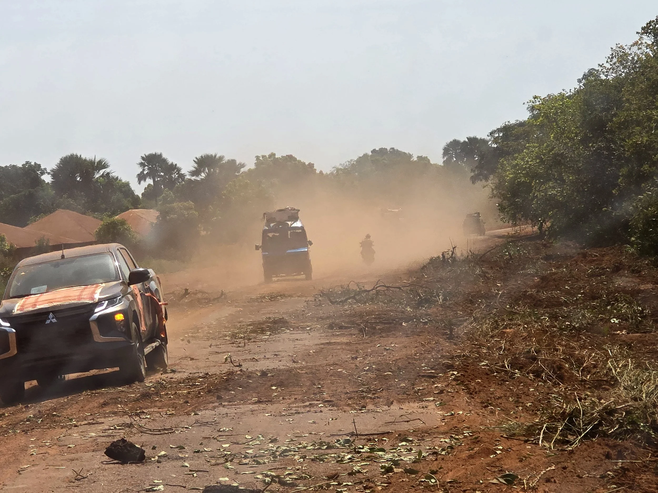
uphill towards the banyo track

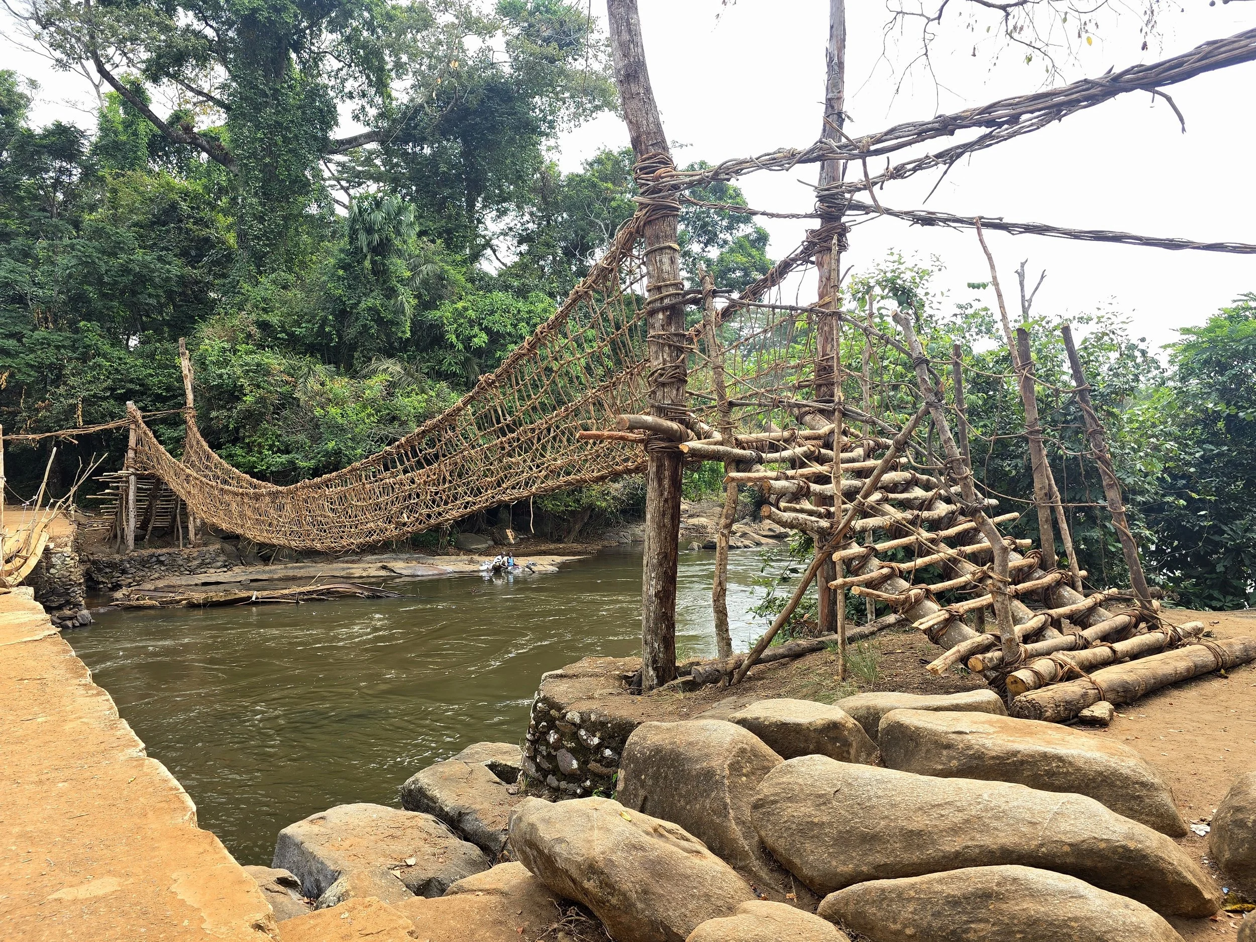
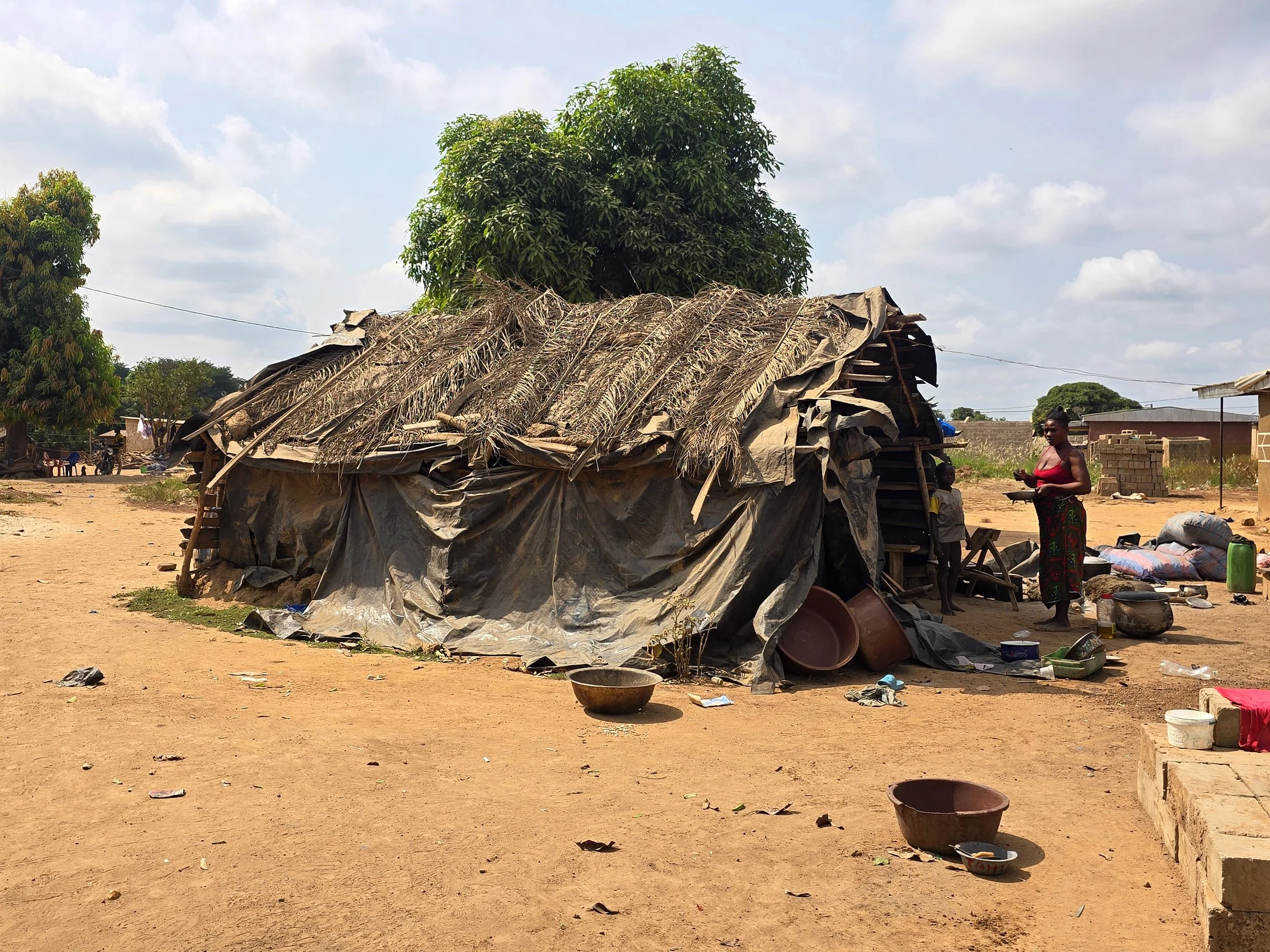
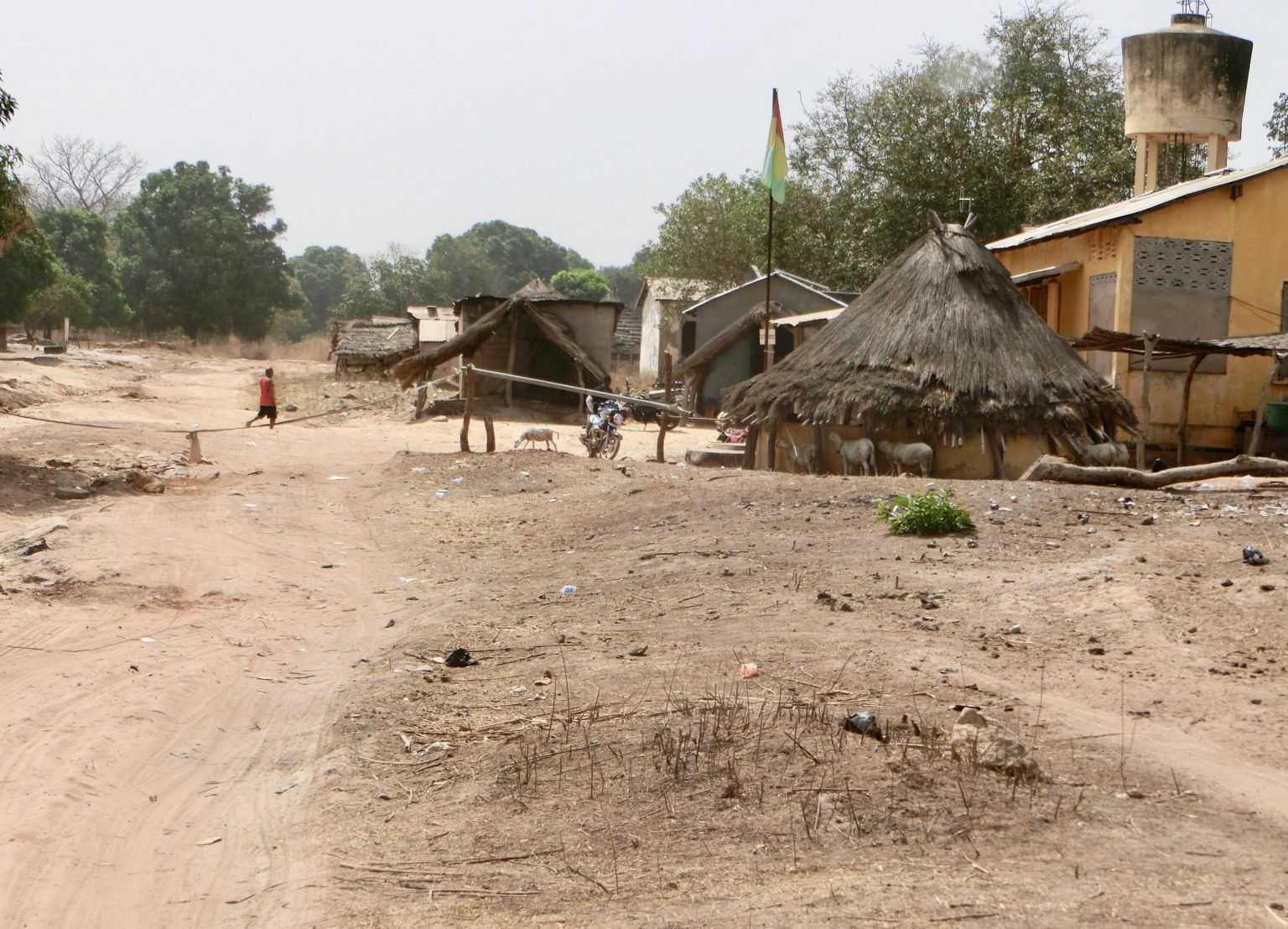
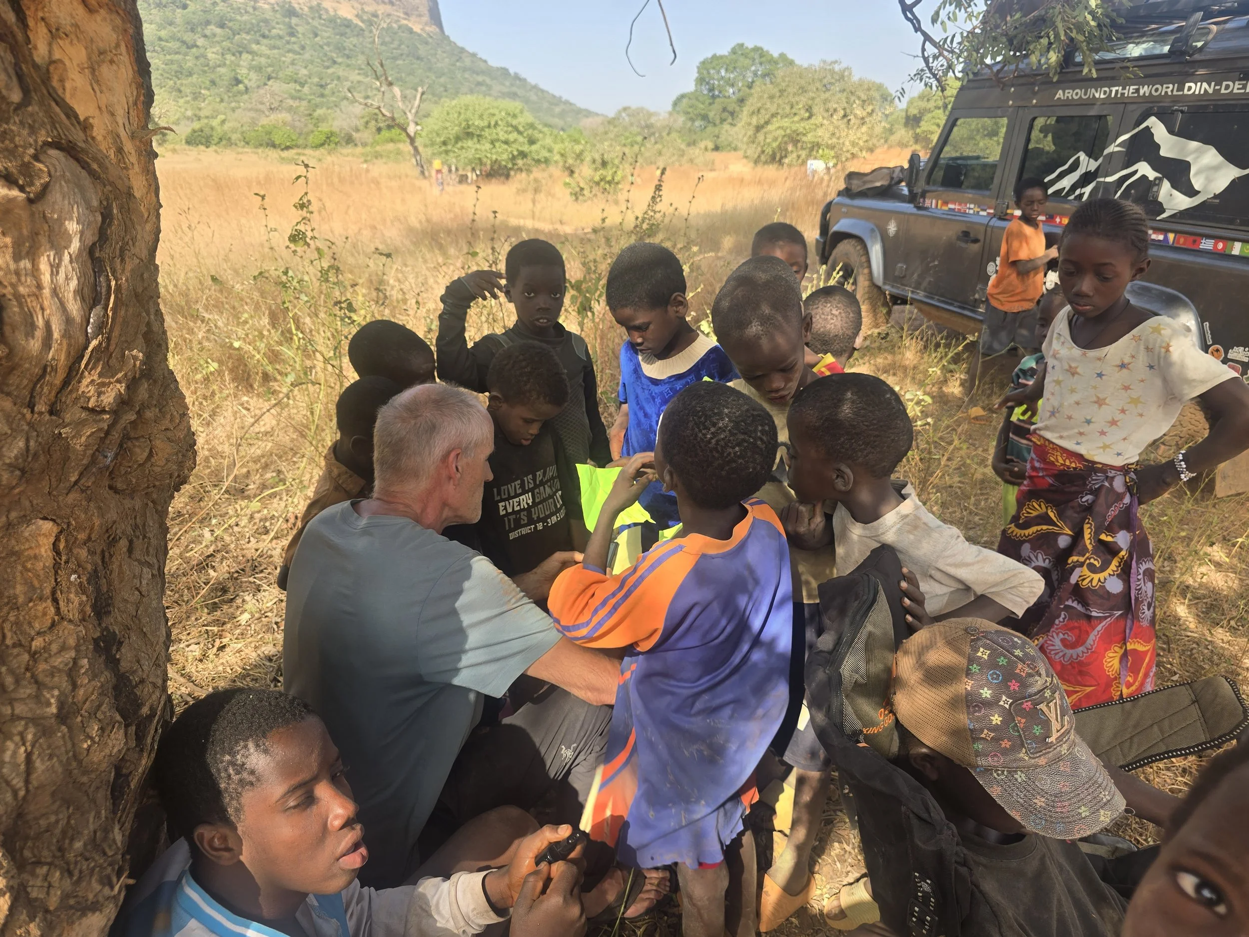
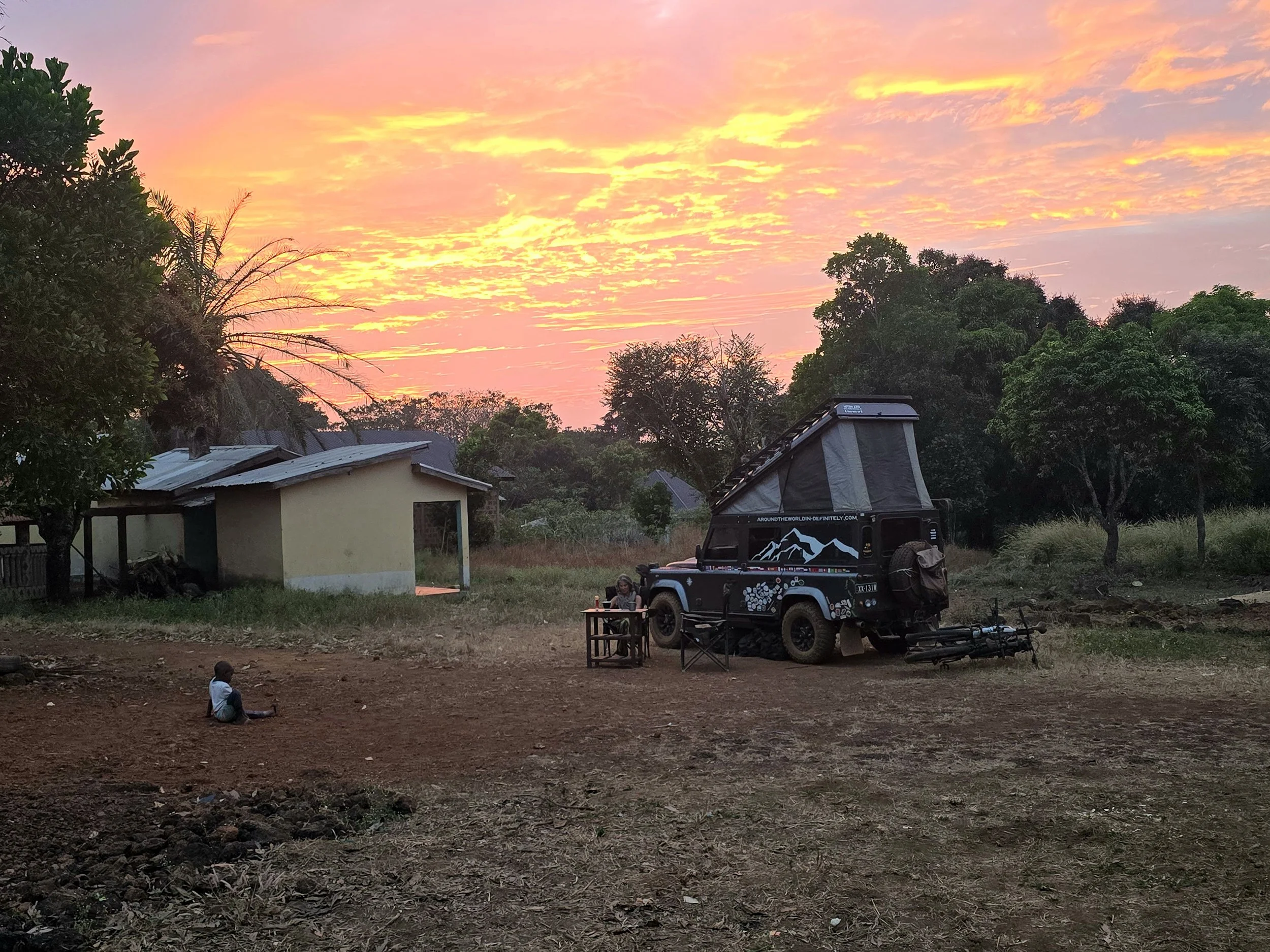
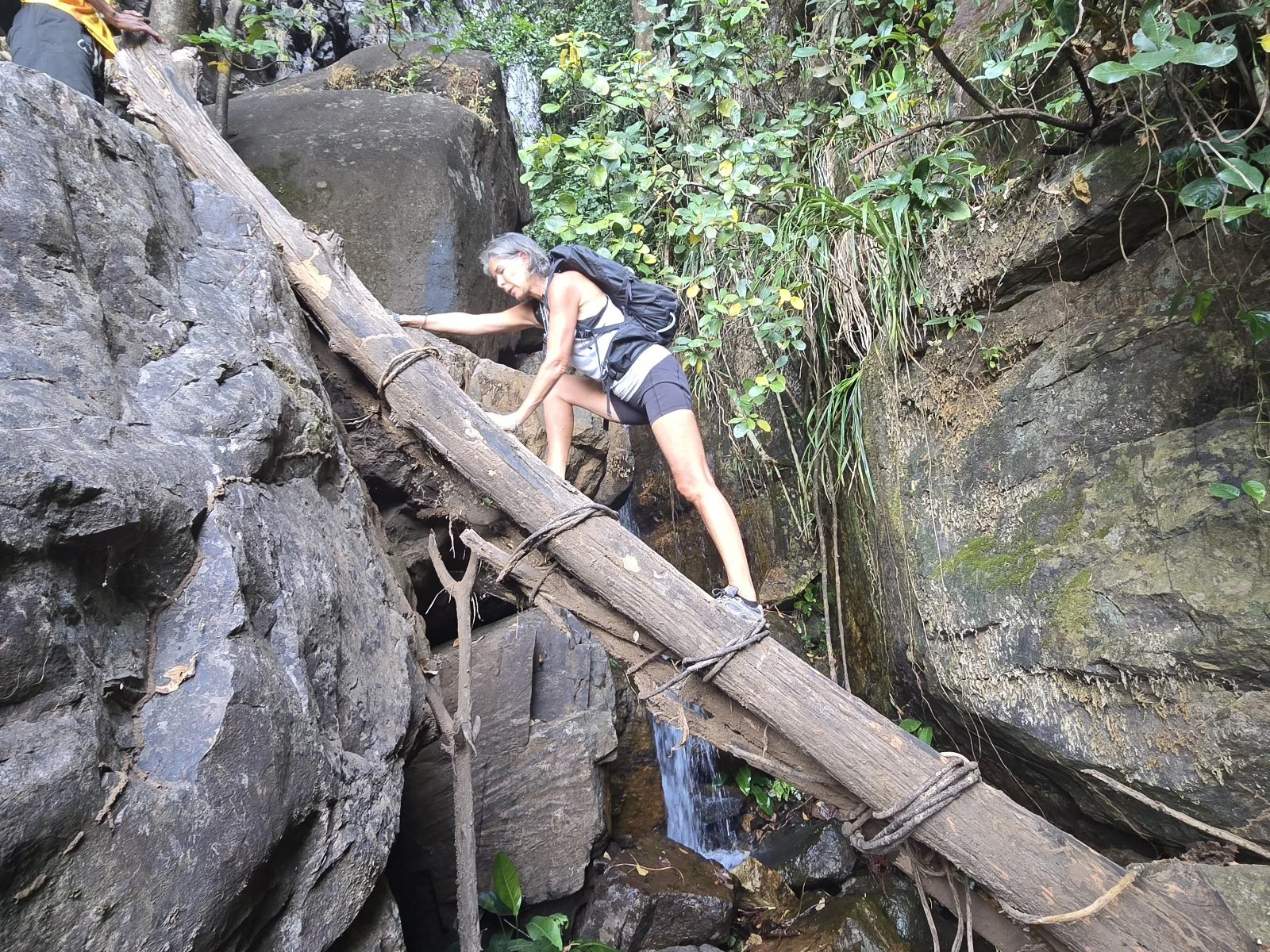
Leaving Afi Ranch, it took three days to reach the high village of Nguroji.  The roads were a mixture of tar and gravel, with an unexpected thunderstorm on the last section demonstrating how quickly conditions can change from a scenic uphill drive to loss of visibility and traction on the steep bends.  The storm didn’t last long and not wanting to spend the night in the village we detoured 4km to the Mountain Forest Project, a research camp accessed by steep, narrow tracks and a rickety wooden bridge.  Despairing of ever getting there, we finally reached the gates of the project with an entourage of about 15 village children who had run all the way behind us.  As we handed out pencils and notebooks, one of the older boys burst into tears as he haltingly thanked us for the opportunity to practice writing his name in English.

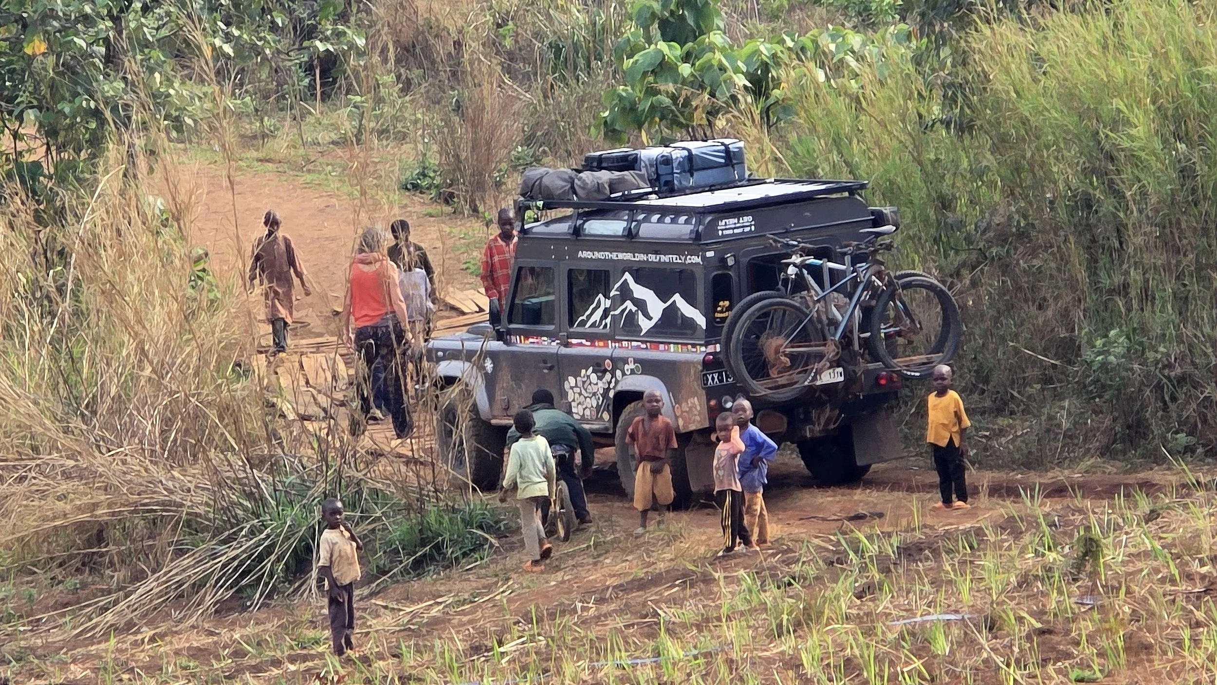
children of nguroji village

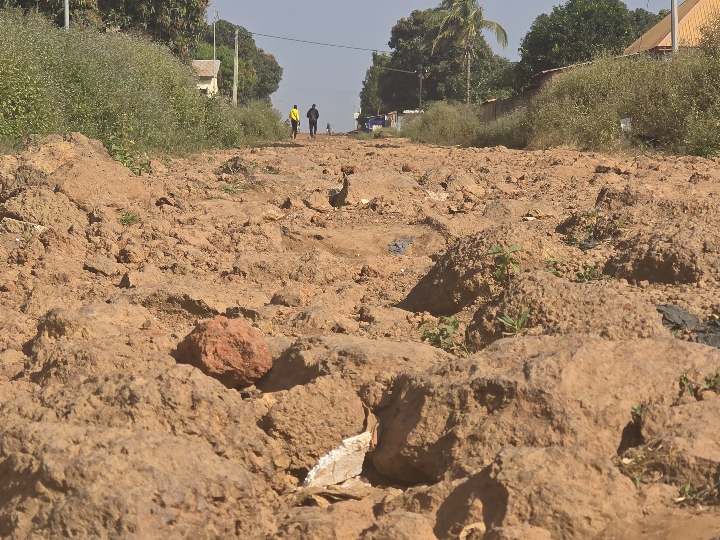
Tempting as it was to remain at the camp for more than one night, our concerns about the weather and deteriorating road conditions had us back at the village and at the beginning of the Banyo track early the next day.  The rainy season was due to start and as difficult as the track would be under dry conditions we reckoned it would be impossible for us to get through once the dirt surface morphed into a muddy hell.

The weather gods smiled on us and we covered 100km before wild camping off to the side of the track overlooking rolling grassy hills.  The track had definitely been challenging with its ruts, moguls and long steep inclines littered with large rocks, but Bob hadn’t faltered once and we were grateful that we had no horror stories of our own to tell.  Apart from the occasional local motorbike, we hadn’t seen any other vehicles on the entire track which did make us wonder whether continual deterioration had now made it impassable for many.  Staying out of the deep ruts in wet weather would have been impossible and the ground clearance needed would be more than most vehicles (including Bob) could manage.  The isolation of the region was welcomed but no cell phone reception or passing traffic yet another issue to be considered.    

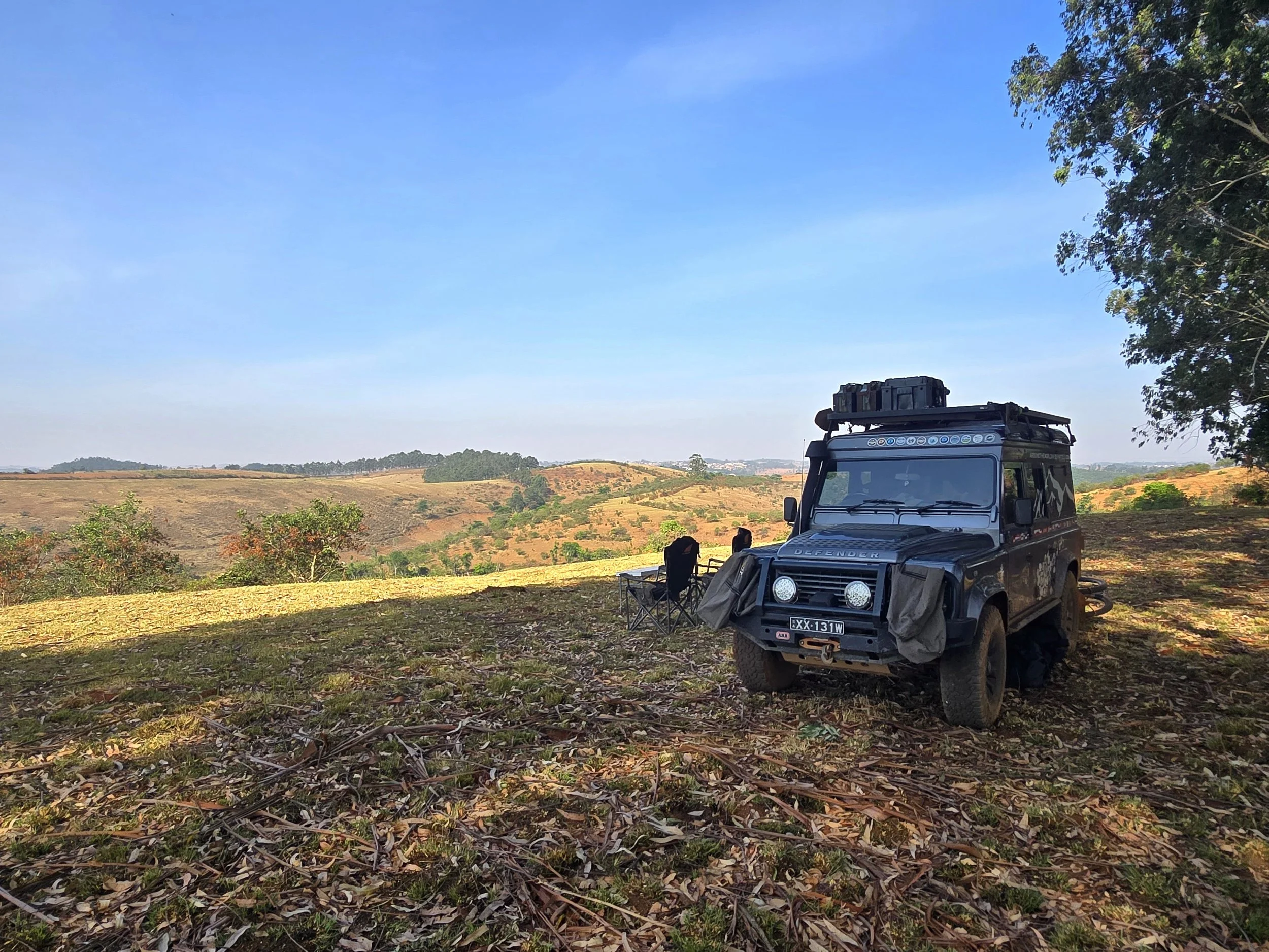
scotland or nigeria?

The track continued much the same the following day and we arrived at the border village of Kan-Lyaka around midday.  There was a small hut housing an immigration officer who stamped us out of Nigeria and a teenager sat on a bench under a tree who did the same with our Carnet and, just like that, our adventures through Western Africa come to an end.

Cote d'Ivoire, Burkina Faso, Ghana & Togo

bead making, korhogo

Despite its alluring name, we hadn’t planned to visit the coast of Cote d-Ivoire, preferring instead to travel north to the town of Korhogo, a hub of artisan crafts including bead making and shea butter production. It is also where the Boloye (panther) dance is performed by the Senufo people.  One small issue: no brakes.  Five or six vigorous pumps on the pedal produced a faint bite but nowhere near enough force to stop a 3,000 kg vehicle.    

Overlanding in West Africa is notoriously tough: extreme heat, poor or absent roads, border bureaucracy, police checks, chaotic cities, and a glaring lack of infrastructure – especially when you need repairs.  African bush mechanics are remarkable, but without modern tools or parts, even they couldn’t help us. 

So, once again, we were online ordering parts.  After consulting UK garages, we gambled on a faulty brake servo and arranged delivery to Ghana.  English speaking and home to a recommended mechanic in Accra via iOverlander, this seemed our best bet.  Aborting current plans and heading directly to Accra would be an 800 km drive; via our planned route, nearly double that.  What to do?  If we changed plans every time Bob needed attention we were in danger of passing through large parts of the continent just hopping from one garage to the next; press on and it was 1,500 without brakes.  We left it to fate: if our Burkina Faso evisas arrived, we’d continue as planned.  

The next day we reached Korhogo.  With few tourists around, finding a guide was easy and after an afternoon visiting the various cottage industries, he took us to the village of Waraniene. Young Senufo men undergo a forest rite of passage where, whether to keep forest spirits at bay or to alleviate boredom, they develop acrobatic skills which are later performed at ceremonies and funerals.   

Children dominated the village – thrilled by visitors and unstoppable once the musicians began on their peculiar bolons.  They tumbled into the arena – somersaults, handsprings, cartwheels – effortless, aside from the challenge of keeping their threadbare trousers up. 

All too soon, the Boloye dancers arrived in brown, ear-topped onesies, feet and the occasional eye visible behind feline masks.  After greeting the musicians, they delivered a sharper, faster version of the children’s display – leaps, spins, backflips – that had us debating whether to applaud or move our chairs back.

Ceremonies like this have been a highlight of our time in Cote d’Ivoire.  The warmth and inclusion extended to us have left a strong impression and as we headed towards our next country we were in high spirits.      

no-man’s land, burkina faso

Burkino Faso sits landlocked in the heart of West Africa.  Independent from France in 1960, its first president lasted six years before the army intervened – the start of what was to become a national habit.  The standout chapter came in 1983 when 33-year-old Thomas Sankara seized power, launching sweeping reforms: rejecting aid dependency, pushing vaccination, land reform, anti-corruption, women’s rights and reforestation.  He sold off government Mercedes, put civil servants on bicycles, and renamed Upper Volta to Burkina Faso, “Land of the Upright People”.   

He was assassinated in 1987 by a former ally who ruled for 27 increasingly unpopular years before fleeing amid protests.  Elections followed in 2015, but a jihadist insurgency spreading from Mali eroded security.  Attacks on military, police, schools and religious sites left thousands dead and large areas of territory beyond state control.  More coups followed, and in 2023 Captain Ibrahim Traore took power.  Unsatisfied with counterinsurgency support from resident French troops, western alliances were replaced with support from Moscow, a security partner willing to provide weapons, training and paramilitary support without lectures on governance or human rights.  A similar model already adopted by other militarised African countries including Mali, Niger and Central African Republic.

sindou peaks

Nearing the Leraba border crossing, checkpoints multiplied - police then soldiers - each stop more imposing with tougher looking men sporting bigger guns.  There was no suggestion that we should turn back.  Exiting Cote d’Ivoire the Douane (customs) compound was huge and finding the right stamp for our Carnet took time, tourism clearly thin.  Immigration, 5 km down the road, meant a tent, a portacabin and a long line of around 100 people waiting under a burning sun to be processed.  Resigned to the same fate, we went to join them but were instead waved into the tent where it took over an hour to enter our details into various ledgers, although we were offered lunch!

No-man’s land stretched for 35km, most of the traffic consisting of trucks, and once we reached Burkina immigration and customs we went through at a similarly sluggish pace.  It took most of the day and we didn’t progress far before finding a suitable spot to wild camp.

the house of plastic bags and glass bottles

Despite its troubles, Burkina felt calm and somehow softer than its neighbours.  There was noticeably less trash, the villages were tidy with extensive vegetable plots and the people were busy.   Being naturally reserved, there was no hassling or begging and the novelty of personal space was striking.    

We continued to the country’s second largest city, Bobo-Dioulasso, stopping at the Sindou Peaks and Domes of Fabedougou, striking landscapes of ancient, weathered sandstone.  Clambering onto the top of one of the towering formations, we surprised (and were surprised by) 30 teenagers in bright “Friends of the Earth” shirts.  Shy at first, they soon started practicing their English and walked partway back with us, curious about our journey. 

This easy friendliness carried to Bobo, where we camped in the garden of a guesthouse run by a Dutch woman.  A group of Swiss volunteers were also in residence, overseeing the building of a house utilizing plastic bottles and bags.  Construction was being carried out by a group of local lads and whilst it was an interesting concept, garnering a lot of interest from the media, its long-term progress once the volunteers returned home seemed optimistic.     

wild camping, burkina faso

Bobo was as far into the country as we intended to go; we would exit via the Ouessa/Hamile border crossing into Ghana.  The “upright people” had shown themselves to be quietly dignified, unfailingly courteous and entirely true to their name, and we were glad we’d made the detour despite the risks.    

Our final wild camp, just 40km from the Ghana border, passed quietly.  As we were leaving, four men on motorbikes arrived.  After brief greetings, one flashed an ID – not in uniform but indicating he was police.  Struggling to understand what he was saying we gathered that we were to wait for colleagues from a nearby town to check our documents.  Reasonable enough, until one of the other men (no ID) demanded to see our passports.  We were alone on scrubland, 100 m off the road, facing four ununiformed men asking for documents.  Ian offered photocopies which caused some agitation, a situation that was further aggravated by my getting into Bob and starting the engine.  Keen not to get left behind, Ian jumped in but just missed closing the door before the guy – now extremely angry - grabbed it.  My attempts to calm things failed, and the one word that cut through any communication issues “ambush” ended any attempts at further discussion.   

With the man still clinging to the door, I accelerated.  We moved as one – him running alongside, apparently trying to wrench the door off its hinges.  The scrub land in Africa is not unlike that in Australia, sparse but wickedly thorny, and just in front of us was a particularly spiky specimen.  I drove straight at it.  It was touch and go for a few seconds as the man considered his options, but with a loud shout he admitted defeat and let go.  With just enough space for a wide turn, we bounced across the scrub and rejoined the road towards the border.   

Unsurprisingly, we were soon being pursued and then overtaken.  Having pulled over, one guy was loading a catapult with stones while another hefted a large rock above his head.  The shot hit the rear wheel; the rock struck the driver’s door.  Whether from choice or inability, we didn’t stop….

….. until we were pulled over at a checkpoint 20km down the road.  They were expecting us, suggesting at least one of the men was indeed police.  We were told to return with our documents which we refused to do and after an hour-long standoff, they escorted us to the border instead.  More delays followed while our phones were checked for photos that we had apparently been taking???  Being labelled spies, we suspected, helped justify the earlier theatrics.  

It was an unfortunate incident.  Even with the benefit of hindsight, it’s unclear if we handled it correctly.  Fortunately, there were no serious consequences, just a chipped back wheel and a long gouge across the driver’s front door. 

walking with elephants

By the time we reached immigration in Ghana immigration it was mid-afternoon.  A heaving, loosely ordered queue waited for passport stamps, but once again we were waved to the front – nearly triggering a riot.  Control seemed minimal, and after the morning’s drama, it felt like a very long day.  Still, we were processed and sent across the road for the Carnet, where we again waited for the elusive man with the right stamp – this time with chairs and Jerry Maguire on TV, which helped

After a night on a rural petrol station forecourt, we aimed for Mole National Park.  West Africa can’t rival East or Southern Africa for safari – too many people, too much hunting – but Mole offers something rare, walking safaris among forest elephants, antelope and warthogs.  As Ghana’s largest reserve, it’s still lightly visited, adding to the appeal.  Game drives were on offer, but with the lodge perched above a waterhole, watching wildlife from the verandah with a cold drink was also an option. 

volta region, ghana

Soon it was time for Accra.  We split the 710 km journey in the Volta Region – green hills, waterfalls and accessible hiking.  Failing to book ahead, we couldn’t get a room at Tagbo Falls Lodge, but they let us camp on the lawn where, a few days later, we noticed the flat tyre – coincidentally the same one that had taken a catapult hit days earlier. 

bilal’s legendary workshop

With the mis-matched spare on, we rolled into Accra and straight into Bilal’s Legendary Workshop.  Handing Bob over was a relief; the diagnosis wasn’t.  The brake servo was fine – the master cylinder had failed.  So: find somewhere to stay, order parts and wait.  Importing those parts – plus a BF Goodrich tyre – proved eye-watering.  Duties and VAT were just the start; health, education, regional and development levies, plus processing and inspection fees, nearly doubled the cost.  In Freetown we’d paid none of this, and everything had been delivered.  In Accra, we cycled endlessly between UPS and Fedex trying to locate our parcels.  Retrieving the tyre from Fedex took most of the day, a cavernous warehouse, teetering piles, crowds hunting parcels and the same details copied into multiple ledgers.  Storage fees, tips – everyone stuck in the same slow grind.   

tyre collection from fedex

Yet beyond the postal chaos, we loved Accra: unmistakably African yet well set up for visitors – aircon, hot water, proper coffee, good bars, a lively music scene and friendly people.  Two weeks later we left.  Bob now sporting 4 matching tyres, a working compressor, sealed front diff plus a functioning camera and reversing light.  We’ll enjoy it while it lasts!

Given how much of our recent schedule had been dictated by Bob and his appetite for imported parts, Togo wasn’t somewhere we planned to linger.  Rather than the main coastal crossing to the capital of Lome, we briefly ducked back into the Volta region and crossed inland at the Shia border crossing, continuing north to Kpalime.

chateau viale, togo

Here we saw the first signs of German influence at the Medieval style Chateau Viale built in 1944.  Togo began as German Togoland in the late nineteenth century, was split between Britain and France after World War I, and the French portion became modern Togo in 1960.  Today it is officially a presidential republic, though decades of family rule suggest something closer to a family business.  Gnassingbe Eyadema seized power in 1967 and ruled for 28 years.  On his death in 2005, the army installed his son, Faure Gnassingbe, who has remained in office since.  Elections exist, at least on paper, though results are regularly disputed.  Had we arrived a few months earlier, we would have coincided with a narrowly avoided coup.

Just 50 km wide at its narrowest yet stretching nearly 600 km from the Atlantic to the Sahel, Togo is essentially a corridor: palm-lined lagoons in the south giving way to dry savannah in the north.  It rarely features on the global radar, though the trivia is plentiful.  The Prince of Monaco fathered a child with a Togolese woman, Togo fielded not one but two cross-country skiers at the 2014 Winter Olympics, it is a significant exporter of phosphate and is one of only three countries in the world whose name contains none of the letters in the word mackerel. 

Digging a little deeper, we were drawn to the Tem people and their reputation for fire dancing, a spectacle which required a five-hour detour inland.  Major roads were, by West African standards, excellent but the increase in speeds did seem to correlate with the steady tally of crumpled vehicles that lined the tarmac.  Roadwords near Sokode delayed us until after dark making our arrival into town, where we represented the total of the white population, somewhat unnerving.  The best (read only) hotel was adequate but at least our guide showed us to take up to Kparatao. 

We don’t usually drive at night, but a fire dance in daylight rather defeats the point.  Following our guide’s fluorescent shirt as he sped off on a moto-taxi, we turned down a narrow, unlit alley between mud houses.  Whether it was the darkness, the long day or the absence of English, the atmosphere felt markedly different.  There was no real welcome – just a fire in the lane and a wooden bench against a wall.

fire eaters of sokode

What little we knew didn’t reassure us.  These people had a reputation as fearless warriors and witch-finders, and the house we leaned against may well have belonged to opposition leader Tikpi Atchadam – a man whose earlier political activities had resulted in the president’s soldiers shooting a tethered cow belonging to the local butcher because it was allegedly “threatening security forces”.  

Slightly on edge, we watched as the drumming built into a hypnotic rhythm, pushing the dancers toward trance before burning sticks were pulled from the fire. Sceptical as we were, it was hard to see the trick: flames ran across arms, chests and backs before being placed in mouths and extinguished.  The glowing ends were then bitten into in a manner similar to eating apples and the dancers advanced towards us, way too close for comfort, hissing through clenched teeth. 

The performance was getting more memorable by the minute.  I could feel the hairs on the back of my hands quietly singeing and I wondered about my only pair of long trousers as fragments of charcoal escaped on the exhale.  One man calmly ate his charcoal, then sat on the fire to extinguish it, remaining there for a long two minutes before jumping up and giving his hips a brisk shake, apparently satisfied that everything was still operational.  As the drumming intensified, blades appeared – swords and razor blades were drawn across torsos, tongues and even an eyeball before a young boy was laid down and slashed theatrically across his stomach.

This ritual honours a pact with the spirit of fire: protection in exchange for respect and display.  Those who perform it are not thought to have learned the skill so much as inherited it.  The ability is believed to pass through certain family lines, less a party trick than a responsibility – something you are born into rather than choose.  The ceremony ended as abruptly as it began, and we were ushered back to Bob with surprising speed – which suited us just fine.

Cote d'Ivoire

PLANTATIONS OF COTE D’IVOIRE

The dirt track down from Mt. Nimba was in good condition, but we were soon back on Liberia’s pot-holed tarmac.  Fortunately, we were only 40km from the Ganta (Liberia)/Danane (Cote d-Ivoire) border.  We hadn’t seen another overlander since the Guinea highlands and the border crossing was no exception, in fact we seemed to be the only people intent on changing countries.  That’s not to say that there weren’t a lot of people around, just that they were all occupied with trying to sell their oranges.  Unlike the big sweet juicy oranges we’d loved in Algeria, these were small and green, the bruised, pitted and bitter skin already removed so that they were ready for sucking, the flesh too fibrous to bother with.     

Declining to boost that economy, we went through the normal procedures of being stamped out of one country and into the next.  For a small border, we were processed extremely quickly, just a slight delay whilst photographs were taken on both sides – whether for immigration records or just selfies remained unclear – but we were soon on our way to the large town of Man.  After an initial stretch of rough road, we suddenly found ourselves on immaculate tarmac and something we hadn’t seen for weeks: white paint road markings.  With an air of recklessness, we accelerated, whizzing past plantations of cocoa, coffee, palm oil, rubber and cashews.

BASILICA OF OUR LADY OF PEACE, YAMOUSSOUKRO

Cote d’Ivoire remains the world’s largest cocoa producer, responsible for roughly 40% of global supply – an agricultural detail that makes most European chocolate aisles quietly dependent on our passing landscape.   The scale of farming is relatively recent.  After independence from France in 1960, President Felix Houphouet-Boigny pursued an open-door economic policy, encouraging migration and agricultural expansion.  For a time, it worked spectacularly well: during the 1960s and 70s the country enjoyed what was called the “Ivorian miracle”, fueled largely by cocoa and coffee exports.  Roads were built; Abidjan grew into a modern metropolis and Yamoussoukro acquired a basilica large enough to be listed in the Guiness Book of Records as the biggest Christian Church in the world.  The model depended, however, on clearing forest for plantations.  By the 1980s, falling commodity prices and rising debt exposed the fragility of the system and forest cover – once among the densest in West Africa – had shrunk dramatically.  A huge blow to the already rapidly declining elephant population.

The country’s very name is a reminder of the ivory extraction carried out by European traders as far back as the 15th century, but the most devastating period for the elephants was between 1970-1990 when commercial poaching and rapid agricultural expansion combined to decimate numbers.  This, like many issues in Africa, is not an easy one to solve as it isn’t just about wildlife, it’s about livelihoods.  When forests are protected, farmers lose land; when cocoa prices fall, people push deeper into forest reserves and conservation is an ongoing negotiation between trees, elephants, and the price of chocolate in Europe.  Ethical certification schemes exist – Rainforest Alliance and Fairtrade among them – though the reality on the ground is, as ever, complicated. 

LIANA BRIDGES, LIEUPLEU

As part of our forward planning, we were aware that Cote d-Ivoire contains a remarkable ethnic density, more than sixty groups and social systems long shaped by lineage, land and the memory of ancestors.  Secret rituals remain important and the visible world is often understood to be closely intertwined with an invisible spiritual one.  Ornate wooden masks are not art objects in the Western sense so much as temporary identities; when someone wears a mask they are no longer acting as an individual but as a spirit or moral force.  Ceremonies involving these masked figures take place at moments of transition – funerals, initiations, harvests, or periods of social tension.  The drumming, dancing and singing that accompanies them are less about spectacle than about keeping the social fabric intact, reinforcing cooperation and a shared sense of belonging. 

Our main objective in such rich culture was to experience as much of it as possible - something that turned out to be considerably harder than expected.  The area around Man is home to the Yakouba people, part of the wider Dan cultural group, numbering several hundred thousand people spread through western Cote d-Ivoire and across the border into Liberia.  Not wanting to take away from any other talents they may have, we were hoping to see them on towering stilts.    

HIKING LA DENT DE MAN

We weren’t naïve enough to think that we could simply drive into a village and happen upon a ceremony in progress.  Ritual events are not advertised and there are no ticket sales, the only way to access them is by using the well-established system of local guides and their contacts with village chiefs.  Struggling with the language barrier, it was quickly apparent that the guides were not interested in organizing a one-off performance, they were looking for deep pocketed tourists wanting multi-day tours, ideally visiting a number of west African countries.  Our efforts produced little beyond a long and expensive guided day out to a waterfall and a living liana bridge – impressive, but not quite the cultural immersion we had anticipated.      

Having committed to stay in the area for several days, we filled the time by hiking up La Dent de Man, the distinctive rock peak that looms above the town.  Declining to hand any more money over for the services of a guide, we promptly took a wrong turn and missed the second half of the walk, which had reportedly included a waterfall and a cooling swim. 

A little despondent, we had largely accepted that any ceremonial rituals taking place would be doing so without us, when we noticed a Russian couple at breakfast with their English-speaking guide.  Having planned their trip months in advance on what appeared to be a rather large budget, they had secured one of the best guides in the area who had organized a series of private performances across Cote d-Ivoire and neighbouring Benin, Togo and Ghana.   

They were just leaving for a stilt dance in Silakoro, one of the best-known stilt-dancing communities in the area, and we asked – out of pure desperation – if we might join them.  We offered to contribute, naively unaware that, in addition to guide and vehicle costs, they were paying in the region of 500 US$ per dance.  After a brief consultation, they agreed we could accompany them, generously declining any financial input from us, settling instead for an evening meal back at the hotel.  Five minutes later we were racing back towards the border, the 130 km journey covered more quickly than any other since arriving in Africa, as Bob valiantly tried to keep up with their unladen Mitsubishi Pajero.   

Silakoro was a dusty but orderly village.  Traditional circular adobe huts stood alongside newer buildings which housed a school and small clinic.  Everyone was occupied.  Women cooked over small fires, pounded rice in mortars and pumped water from the community well, while men erected long poles that appeared to be the framework of a new building.  Rural life here appeared highly structured, the basic components necessary to survive occupying most of the daylight hours.    

SACRED CATFISH AT SILKORO

Before the performance began, we were taken to a small pool containing sacred catfish.  Such animals are venerated in various parts of West Africa, often regarded as protectors or messengers linked to the spirits.  Although sometimes used in sacrifices, they are never eaten and always buried with much ceremony should anything unfortunate happen to them.  They were greedy little buggers and once we had run out of bread we retreated to the center of the village. 

By now we had drawn a large crowd of young boys, united with the sole purpose of having their photographs taken.  The resulting images were examined with intense concentration, much pointing and outbursts of laughter, before further demands were made.  We might never have disentangled ourselves were it not for the sound of drums starting up.  An older man and his young companion had arrived into the large central clearing and were beating out a rhythm on a multi-drum configuration hung from their necks.  Quickly seated on brightly coloured plastic chairs under a straw canopy, we were about to witness elements of a Goudoufou ceremony.  Yes, it was being performed because the Russians had paid for it, but the addition of a large food contribution arranged by the guide – enough for a village feast - had swelled numbers sufficient to create a lively atmosphere.

For nearly two hours the ceremony unfolded in layers of drumming, chanting, dancing and acrobatics. Voluminous costumes of raffia and layered textiles were topped with large ornately carved masks, bells jingled from ankles and flywhisks or bundles of fibers were waved and shaken.  Young women dressed entirely in white, were followed by a group of powerful male dancers, their exaggerated dance steps raising energy levels and preparing the space for the stilt dancer.  Towering above the crowd, his height reinforced the idea that this was an unapproachable spirit; his sinister looking mask suggesting an element of danger.  Ungainly at first he paced in front of the excited crowd, his attendant spotters suggesting that his upright posture was not guaranteed.  However, after a few more long strides without mishap, he threw himself into a series of leaps and spins, mostly on one leg.  Whilst us and the Russians conformed to type with minimum reaction, other attendees were not so reserved, their screams of delight and alarm almost drowning out the sound of the drums.

We weren’t told the full meaning of what we were seeing, it being a closely guarded secret, but initiation into adulthood and a rite of passage to connect with the divine seemed likely.   The whole event had an unmistakably other worldly atmosphere.  For the duration of the ceremony, they were not men in costumes but spirits moving among the living – a distinction everyone present seemed to accept without question.    

Leaving the village to their feast we headed back to Man, assuming the day’s programme was complete.  It was not.  After a quick lunch we set off again, this time a lot more sedately, along a badly rutted forest track that took us 60km in the opposite direction to a small Guere community at Diourouzon.

The Guere are part of the wider Kru-speaking people.  Traditionally located in a region of dense forest and historically limited road access, their interaction with the outside world has been minimal.  Even today, some ceremonies are known only locally and performed infrequently, which explained why our guide seemed quietly pleased that the village had agreed to receive us, although given the huge wodge of cash the Russians were handing over, not altogether surprising. 

The ceremony we were about to witness was known as the Dance of the Jongleurs, aka snake dance or dance of the knives.  As we all deliberated over the shadiest spot to sit, the musicians were already beating hollowed wooden cylinders with thin sticks accompanied by a metal rattle.  Four young girls then appeared, their intricately painted faces unnaturally composed, suggesting a trance-like state.  A state that was reinforced during the performance by their being suspended upside down above the intensified playing of the instruments. 

The jongleur, father of the girls, should have looked ridiculous in his outfit of knee-high red socks, a short skirt and skull cap made of cowrie shells and a stripey crop top, but the reality was an imposing figure, not a costumed entertainer but someone marked for a specific, inherited role.  He and his daughters were the only members of the community able to perform this particular ceremony, the training for which is conducted from an early age, in secret, in the forest. 

After the ceremonial dead rabbit had been placed on the ground, the girls began a sequence of gymnastic movements and balances before their father stepped forward.  Brandishing two long knives, he caught one girl after another as they leapt into his arms, before being tossed in the air or draped around his torso.  The posture of the girls alternated between being completely limp and rigid as a board, their barely open eyes unchanged throughout.

The Guere people believe in a Creator-God who communicates with humans only through intermediaries; masks.  These masks are known as Gla, dancer masks and have different roles within their societies.  Some are associated with justice, some with initiation, others with protection of the community as well as conflict resolution and social regulation. The Gla dance that followed the juggling featured a large and vividly painted mask, with metal chains hanging from its chin.  We weren’t privy to what this particular one presided over but were informed that the presence of a guardian was two fold; one to guide the spirit – whose vision inside the mask was extremely limited – and, as the guide put it, to intervene if the spirit became “too energetic”, an explanation delivered with admirable seriousness.

There wasn’t too much dancing going on, rather a lot of pointing and staring before the mask threw itself on the ground and started rolling around in a manner suggesting either deep spiritual engagement or exhaustion in the afternoon heat.  It was at this point that our guide tactfully suggested it was time to leave.     

With two great performances under our belt, we left Man the following morning, heading cross country to Yamoussoukro, the official capital of Cote d’Ivoire.  Once a small village, it was transformed during the long presidency of Felix Houphouet-Boigny, who was born there and decided, with presidential efficiency, that it should become a capital.  The result is a city of wide boulevards, monumental buildings and a presidential palace guarded, somewhat improbably, by crocodiles.  But, despite all this, the real business of government and commerce still happens in Abidjan, 240km away on the coast.  Lacking any real commercial usefulness, Yamoussoukro is left feeling grand, spacious and somewhat under-occupied – as if built for a crowd that never quite arrived. 

Taking advantage of the slightly faded grandeur of the Presidential Hotel – whose entire top floor is the Presidential suite - we resumed negotiations with guides, all of whom were based in Abidjan.  This meant that hiring one meant effectively sponsoring a small logistical expedition: several hours’ drive each way, accommodation, meals, fuel, interpreter fees and performance costs.  But, with a decent payday on the horizon, our guide and interpreter did arrive punctually the following morning in a vehicle that was far removed from the price that we had paid for it.  With no air-con, dust and fumes coming through the open windows and sweaty backs sticking uncomfortably to the plastic seats, we were relieved to arrive in Baoufle, Guro territory.   We were here for the Zaouli dance, one of West Africa’s most famous and most difficult due to the fast footwork required.  Inspired by a woman in the mid-20th century, the dance is a homage to female beauty, each village having its own designated male performer who on average trains for up to seven years to master the form. 

The warm-up act was delivered by rag-taggle group of village children who, barely able to reach the top of the drums, still managed to produce an impressive beat.  Even though the performance was arranged just for us, the entire village soon gathered to watch making us feel as though we were attending a party. 

Covered in brightly coloured layers of cloth, stripey tights with layers of seed pods at his ankles.  The mask was unquestionably female, with an unusual headdress: a large cat attacking an antelope  This could have represented the cat as the Guro people dominating their rivals or it may just have been to add height, something we were starting to realise was helpful when communing with spirit.  Spiritual connection aside, this was the dance we most wanted to see and we weren’t disappointed.  Regarded as one of the hardest dances in the world, the speed and precision of the footwork was mesmerising.  The dancer’s upper body, mask and headdress remained perfectly composed, while his legs and feet executed rapid and intricate steps.  It was a masterpiece of execution, a timing and co-ordination  that could only have been achieved after years of disciplined training. 

cacao pod

Our guide had generously offered to throw in a couple of extra treats.  The first, a trip to a cacao plantation, many of which were established by the French prior to independence in 1960.  Anticipating a structured guided tour following by extensive tasting, pulling over at the side of the road and being shown the inside of a cacao pod probably wasn’t the highlight of our day.

The next morning, we set off to meet the Baoule – Cote d’Ivoire’s largest ethnic group, accounting for roughly 23% of the population – and to observe the Goli masquerade, widely considered the country’s most dominant traditional dance form.  It is performed to bless the community, deter misfortune and keep the forest spirits suitably appeased.  A full ceremony can last all day.  We were attending the condensed version.      

baoule weaver

The Baoule are also respected weavers, producing long, narrow strips of cloth that are stitched together for larger garments.  Wooden looms were set up on a scrubby allotment, each loom connected to long lines of thread running the length of the patch where they were tensioned by heavy rocks.  The overall effect was that of a rural laser-beam course, one that had to be carefully navigated in order to reach a small clearing behind the village.  Seated under the shade of a Baobab tree, we waited while a young boy attempted to subdue the dust by flicking water from a bucket with the back of his hand.  It was optimistic.    

A line of men in white T-shirts and blue -and-white striped cloth wrapped around their waists opened proceedings.  Shaking their toha – large calabashes wrapped in netting and filled with pebbles they produced a steady, insistent sound.  The Goli dancers followed, looking like giant haystacks enveloped head to ankle in raffia and what looked like a cow hide draped across their backs.  The first pair representied the female aspects of spirit, wearing kpan masks – round and human-like.  They were followed by the male aspects, whose masks were huge crocodile faces with antelope horns. 

What followed had the unmistakable structure of a ritualized dance-off.  One mask advanced, stamped, spun, then struck himself firmly across the back with a long stick before retreating.  The partner mask responded in kind.  What appeared to be self-flagellation was an act demonstrating strength, endurance and fearlessness.  The masked figure no longer an individual but a spirit force beyond ordinary human vulnerability – a useful distinction when hitting oneself with a stick.

Entertaining as it was, the true purpose of the ceremony is to allow the power embodied by the mask to circulate through the community, reinforcing cohesion and a positive social hierarchy-

Hoping that some of the force had quietly transferred to us, we returned to Yamoussoukro where our guide had arranged one final cultural highlight: a visit to the vast Foundation complex built in honour of the country’s founding president.  Unfortunately, this lasted a lot longer than a quick look at a cocoa pod and our stamina for listening to a detailed account of his ancestral lineage – accompanied by photographs of relatives both deceased and still very much alive – waned somewhere around the third cousin. 

Yamoussoukro, beyond its novelty, offers limited distraction, and we were keen to head further inland.  There was, however, one small complication.  As we rolled out of the hotel grounds, we discovered that Bob had no brakes!! 

Guinea-Conakry, Sierra Leone & Liberia

guinea-conakry border

The principal border crossing between Guinea-Bissau and Guinea-Conakry lies at Buruntuma (Guinea-Bissau) / Koundara (Guinea), the easternmost practical exit point from Bissau territory and judging by local opinion, the only one that exists in more than cartographic theory.  Although maps suggest alternative crossings farther south and closer to the coast, reports of overgrown jungle tracks—some barely wide enough for motorbikes—and a necessary, but long-submerged one-vehicle ferry, persuaded us inland.

Exiting Guinea-Bissau was swift and uncomplicated.  The drive through the strip of no-man’s-land that followed was less reassuring, offering an early hint of the conditions ahead.  On the Guinean side, the border post outside Koundara consisted of little more than a handful of thatched huts and two slightly sturdier buildings serving as Passport Control and Customs.  Apart from four officials presiding over proceedings, the place was deserted and were it not for a protracted discussion over whether Birkenstocks qualified as flip-flops, the process would have been admirably efficient.

Victorious on the footwear question—although somewhat baffled by the official emphasis on road-safety advice—we crossed into Guinea-Conakry proper.  What followed was a punishing drive over an unbroken expanse of ruts, craters, and loose rock, a surface that appeared to have been designed less for vehicles than for testing personal resolve.  Progress toward Koundara town, and the now eagerly anticipated return of potholed tarmac, slowed to a crawl before grinding to a complete halt.

While edging through an especially brutal stretch, Bob’s rear suspension emitted an ominous groan, followed by a rhythmic clunk from the rear passenger side – the automotive equivalent of a polite cough before collapse.  We pulled over to investigate.  The flat tyre was obvious and were it not for the fact that we no longer had the locking nut key for the spare, not a big deal.  More troubling, was the cause: a displaced suspension coil spring.

bush repairs preferred tool - a hammer

The uncomfortable pause when your world stops and seems reluctant to begin again doesn’t last long in Africa.  Within ten minutes we were surrounded by twenty or so children, joined shortly after by a few older boys on motorcycles.  We were only 13 kilometres from Koundara, so Ian climbed onto the back of one of the bikes to find a mechanic and departed which left me in charge of crowd control.

thisi s what happens if you lose the locking nut key

Never having had any desire to have my own children, I now found myself well outside my comfort zone.  It was hard to remember the last time I’d made a paper aeroplane, and without internet coverage to help, progress was embarrassing.  But I did learn something, just handing out coloured squares of paper was greeted with glee and much excitement, suggesting that novelty, like entertainment, is largely a matter of context.  An hour later, Ian returned with the mechanic, who had come well prepared — with a hammer.  In many bush repair situations the hammer has no doubt proved its worth but, as our socket wrench was the wrong size, the mechanic soon disappeared back to town in search of another tool, leaving us to reflect that roadside repairs, like border crossings, proceed according to their own timetable.

With Ian now on aeroplane production and, with the addition of a hopscotch grid scratched into the sand, another hour passed.  On his return, the mechanic removed the flat and reverting to his preferred methodology, smashed the locking nut off the spare.  Unfortunately, attempts to force the displaced suspension spring back into position failed, and he vanished once again in search of a third tool.

making paper aeroplanes

By now we were running out of ideas to occupy the children.  Circles were drawn in the sand as landing targets for the paper planes, but not everyone had one, which quickly led to disputes.  Slaps and smacks were exchanged with enthusiasm and the hopscotch grid dissolved under the scuffles.  In the midst of this chaos, an older man appeared — quite literally from nowhere - and immediately set about attacking the spring by forcing an assortment of metal pieces between the coils.  Unbelievably, an hour later the main spring was back in place.  The inner helper spring, however, had lost its cap and remained defiantly out of position.

The spare wheel was fitted — despite being a different size, a detail no one felt the need to explain — money was distributed to everyone involved, and we set off again, even more slowly than before.  The constant banging of the loose inner coil against the underside of Bob was deeply unnerving, but we limped into Koundara to find a festival in full swing and every room occupied.  That night we slept on the forecourt of a petrol station, returning to the mechanic early the next morning with the aim of removing the inner spring altogether.

Six hours later — following a sheared shock nut and visits to both the local blacksmith and welder — the helper spring was finally out.  Bob was driveable again, if far from healthy.  To be safe, we bought another tyre, ignoring both the state of the tread and the fact that it was, yet again, a different size, and pressed on towards Labé.

wild night out

It is hard to imagine why anyone would visit Labé unless drawn by the prospect of a night at the local disco.  The town was hectic and dirty, with roads that consisted largely of dumped piles of rock where any attempt at levelling had failed spectacularly.  But after two days standing in the heat watching Bob on the receiving end of a hammer, we needed a break.  Just outside town we found some relatively new accommodation with its own generator and solar panels.  Hot water and round-the-clock electricity felt like extravagances after many days without either.

is this really a road?

The Labé region lies in north-central Guinea atop the Fouta Djallon plateau, around 1,050 metres above sea level.  Often referred to as the “Water Tower of West Africa”, it is the source of several major international rivers, including the Niger, Senegal, and Gambia.  Although it is theoretically possible to visit the region’s many waterfalls independently, the lack of marked trails has created a thriving niche for one well-known local guide, whose work supports not only his nine children but much of his wider community.

hassan bah village compound

Hassan Bah, a diminutive 63-year-old from the Fulani (Peul) ethnic group — one of Guinea’s largest, predominantly Muslim communities — welcomed us warmly into his village compound.  Within minutes he had produced a flask of lemongrass tea sweetened with local honey.  With boundless energy and obvious affection for his highland home, Hassan and his nephew guided us on a series of hikes, imaginatively named Wet and Wild, Chutes and Ladders, and Indiana Jones.

A small but steady trickle of overlanders passed through during our stay, including a couple from New Zealand who had begun their journey with a UK-based overland trucking company driving from Morocco to South Africa.  Their trip had started with two troop-carrying trucks, each carrying fourteen people.  One of the trucks, driven by a distracted septuagenarian had, just days before, lost an argument with a tree and two passengers were killed.

Unsurprisingly, the group was badly shaken, made worse by the fact that twenty-four people were now crammed into a single truck after four sensibly opted to return home.  Uncomfortable with how things were unfolding, our new friends had hired a local guide and were exploring independently before rejoining the truck in Ghana.   Hearing their story — and reflecting on our own recent misfortunes — it was clear that things could have been much worse.

Leaving Hassan’s was difficult, the prospect of tackling treacherous roads with compromised suspension weighed heavily and, against our better judgement we followed his advice and opted for the shorter route toward the Sierra Leone border.  It took three days to reach it.  Rough, dusty mountain tracks rarely allowed speeds over 20 kph and when we eventually reached tarmac, we sat for hours in the gridlocked traffic around Conakry, progress measured largely in patience.  

We pressed on to the border and, for the briefest of moments, our luck appeared to have changed.  We were processed swiftly out of one country and into the next and had just begun to congratulate ourselves on our growing fluency in West African bureaucracy when ……

…… we were halted in front of the by now all-too-familiar, rope barrier.  Western Africa has a habit of presenting a fresh challenge just as you start to feel competent.  This time it was the Road Safety Corps.  We knew from iOverlander that, as in Guinea-Conakry, we would be paying road tax.  Handing over 40 Euro wasn’t the issue.  The problem was that Sierra Leone had banned the importation and use of right-hand-drive vehicles. 

The justification, we were told, was that research linking them to higher accident rates.  As this was being explained, a procession of clapped-out vehicles rattled past, belching thick black toxic clouds of smoke.  Scooters carried four to six people at a time, while community minibuses were barely visible beneath layers of passengers clinging to the outside and perched on towering roof loads.  But experience had taught us there was no value in debating logic.  It was far better to focus on finding a solution. 

What followed offered more insight into the inner workings of Sierra Leone’s ministries than we ever knew we needed - or wanted. The Ministry of Land Transport, Ministry of Tourism, the British Embassy, and the Station Chief of the Road Safety Corps were all contacted.  As we sat beneath a sign reading “Welcome to Sierra Leone”, Ian made over 120 phone calls while twenty-four hours quietly slipped by, before the Station Chief finally arrived, apparently keen to join the spectacle.

safer than a right hand drive?

Hope was fading and the prospect of a lengthy detour loomed when, suddenly, a letter appeared on the Chief’s WhatsApp.  Permission to transit had been granted.  At last, we were allowed to enter.

Set on the western edge of Africa and bordered by Guinea and Liberia, Sierra Leona is still recovering from one of the continent’s most brutal civil wars.  Between 1991 and 2002, the country was ravaged by a conflict marked by widespread atrocities, including the forced use of child soldiers by both rebel groups and government forces.  The war was largely fuelled by diamonds mined in conflict zones and exchanged for weapons; a trade later popularised by the Hollywood film Blood Diamond.  More than two decades on, communities are rebuilding, but the country remains deeply divided and hampered by corruption. 

freetown

free camping en-route to liberia

Once over the lowered rope and leaving the border nonsense behind, we headed straight for Freetown, a capital founded in the late 18th century by British abolitionists.  Its early settlers included the Black Poor of London, later joined by Black Loyalists from Nova Scotia and Jamaica.  While the settlement provided a home for freed and formerly enslaved Africans, it also established a British colony that primarily served imperial interests.  Driving into the city, the layers of history were unmistakable: colonial buildings in various states of decay, street names like Freedom Way and Independence Drive hinting at past aspirations, and a port that still anchors the economy.

The economy reflects both Sierra Leone’s natural wealth and its fragility.  Diamonds, bauxite, and iron ore remain central, alongside agriculture, which employs most of the population through small-scale farming of rice, cassava, and cocoa.  Much activity operates informally, shaped by fluctuating commodity prices, weak infrastructure, and periodic shocks such as Ebola and COVID-19.  Growth exists, but it is uneven and easily disrupted, making daily life highly adaptive rather than predictable.

It was crowded, noisy, and exhausting – but unavoidable.  We needed to visit three embassies to secure visas for Liberia, Ghana, and Côte d’Ivoire, and Bob was optimistically hoping that a tyre and several replacement parts would be arriving from the UK.

A handful of UK-based companies specialise in shipping Land Rover parts worldwide.  Import taxes and customs duties are paid in advance, removing much of the uncertainty — and delay — that often accompanies international freight.  We had been tracking our parts for days, hoping they and we would arrive in Freetown at roughly the same time.  Remarkably, this is exactly what happened despite the parts taking a route that suggested an enthusiasm for sightseeing.  They travelled first to Nigeria, then Côte d’Ivoire, detoured through Liberia and finally landing in Sierra Leone, where they were delivered directly to a helpful and refreshingly impartial Toyota garage.  Bob was repaired and, once again, ready to move. 

cycling in lunsar

Before heading for the Liberian border, we stopped in Lunsar, visiting the local cycling club and spending a couple of days in a town that rarely sees tourists, let alone white ones.  Our arrival was met with blank stares but as we waited outside a tin shed crammed with old bicycle parts, locals soon gathered and introductions gradually followed.  By the time we left, it felt like we were saying goodbye to family and, through a bit of impromptu crowdfunding with friends back in Australia, we raised enough money for Sheik, a strong local cyclist, to relocate to pursue his cycling career overseas.  Quick update - Sheik is flying to Dubai on 15th February and we wish him the best of luck.

This warmth and rapid inclusion is something we have experienced repeatedly since southern Senegal.  Stepping briefly into other people’s communities, we have never felt judged and despite the hardships visible all around us, have been met with curiosity, generosity, and kindness.  These moments have added a new dimension to our travels and provide a necessary counterweight to the inevitable frustrations of overland travel in this part of the world. 

monrovia

Next up Monrovia, the capital of Liberia.  After the excellent roads of Sierra Leone, we were suddenly back on pot-holed tarmac and - rather oddly - our slow progress was now being measured in miles rather than kilometres.   This peculiarity owes itself to Liberia’s long-standing ties with the United States.  Its founding history mirrors Freetown in some respects: established by the American Colonisation Society for freed slaves returning from the Americas, the nod to the US was evident in grid-like streets, American-style churches and holidays and a flag that could almost pass for a distant cousin.

crazy kehkeys

The city itself is sprawling yet scarred by more than a decade of civil war.  Ruined and bullet-riddled buildings serve as a constant reminder that Liberia remains one of the 10 poorest countries in the world.  The short bursts of relative wealth from rubber, timber and iron ore never translated into sustainable infrastructure.  The evidence sits silently on Ducor Hotel, one of Africa’s first and most prestigious five-star hotels, which hosted Africa’s elite.  Whether the anecdote about Idi Amin, former dictator of Uganda, swimming in the pool with his gun is true or apocryphal, it seems emblematic of the hotel’s storied - and slightly absurd - past.

Despite the city’s wide streets, we approached Monrovia at a snail’s pace.  The traffic, which was about 90% kehkeys, appeared to operate on the principle of negotiation rather than regulation.  Main roads were choked with market stalls, leaving barely enough space to inch forward through a chaotic jumble of thousands of people and the contents of what looked like container loads of used clothing, electronics, and household goods.  We assumed most of it came from Europe, the US or Asia – but that theory quickly changed when a local guide walked by wearing a polo shirt emblazoned with St. Peter’s College, Adelaide.    

Reaching our hotel unscathed was a small triumph, and we lingered for a few days.  The long Embassy waits in Freetown combined with recent border hassles, had left us feeling wiped out and the slightly colonial vibe of the well-stocked hotel bar was very welcome.

mt nimba lodge

Monrovia itself - and Liberia in general – offers few conventional tourist sights.  However, just before we reached the Ganta border into Cote d-Ivoire we spent a few days in the mountains of Nimba National Park. 

Mt Nimba, once a mining area, has gradually greened over 45 years of disuse after operations ceased with the outbreak of civil war.  The park has a remote lodge with accommodation and hiking opportunities and a large parking area for overlanders.  It is also notable for its tri-point stone, marking the convergence of Guinea, Liberia and Cote d-Ivoire, a neat geographical full stop marking the end of our time in Liberia. 

Guinea-Bissau

road to guinnea-bissau

Leaving Ziguinchor, the capital of the Casamance region, the road to the border with Guinea Bissau was without mishap, mainly due to the fact that we managed to dodge the traffic cop who tried to flag us down.  The border crossing with our newly acquired Carnet de Passage also went smoothly and provided more insight into Western African life.  We were stamped out of Senegal in less than 15 minutes and pointed onto a short stretch of dusty no-man’s land which deposited us at the official border of Bissau – a metre high rope strung across the road between two large trees.  A group of officials relaxing in plastic chairs under the larger of the trees motioned us towards a tiny shed where, for the first time since arriving in Africa, we were asked to pay road tax of €8.  This did seem a bit incongruous given that both of the Guineas – Bissau and Conakry – are reputed to have the worst roads in the whole of Africa; perhaps our contribution was going to help.  Once we received our receipt, the rope was lowered and we were permitted to proceed towards passport and customs control.  Having already acquired our visa in Ziguinchor, we were stamped in without a fuss, the exit rope was lowered and we entered a new country.

mandinka warrior

Before Europeans arrived (pre-15th Century), the territory of today’s Guinea-Bissau was part of powerful West African trade networks dominated by the Kaabu Empire, a kingdom founded by Mandinka warriors.  The Portuguese arrived around 1446 and set up trading posts along the rivers and coasts of Guinea,  When the Kaabu empire proved too strong for direct colonisation, strong trading relationships were developed with gold, enslaved people, ivory, gold, wax and rice being exchanged for firearms, horses, metal goods, textiles and alcohol.  With increased material capacity but blissfully unaware of long-term well-being and stability, the country flourished.

Inevitably the bubble burst.  The decline of Kaabu (18th-19th Centuries), due in part to uprising from exploited subjects and an increased Islamic presence launching jihads (holy wars) across the region, allowed the Portuguese, who had long lingered on the coast, to expand inland.   During this period known as “Scramble for Africa”, the power vacuum left by Kaabu’s fall was filled by Europeans.

bissau toll booth

Today, Guinea-Bissau and its population of 2 million faces a difficult balancing act.  On the one hand there is potential – natural wealth, a young population and an economy that can grow.  On the other, repeated political instability, following a bloody war against Portugal before independence in 1973, institutional weakness, over-dependence on one export crop (cashews) and social challenges which make progress fragile.  The country has long been labelled (by international media) as a “narco state”, a major transit hub for international cocaine trafficking from South America to Europe, the beneficiaries from this illicit trade found among senior officials within the military, security forces, customs, law enforcement, judiciary and political classes.

main road out of bissau

It took 4 hours to drive 120km to the capital of Bissau: What roads existed were pitiful.  The pot-holes were large enough to swallow a car whole if one managed to hit them at the right angle and as most of the traffic coming towards us was generally on our side of the road (also trying to avoid the cavernous pits) an on-going game of chicken was at play.  There were goats, pigs, cows and school children to avoid and the never-ending conundrum of who do you pull over for.  Is it the man in a high vis vest waving a bright green flag, or the girl sat in the middle of the road next to a man painting a small booth or the policeman with nothing better to do but with no means with which to take chase.  Continual choices, although the girl was actually manning a toll booth and we did reverse to make a payment. 

beautiful bijagos

Our arrival into Bissau coincided with a contentious presidential election.  The incumbent president was seeking a second term amid fierce backlash from the opposition, a relatively unknown candidate backed by the African Party for the Independence of Guinea and Cape Verde.  Naively ignorant to the agitation that we now know surrounds West African elections, our impression of the capital was of a laid-back and friendly city, notwithstanding the large presence of gun carrying soldiers and members of the national armed forces. 

bijagos island transfer

Bissau was just a transit point for us on our way to the Bijagos Islands, an archipelago of 88 islands, 22 of which are inhabited, located just 100km off the coast.  They are difficult to get to and expensive to visit as there are no direct flights from major international airports.  A Cessna plane (20 minutes) with five passenger seats supposedly runs daily between Bissau and Bubaque, but the schedule is at the mercy of the weather and the online booking system wasn’t working.  The weekly ferry (4-5 hours) was showing on the website to be out of service and information on the local wooden pirogues (6 hours) stuffed to the gills with people, provisions, motorbikes and furniture was scant.  The preferred way to travel was on one of the speedboats (1-2 hours) owned by a couple of island hotels but unless you are lucky enough to find one already organised the cost of a one-way trip is €300.

orango park

Our attempts to communicate with the speed-boat owning hotels mostly went unanswered, the exception being the Orango Park Hotel, a Spanish non-profit entity, aimed at conserving biodiversity throughout the islands and preserving Orango’s rich cultural heritage.      

Splitting the cost of the trip with a lone Swiss traveller, we were collected from our hotel in Bissau and driven to Quinhamel (40 mins) where we boarded the Orango boat.  Not a speed boat after all, a 6m long steel craft with a small outboard engine.  The trip out to the island was smooth sailing and 4 hours after departing Bissau we were deposited on an extensive beach of fine white sand surrounding an immense tropical forest.  Circular bungalows provided accommodation for up to 28 people which seemed optimistic as aside from us, the only other people staying were two Portuguese women, a French woman and our Swiss companion.

queen okinka pampa mausoleum

The itinerary for our 3-day stay included visiting the local village of Eticoga, a matriarchal society residing in a hotchpotch of simple huts around the mausoleum where Queen Okinka Pampa, the last Queen of Bijagosm, and her family are buried under a slab of concrete.  She was 100 years old when she died in 1930 and is still venerated, not just for her ability to walk on water, but for her negotiations with the Portuguese settlers who ended up signing a peace treaty that freed the archipelago from colonisation. 

Interesting as this was, our main reason for choosing to stay on Orango, one of the outermost islands, was two-fold.  The first was the presence of an isolated pod of saltwater hippos, a subspecies that has unusually adapted to life in saline and coastal environments.  A short boat ride from the hotel was followed by a 30-minute walk through tall grasses and a leech-infested swamp to Anor Lake, one of a handful of sites known to attract the hippos.  Sure enough, there was a large group no more than 20 metres away from us cooling off in the water.  We were lucky, as with the lake waters drying up as the dry season progresses, the hippos would soon be making their way out to sea and swimming further round the island making them much more difficult to reach.  We have seen hippos in their natural environment before and whilst it is true that all we can really observe are ears and the top portion of heads poking out of the water, I doubt that we will ever find ourselves standing next to a large group without some sort of safety barrier in-between.  Well, fingers crossed!!  

bijagos fishing

pailao marine park camp

The other fascinating natural spectacle are the thousands of green sea turtles that swim hundreds of kilometres to nest on the remote southernmost island of Poilao.  Last year, turtles laid more than 44,000 nests on its 2km beach, the eggs hatching between August and December.  The boat trip took over 7 hours, although we did land at one particularly Robinson Crusoe-esque island for a picnic lunch.  The boat crew were quick to get fishing nets and lines out and in a very short time had caught several large barracuda and, rather unfortunately, a protected ray.  The boat was getting quite full - four tourists, a guide, translator, cook, boat driver and mate - but we eventually arrived on yet another stunning empty beach where we were expecting to meet workers from the Joao Vieira and Poilao Marine National Park.  Walking into the tiny makeshift camp we were surprised to find it empty of occupants, particularly odd taking into account the sacred nature ascribed to the island and the strictly controlled numbers of tourists (no more than a dozen at a time) allowed to be there.  Turns out everyone had gone over to the main island to cast their election vote and we had been left to our own devices for the night.  We sat and watched as tents were set up and after an excellent Barracuda supper we managed to grab a couple of hours sleep before our midnight patrol along the shore. 

heading back to the ocean

wonder where he is now?

Turtle conservation programs have become a staple of resorts in many popular destinations, and we seemed to have picked by far the most difficult one to visit.  But, I can’t imagine being given free-rein anywhere else to witness huge (up to 250kg) female turtles digging nests and laying their eggs before making the cumbersome journey back to the ocean.  Our only instruction had been not to use the flashlights on our cameras, the red light on head torches was given the thumbs up.  No more than 50m away from the camp we nearly walked over the top of a couple of nests where hundreds of babies had just emerged.  There wasn’t much moonlight to guide the babies into the water and we watched them running around aimlessly, falling into holes they couldn’t get out and getting stuck behind rocks.  Totally ignoring the no light mandate, we all rushed to the water’s edge with mobile torches on lighting a path towards the safety of the ocean.  Probably not acceptable protocol but surprisingly effective; the babies took full advantage of our intervention and raced into the surf.  Fingers crossed they make it through the next 20 years to maturity.

Leaving Poilao we had arranged to get dropped off on Bubaque, the main island, rather than returning to Orango with the others.  Our planned early start was delayed due to strong winds but when conditions hadn’t improved much by mid-day the decision was made to leave anyway.  It was a bit disconcerting to observe our little boat being thrown around by rolling waves and straining at the two ropes anchoring it just off the shoreline and boarding was no easy matter in the waist deep surf.  Eventually, we were all in, room somehow having been found for a dozen or so plastic-coloured chairs, tents and cooking equipment.  The little boat struggled to make progress through the choppy waters, each wave met with a resounding slap that reverberated up our spines with increasing intensity.  Visibility was limited due to the large wash of water coming over the sides of the boat but at least the bilge pump was working and only one of the metal struts securing the canopy had detached.  After 2 and a half hours, just when we were expecting Bubaque to appear, we motored over a long fishing net suspended by a series of surface floats.  The look of surprise on the crew’s faces was clear indication that we were off course.  This was confirmed when the question “Has anyone got a phone with GPS?” was heard from the back of the boat.  Ian loaded MapsMe and handed it over and, after some consultation, a 90 degree turn to the left was made and we tentatively set off.  We hadn’t gone more than 50m when the engine was switched off again and the next question came “Is anyone able to read the GPS map?”  A quick look confirmed that our correct course was in fact 180 degrees to the right, we were about 15km further out to sea than we should have been. 

waiting for the coup d’etat to settle down

We did eventually arrive at Bubaque, wet and exhausted, but relieved that we weren’t returning to Orango with the others which would have meant another 2-3 hours of washing machine action.

Guinea-Bissau has a long history of coups, at least nine over the last five decades, so it shouldn’t have come as too much of a shock to find, the following morning, that the incumbent President had been deposed and the military had taken control of the country, one day before the final election results were expected.  Rumour has it that this was all smoke and mirrors.  Expecting to lose the elections, the President had fabricated a coup d’etat and installed allies from the military so that he could lead by proxy.  With all borders closed, all transport suspended and a curfew in place, a general was sworn in as the country’s new transitional leader for the next 12 months.

bijagos sunset

Safely out of harms way on the islands and grateful that we had found an underground garage attached to Bissau’s main hotel in which to leave Bob, we had no choice but to sit it out before the country got going again and we were able to get a boat back to the mainland.

Fully aware of the limited island transport options, we got lucky.  A group of visiting anglers had organised a speedboat to get back to the mainland and with seconds to spare we managed to jump on before they sped off.  Two hours later we were dropped off, in the dark, at a dilapidated and deserted wooden jetty.  Our idea of getting a taxi back to the hotel was laughable and after navigating the shipyard full of containers we walked the streets of Bissau for 2km optimistically assuming that the curfew was no longer in place.

The city was unusually quiet and the hotel was completely deserted.  Concerned that the opposition might call on people to stage protests against the coup, we didn’t hang around long and the following morning were making a speedy exit out of the city and towards our next country Guinea-Conakry.

guinea bissau / guinea konakry border

The main border crossing between the two countries is in the north-east corner of Bissau and the roads got progressively worse the closer we got.  An eight-hour drive, that the Sat-Nav had said would take three got us as far as Gabu, Bissau’s second largest city - a bustling, dusty place where, as is the norm country-wide, the electricity was only available between 7pm-7am but we had the best chicken dinner to date. We paid for a room in a run-down colonial hotel but after a quick look inside slept in Bob in the tiny courtyard out the back. The remaining 70km to the border took another three hours, the border recognisable by the now familiar tatty rope – this one embellished with plastic bags - strung across the road.  We were the only people wanting to exit and passports and carnet were duly stamped and the rope lowered.  A short but hellish drive through no man’s land deposited us at the Guinea-Conakry border.   

Gambia After The Rains

Gambia After the Rains

local bike shop, gambia

Five months ago we abandoned Bob, leaving him to cope with Gambia’s rainy season while we headed off to drier climes.  We had planned to return to Africa at the beginning of October, but the rains hadn’t stopped, and with Europe rapidly cooling we headed to Bali instead.  This presented the perfect opportunity to get stuck into the logistics of further travel through the dark continent and we enjoyed being static for a while until we were both struck down with Bali belly and it started to rain there also.  

shopping for heavy duty battery for bob

We are under no illusions that this next few months of travel will be arduous.  On top of the norm that we have come to associate with western Africa (limited infrastructure/services, corruption and poverty) there will also be numerous visa applications to apply for, long stretches of badly maintained roads that have somehow managed not to get washed away by the long, wet season and malaria carrying mosquitos to deal with.  Malaria will hopefully be avoided due to our burgeoning supply of Malarone tablets, a new gear stick and lots of stickers for Bob should keep him happy and as for the visas, this is likely to be an on-going battle with sluggish Embassies, poor websites, patchy internet and greedy officials but, hey, without all of this where would the adventure be?! 

Our arrival back to Sukuta camp and Bob was delayed by complete chaos at Banjul airport.  The disorganised collection of a €20 entrance fee from non-Gambian passport holders had everyone queueing just to get inside the airport and it was 3.30am before we awoke the night guard at the camp asking to be let in.   At first glance, a few hours later, Bob looked none the worse for wear, in fact thanks to the administrations of the camp staff, he looked in better shape than when we had left him.  There was just a small problem, his battery was completely dead.  Trying to source anything in this part of Africa is a bit hit and miss and after getting the bicycles roadworthy we spent much of the day riding from one hole in the wall to the next looking for a suitably heavy-duty battery.  Rather naively, we had expected the weather on our return to be coolish and fresh after the rains.  Ha!  The reality was stinking hot temperatures and humidity levels resembling a dishwasher on steam cycle.  Leaking moisture from every pore, we covered about 20km before eventually finding a battery just 200m from the camp. 

footsteps eco lodge, cunjur

With battery installed and over 70kg of European ‘shopping’ crammed within, Bob was ready to hit the road once more.  Not wanting to overdo things first day back on the road, we followed the coast road south for an hour until we reached Gunjur and Footsteps Eco Lodge.  The lodge, with its detached clay roundhouse cottages and chalets, is the result of one man’s mission statement to provide sustainable tourism whilst benefitting local communities.  A far cry, and 3,000 miles away, from his previous job as a consultant for BarclaysWealth.  Along with his Norwegian wife, ambassador of The Green Box Gambia Charity, not only has the lodge developed into one of the best in Gambia but significant progress continues to be made in supporting women and young girls, the fight against child abuse, the protection of animals and nature, promotion of sustainable waste management and the provision of scholarships.  With so many good causes to choose from we opted to spend the day with the Gunjur Dog Patrol.   

typical home in gunjur

This is a relatively new incentive aimed at treating sick animals whilst providing support and information to their owners.  The rangers (paramedic vets) patrol the area on bicycles identifying dogs that need help and visiting any owners that have asked for a visit.  These guys are amazing, they go out 5-6 times a week and, if our experience was anything to go by, are out for around 5 hours at a time.  It was a great way to experience the realities of life in the Gambia as we were invited into the most basic of homes with huge smiles and much warmth.  Despite vaccinations that are generally out of date and difficulty in getting hold of medical supplies, the team did some great work; mostly dealing with parasitic infections and fungal diseases.  Any money donated to either The Green Box or Gunjur Dog Patrol goes directly to where it is needed and is not diluted.  The links are https://www.thegreenbox.no/ and https://footstepsinthegambia.com/gunjur-dog-patrol/gdp/ 

treatment for parasitic infection

Gambia is the smallest country on mainland Africa, a narrow strip of land about 480km long and no more than 100km at its widest point. Apart from its short Atlantic coast, it is completely surrounded by Senegal and our short drive south from Sukuta had us almost at its border.  The country’s shape and borders came about from British and French colonial rivalry; The British controlled the river (for trade access), while France took the surrounding lands (modern Senegal).  The area of Senegal that extends below the Gambia is the region of Casamance, an area of dense forests, mangroves and fertile plains. 

carnet de passage

Our first entry into Senegal, a few months back, had been our most expensive country to access to date as customs had demanded payment of €250 for Bob (a foreign vehicle more than 8 years old) in exchange for a TIP (Temporary Import Permit).  Recent research on the specific visa requirements of the Western African countries in front of us had thrown up some disconcerting information; mainly that Ghana (and possibly Nigeria) would no longer be issuing TIPs and a Carnet de Passage was the only way to get Bob across their borders.  During our time in Europe we applied to the Australian AAA for a Carnet, outlining the purpose of our journey and a list of the countries we would be visiting.  The fee was AU$1,139 plus a refundable bond of $500 receivable when the carnet is returned to the AAA showing entry and exit stamps for each country visited.  A Carnet is usually issued when a vehicle leaves Australia but after explaining our circumstances our application was approved and forwarded to us in Portugal.  It was put into use for the first time as we crossed from The Gambia into Southern Senegal and turned out to be so much more straightforward than the TIP – why on earth hadn’t we been using this from the get-go??    

casamance mangroves

In contrast to The Gambia, which seems to rank pretty low on the scale for most overlanders, we had heard many favourable reports about Casamance and its mosaic of ethnic groups – most prominently the Diola.  Travelling overland with Bob is hugely rewarding but, being transient in a world where communities are built on long-term relationships, has us permanently on the outer.  Apart from not speaking a common language, being unaware of social customs, balancing privacy (take a photo/don’t take a photo) with local expectations of sociability and navigating hierarchy and protocols we stick out like a sore thumb.  We are far more likely to be approached by the local children trying to get us to give them our bikes than being invited to sit down amongst the adults.  Our approach to dealing with this is to take a tour with a local and VTT Casamance offers a great selection of cycling, kayaking, hiking and cultural itineraries.

We opted for a multi-day trip, which turned out to be rather optimistic on our part given the searing temperatures and the fact that we were still being constantly reminded of Bali.  Over the course of three days, we cycled on sandy jungle tracks through local villages, kayaked along mangrove waterways, rode on the back of motorbikes, trekked across a vast savannah, climbed a 24m rope ladder manned by two young boys (also in the jungle) and on one pirogue trip were held up by three customs officers complete with guns in a black dinghy.  Fortunately, this encounter was short, probably due to their boat taking on so much water that their time afloat was rather limited. 

One item on the itinerary was a visit to Eloubaline, a small island-village that lies amid mangroves and bolongs (backwaters).  Over 600 Diola inhabitants live in 42 traditional huts, including six impluvium houses – ingenious circular clay communal dwellings where rooms are organised around a courtyard that collects rainwater via a funnel-like thatched roof and domestic life is often shared between 60-70 family members.  The Diola ethnic group are just one of many throughout Africa that identify as animist: a view in which the natural world is spiritually alive; where ancestors and spirits interact with humans and rituals, dances and ceremonies maintain harmony between the realms.  Their social structure is relatively egalitarian with decision-making usually happening at the village level and where initiation (age and ritual) plays a big role in status.  As we walked around the island, different fetishes (sacred spiritual objects) were pointed out to us, each with their own particular purpose and where offerings such as food, drinks or animal sacrifices are made.     

cap skirring

Our original intention had been to leave Casamance after the tour and continue south into Guinea-Bissau.  However, rather inconveniently, my computer decided to die.  Why it couldn’t have done this in Europe or Bali where it would have been easy to find a replacement is difficult to answer and after considering where we were and where we were going to be going, the only possible place to find another was Dakar, a two-day drive in the opposite direction.  What happened next probably best describes the Casamance people.  Having booked into a hotel in Cap Skirring, we were connected with a couple of local guys who spent considerable time trying to fix a machine that very clearly had no intention of being resurrected.  They then made numerous calls to Dakar and within 24 hours had located not just any computer, but the latest model of my original.  Arrangements were then made for their cousin to collect the computer from the shop and persuade someone on a flight to Cap Skirring to take it on as hand luggage.  It was consequently picked up at the airport and brought round to our hotel.  When it came time to pay them, they asked for whatever we were happy to give – always a tricky one – but thankfully we parted on excellent terms.  As frustrating as this part of Africa can be with its exhausting systems that create stagnation and unpredictability, there is no denying the resilience and ingenuity of the ordinary people that live here and it is all of this combined that shapes the region’s identity. 

guinea-bissau embassy, ziguinchor

The city of Ziguinchor serves as the regional hub for Casamance and was where we found the Guinea-Bissau Embassy.  It took no more than 20 minutes for a visa sticker to be affixed into our passports and we were ready to continue south.   

The Gambia

from senegal into the gambia

Our entry into Gambia was, surprisingly, our smoothest African border experience to date.  Still getting to grips with the vagaries of African bureaucracy we approached the chaotic Karang/Amdallai border crossing with low expectations and much debate as to whether a strategic bribe might grease Bob’s wheels.  Our encounters with Senegalese officials had taught us that the smallest of misdemeanours could be monetized and we wondered what the state of play would be when dealing with the Gambians.  Having been stamped out of Senegal without incident we drove onto Gambian soil where we were directed to park slightly away from the action, underneath a spreading Baobab tree.  This segregation from the general melee didn’t seem like a good start but, once inside the concrete block building housing the customs official, we were met with a cordial greeting welcoming us to the country which was promptly followed by the announcement “we are all now friends”.  On the face of it, all good, but the lengthy pause that followed indicated that there was an expectation that something would be forthcoming from us.  Bearing in mind that we had paid €250 for the TIP to get Bob into Senegal and Gambia didn’t seem to be officially asking us for anything, we happily donated €20 to the Ministry of Friendship which was received with big smiles and resulted in a speedy exit from the border post.

wiaitng for the ferry at barra

Our rapid progress didn’t last long however, as less than half an hour later we arrived at Barra, gateway to the infamous Gambia River ferry – a short 5km boat ride to the capital of Banjul that we realised in hindsight has been negatively documented by many.   Our preoccupation with the border crossing meant that we had done zero research on the ferry and were totally unprepared for what was to follow. 

The town of Barra is basically one long, narrow dust-choked street overrun with trucks, cars, donkeys, street vendors and an entire economy based around waiting for the ferry.  We were instantly surrounded by several local men, all shouting in stereo and gesticulating with a similar urgency to air traffic controllers.  They pointed us to the side of the road, right behind what appeared to be a long-ago abandoned bus and informed us we had reached the back of the ferry queue.  The line ahead of us was grim; without exception every vehicle was devoid of occupants and covered with a thick layer of dust suggesting they had been waiting for some time.  Worse still, we had no ferry ticket, a major oversight on our part having driven straight passed the ticket office and weighbridge some 5km back down the road. 

Still surrounded by locals we were escorted to an unmarked ticket office where a woman sat behind iron bars issuing tickets to foot passengers only.  More shouting then ensued, and we were repeatedly told “This is not the right place… but we can fix it”.  And, sure enough, after a mysterious negotiation involving most of the town and what we suspect was another “friendship fee” a ferry ticket was handed over.   

chaotic ferry boarding

While we were getting to grips with “The Smiling Coast of Africa”, a small Dutch truck pulled up – another hopeful arrival in a mass of vehicular limbo.  Like us, they were immediately surrounded by a shouting gang of local fixers.  Sensing that sanity lay in numbers, we struck up a conversation and, as the day progressed, got to know them rather well.  She was an actress, he a movie lighting technician, taking time out to enjoy a few months overlanding.  They had crossed the same border as us earlier in the day but had declined to offer a sweetener, a decision that had resulted in a four-hour hold under the same sprawling baobab tree while the entire contents of their truck were unloaded and searched.

barra/banjul ferry

Six hours we spent hanging around waiting for a ferry to arrive.  Actually, that’s not quite accurate; two ferries did arrive during that time but only a handful of vehicles from our queue were allowed on.  We watched in dismay as a series of dust free, shiny vehicles appeared out of narrow side streets from where they were waved forward towards the waiting ferry.  Over the course of the afternoon, we learned that while the Barra-Banjul ferry service normally operated three ferries, only one was currently operating.  The other two were making sure that this service didn’t lose its reputation as one of West Africa’s most unreliable.  And it appeared that the remaining ferry was hanging on by a thread, just days earlier, its engines had failed mid-crossing and it had drifted out toward the Atlantic before a rescue boat was found and dispatched to tow it back.  It had since been dubbed “The ghost ship of the Gambia River” which admittedly did sound rather poetic but cast even more gloom over the whole ordeal. 

With the final ferry due to arrive at 9pm, we faced a dilemma.  Boarding the ferry, bearing in mind the slim chance of actually getting on, had definitely lost some of its appeal but the prospect of spending the night camped on the dusty street or finding a more suitable campsite somewhere close by only to return the following morning to repeat the whole process again was equally unappealing.    

sukuta camp

The ferry did eventually turn up, but lacking the discipline of the ferry officials who had now clocked off for the day, the orderly queue collapsed into a vehicular mosh pit.  Horns honked, expletives were yelled, and it was every car for themselves.  Fortunately, our retinue of unofficial “assistants”, still hoping to make some money out of us before the end of the day, sprang into action.  They leapt in front of rival cars, shouting aggressively whilst fists came down onto bonnets, giving us just enough room to slip through the barriers and onto the ferry.  The Dutch couple weren’t so lucky.  Sensibly deciding not to have another attempt the following day they rerouted inland, catching up with us at Sukuta Camp three days later.  We later learned that the new Senegambia Bridge near Farafenni offered up a much more reliable route, albeit an extra 5-6 hours of driving.  If only we’d known. 

gambia’s finest!

We had envisioned The Gambia as a much-needed pause, the first English-speaking country after months of grappling with our high-school French.  With its reputation for laid-back charm, sun-soaked beaches and budget-friendly travel we had visions of a tropical pitstop with good food, friendly people and a blissfully slow pace of life.  The reality was quite different.  Home to at least nine ethnic groups, each with their own language, English, when spoken, was patchy at best and we frequently wondered whether we were in fact speaking the same language.  The warm weather came with a side of Saharan dust blown in on stiff Harmattan winds which meant that everything was once again covered in a fine, throat-coating powder.  The Sukuta campground, run extremely well by a couple of Germans was centrally placed which meant that we found ourselves in the orbit of “The Senegambia Strip”, a lively but undeniably tourist-centric stretch filled with British pubs, karaoke bars and signs advertising “Full English Breakfast Served All Day!”.  Heinz baked beans and tomato ketchup accompanied most meals and French pastries had been traded in for sliced white bread and Marmite. 

Then came the “bumsters” – a uniquely Gambian phenomenon.   Young, charismatic Gambian men who patrol the beaches or stroll the streets, striking up conversations with tourists.  Some offer guided tours or cultural experiences, others companionship – with “benefits”.  While a few genuinely want to share an insight into their country, many are opportunists in search of what has become known as “girlfriend tourism”.  The stereotype that most of us are probably more used to has been completely flipped on its head.  Middle-aged European women – mostly British and French – are hooked up with strikingly handsome, much younger Gambian men.  Despite its unofficial status, this kind of relationship is interwoven into the tourist economy of one of the smallest and poorest countries in mainland Africa.   

en-route to see the chimps

As for the climate?  Along the coast it was warm but manageable.  Inland?  Temperatures soared past 35°C (95°F), the air was thick and clingy and there was the added irritation of mosquitos.  Although malaria isn’t a big issue outside the rainy season - which, thankfully, was still a little way off - we weren’t taking any preventative meds, so why take the risk and head inland?

Because The Chimp Rehabilitation Project (CRP) is there – and it was worth every sweaty, checkpoint-heavy hour of the 10-hour round trip. Deep within the Gambia National Park, our visit to the sanctuary was like stepping straight into the pages of National Geographic.  A lush, unspoiled enclave of biodiversity tucked into a remote bend of the River Gambia.  This protected area, encompassing nearly 580 hectares, is dense with Mahogany, silk cotton and oil palm trees lining the riverbanks, pods of hippos announce their presence as nostrils and then eyes slowly break the surface of the water and nature reigns supreme.  And, at the heart of it all are the Baboon Islands, five river islands that serve as a rare, semi-wild refuge for one of humanity’s closest relatives: the chimpanzee.  

hippos of the gambia

The CRP is one of the oldest and most successful primate sanctuaries in Africa, one where the chimpanzees live without cages or fences, therefore free to roam, forage and form complex social groups much as they would in the wild.  Each chimp carries a story of rescue from captivity, research labs, pet ownership and orphanage and towering behind them all is the remarkable story of Janis Carter who turned a bold experiment into a lifelong mission of rehabilitation and protection. 

It all started with Lucy the Human Chimp who, in the 1960’s, was adopted at 2-days old by a pair of psychologists for the purposes of researching nature over nurture.  Lucy was brought up in the same manner as a child; she was taught to eat with utensils, use sign language and even make tea for guests.  But by age 12, nature proved to be far stronger than nurture and a new home needed to be found for her.  Janis Carter, a psychology graduate student, had bonded with Lucy in Florida and with the objective of teaching Lucy how to live in the wild, travelled with her to the Gambia.  What was intended to be a trip of just a few weeks for Janis turned into nearly seven years, during which time she lived on one of the islands with Lucy and a small troupe of orphaned and previously captive chimps.  Janis’s dedication was remarkable and although we didn’t get to meet her during our visit, we did speak with her and were amazed that at 73 years old she is still at the helm of the Project.

Today the sanctuary is home to over 140 chimpanzees, thriving across three of the park’s five islands in four family-like groups.  Visitors are not permitted on the islands themselves, but the chimps can be glimpsed from the guided boat trips that circle the perimeter of the islands.  Another alternative is to stay at the CRP Lodge, only open to visitors on weekends and with limited accommodation in a few safari-style tents.  It was a place that felt a million miles away from civilisation and an amazing legacy created by both Lucy and Janis.  A documentary of this extraordinary story can be seen here.  https://www.dailymotion.com/video/x8k2nzv 

Cabo Verde & The Island of Fire

Our grand plan, assuming a successful Saharan crossing, was to unwind in The Gambia’s warm, palm-fringed embrace. Unfortunately, the reality of Africa’s smallest mainland country didn’t quite match up with our expectations and we were looking for alternatives.

Cabo Verde, a cluster of islands almost visible on the horizon, looked like a smart choice.  After making quick arrangements for Bob to wait for us at Sukuta Camp, we caught a short flight from Banjul back to Dakar, and from there, flew directly to Santiago, the largest of the Cape Verdean isles.    

Cabo Verde lies just 570km off the African mainland.  Ten volcanic islands, born of fire and salt, left unclaimed by humankind until the Portuguese stumbled upon them in the 15th century.  Colonised in 1462, the archipelago soon became a maritime crossroads between Africa, Europe and the Americas.  Salt, cotton and slaves were processed through the islands, ships were restocked and repaired before continuing west and shelter sought from an often-hostile ocean.

ilheu de santa maria

After five centuries under Portuguese rule, Cabo Verde shook off its colonial chains following the Carnation Revolution in Portugal – a peaceful, bloodless military coup that overthrew the dictatorship in Lisbon and ended colonial wars in Africa.  Today, the islands are known more for political calm and far-flung diaspora.  Tourism is growing thanks to their beautiful and varied landscapes and despite limited natural resources, a functioning and creative society thrives on the resilience, culture and warmth of its people. 

Having declined to visit the older, flatter, islands of Sal, Boa Vista and Maio, renowned for their all-inclusive luxury resorts, we set about exploring Santiago.  The capital, Praia is home to over half the nation’s population of 300,000 and is the youngest capital city in Africa, having officially replaced Cidade Velha in 1770.  Lacking the polish and glamour provided by modern hotels and shopping malls, the city is a mix of colourful buildings and simple streets.  Although a bit rough round the edges, it is the country’s main political and economic centre and offers an unpretentious experience of Cabo Verdean urban life. 

Slightly away from reality, we were fortunate enough to have booked into a hotel just metres away from the Ocean overlooking the Ilheu de Santa Maria (Quail Island), an islet that was the first stop of Darwin’s Beagle voyage in 1832.  With a history that includes serving as a leper colony and coal dockyard, the islet was recently destined to be turned into a resort and casino by a large Chinese company, but given the only progress over the last eight years has been the construction of a connecting bridge we guessed that life on the islands plodded along at a fairly sedate rhythm. 

Despite being warned several times not to wander the streets of Praia at night, we didn’t run into any trouble.  Still, we preferred the quieter interior, away from the city’s busy markets and constant noise.  The island is shaped by a couple of mountain ranges, deep valleys (ribeiras) and small traditional villages – and it didn’t take long to see the main sights.   

asomada markets

The inland hiking through the Serra Malagueta Park and the Pico d’Antonia range would ordinarily have been a highlight but our attempt to summit the island’s highest peak, which at 1,394 metres barely qualifies as a mountain, failed miserably.  Likely battling our third round of Covid and unable to climb more than a few metres without having to sit down and catch our breath, we admitted defeat a few hundred metres from the top and went in search of a taxi. 

mindelo, sao vicente

More successful was a visit to the colourful Asomada markets and the curved sandy bays of Tarrafal, a scenic trio of beaches on the island’s northern coast.    

Praia aside, nothing moves quickly in Cabo Verde and any plans we had of using the ferry system to travel between islands were quickly abandoned after warnings from long-suffering locals about the unreliable service.  The aging ferry fleet has apparently been shrinking for years, a decline that was sharply underscored by the tragic sinking of the MV Vicente in 2015.  The ship, overloaded and operating in rough seas, went down off the coast of the island of Fogo, resulting in the deaths of 15 people, including crew and passengers.  Not surprisingly, given the little or no progress that has since been made in modernising or replacing the fleet, public confidence in the ferry service has remained low and with that in mind we opted instead for a short domestic flight to Sao Vicente.

In contrast to Praia, we found Mindelo – Sao Vicente’s capital – most appealing.  There was a lively music scene, some attractive colonial buildings and a stunning bay.  We stayed in an old villa on a hill above the harbour, run by an Australian couple who had successfully introduced a fusion of international flavours into the traditional rustic and hearty offerings which resulted in some of the best food we had eaten for many months. We managed some more successful hiking, helped out at the local dog shelter and even managed a quick swim with the giant turtles at Sao Pedro beach before heading on to the next island, Santo Antao.

Santo Antao, often promoted as the hiking capital of Cabo Verde, stands out as one of the few islands without an airport.  We did hear rumours that one is in the works but suspect that the project is still some years away.  For now, the only option to reach the island is a one-hour ferry from Mindelo.  Despite being handed sick bags as we boarded, the crossing was uneventful albeit rather choppy.

Santo Antao is the greenest and most mountainous island of the Cabo Verde islands.  Although the second largest in size, it’s home to just 35,000 people, giving it a remote, underdeveloped feel that soon had us more relaxed than either of could recall.  The ferry docked in Porto Novo, the main port town where we squeezed into a local alguera which bounced and rattled its way for an hour along the cobbled coastal road before reaching the small fishing village of Ponta do Sol.

porto do sol to cruzinha trail

We didn’t stay too long, just long enough to tackle the spectacular coastal trail from Ponta do Sol to Cruzinha.  It’s a point-to-point walk of about 13km, that hugs the dramatic northern coastline.  The path itself is paved with centuries old stone and was originally carved into the cliffs providing a way between remote fishing and farming villages that were, and still are, largely inaccessible by road.  The trail weaves around crumbling cliff edges, descending into valleys before climbing sharply back up to ridges with panoramic views and passing through a scattering of colourful cliffside villages. 

eco lodge, santo antao

Further around the coast we checked into one of the island’s better-known eco lodges.  A calm, elevated retreat founded by a Belgian couple; one a photographer, the other a chef.  Perched above the ocean with wide views and excellent food, the place had an effortlessly relaxed vibe.  Due to popular demand, Chef Guy also offered up his skills as a boatman and one morning dropped us, along with a few other guests, on a remote, rocky stretch of shore a way along the coast.  Pointing up at one of the many surrounding mountains he vaguely indicated the way back before departing to catch some fish for dinner.   

We would have loved to stay at this accommodation longer, but the lodge was closing for a short break, so we pieced together a four-day walking route across the island’s interior, ending at the Cova Crater.  Not having intended nor packed for a multi-day hike and taking into account the high temperatures and mountainous terrain, we were more than a little relieved to arrive at our final destination having resisted the temptation to ditch the laptop, two tablets, a hairdryer and Ian’s inexplicable collection of four pairs of shoes.  Accommodation along the way was provided by small local guesthouses, simple, clean and welcoming.  The only people we met on the trail were locals, always friendly as they were going about their business which, at the time of our visit, was harvesting the sugar cane required to make the strong traditional distilled grogue. 

descent from covo crater

The walk culminated in a long climb out of one of the island’s lush valleys onto the plateau above the crater.  A dramatic volcanic caldera, one of Santo Antao’s most iconic natural landmarks.  Nearly a kilometre wide, the broad green plain of the basin stretched out below us reminding us just how volcanic these islands really are. 

Our final hike on Santo Anto took us from the crater down into the Paul Valley, another popular trail.  The path dropped a full thousand metres, winding through pine forests and steep agricultural terraces thick with bananas, papayas, and coffee plants.  lt was stunning, though clearly no secret and we passed more hikers on that descent than we’d seen all week.  Back on the coast, we retraced our steps; a ferry back to Sao Vicente followed by a short flight to Santiago from where we could catch a connection to take us to Fogo – the island of fire.   

That was the plan, anyway.  What should have been a 30-minute flight followed by a quick transfer and another short hop turned into a drawn-out odyssey.  A three-hour delay made us miss our connection, and we sat around for another two hours before someone rustled up a standby aircraft.

It’s tempting to look at a map of Cabo Verde – all those islands clustered together – and assume that travel between them is easy.  It isn’t.  Not even close

pico do fogo

The island of Fogo, youngest in the archipelago, is a smouldering, strombolian troublemaker that has erupted more than 30 times since records began.  Its most recent outburst was in 2014 and the one before that in 1995, a reassuring enough gap to make us feel vaguely optimistic about our timing to climb to the summit.  We landed in the island’s main settlement of Sao Filipe, a sleepy colonial-era town perched on the volcano’s western flank.  After a couple of nights at yet another peaceful eco lodge overlooking the coast, we made the hour-long drive up to the eerie Cha das Caldeiras – the high-altitude lava plain inside the volcano’s caldera.  The landscape here was bleak but strangely beautiful.  Eight kilometres of dark volcanic soil, punctured by fumaroles and fissures, with occasional bursts of life in the form of grapevines and improbably cheerful garden plants.  Towering another 1,000 metres above us was the central cone of Pico do Fogo, sharp and moody – a brooding reminder that the whole setup could (and eventually will) blow again. 

The scene felt like something out of Mad Max, with its sparse dwellings, scorched terrain, and the haunting silence that comes with high-altitude desolation.  And yet, people live here – by choice.  The homes, many made from lava blocks, are often built directly on top of the remains of earlier houses consumed by lava.  Even the road had been freshly re-laid over the 2014 flow, with the previous one now entombed beneath tonnes of black rock.

cha das caldeiras

After sampling the local wine (yes, they grow grapes here and produce some of the island’s best whites), we arranged for a local guide to take us up the volcano.  He introduced himself as “Drew”, which didn’t strike us as particularly Cabo Verdean, so we probably misheard.  Regardless, he turned out to be excellent – friendly, fluent in English, and fiercely proud of the tight-knit caldera community. 

We set off at dawn the next day – earlier than seemed necessary, until we spotted several groups already picking their way up the slope ahead of us.  The trail was vague and often disappeared altogether, winding in a zigzag up the northwest flank through ash, lumps of pumice and loose boulders.  As we climbed, the gradient increased until two and a half hours later we reached the crater rim, leaving only the final 100 metres to the summit – a daunting, near-vertical scramble up crumbling rock.  A steel cable had been bolted into the side, which helped a bit, though it did occur to me that anywhere else, I’d be clipped in with a harness, a helmet and perhaps a strong insurance policy.

on the rim of pico do fogo

There was no grand marker at the top, no cairn, no plaque, not even a weather station.  Just a ragged ridge and a lot of wind.  But the view, usually lost in cloud, opened briefly for us, revealing the vast, scorched caldera floor far below, still steaming in places.  After a short breather, we picked our way across a ridge above the smoking crater and began our descent via another steel-cabled section.  This led onto a slope of fine, dusty ash, ankle-deep and sliding with every step.  The only logical way down was to run, which we did, laughing, slipping and completely surrendering to gravity.  By the time we reached the bottom we were covered in black soot, socks filled with ash, shoes trashed, and Ian sporting a nicely grazed arm as a memento. 

In a surprising twist, our flight back to Santiago actually departed on time and after the briefest of layovers, we were back in the air on a satisfyingly larger aircraft, bound once more for the African mainland

Senegal

diama border crossing

Bouncing along the pot-holed, dusty track towards Diama, the Mauritania-Senegal border post, we hoped we had chosen the right crossing. There are two main crossing points, Rosso with a long-standing reputation for corruption and aggression and Diama, still corrupt but with a smile. Our first “fee” was to the man manning the barrier into the compound. The time it took him to write out a receipt was just enough for the fixers and hawkers to arrive. We always knew that entering Senegal was going to be expensive given that we didn’t have a Carnet and Bob was going to be penalised for being a senior. Senegalese officials had seized upon an import regulation targeting vehicles over eight years old and were applying it to those entering the country on a temporary basis. The “fee” in Bob’s case was €250, followed by a further €60 for “mandatory” insurance (despite already having our own) and other incidentals, including a persistent fixer who had clearly mastered the art of not taking no for an answer. To add insult to injury, we then had to wait 3 hours for all the paperwork to be produced and stamped before we were permitted to enter Senegal.

colourful senegal

Once free of the border we drove into a whole new world. Senegal, Africa’s westernmost country is often referred to as the “Gateway to Africa”, and stepping into it felt like a long exhale after holding one’s breath through the stripped-back intensity of Mauritania. A rich fusion of African, Islamic and French influences made Senegal feel less constrained and more expressive; colour and vibrancy everywhere we looked.

Despite economic hardship - more than a third of its 18 million citizens live below the poverty line - Senegal remains a beacon of peace in West Africa, having never experienced a coup or civil war. Its main industries are as diverse as its landscapes; mining, tourism, agriculture, fishing and the humble peanut, which is one of Senegal’s largest food exports.     

senegal street art

The cultural tapestry is woven primarily with the Wolof people (40%), but also includes Fulani, Serer, Mandinka, Jola and Soninke groups. And, although around 95% of the population are Muslim, this wasn’t the more rigid Islam that we had witnessed in Northern Africa. Sufi mysticism, with its emphasis on art, music and inner peace has created a version of Islam where men and women interact freely and any veils worn seem more Vogue that virtue.

Once across the border we knew exactly where we were going – the Zebrabar, a Swiss owned and run, campground and restaurant situated directly on the beach just south of the city of Saint-Louis.  Named by blending zebra (symbolising Africa) and Njagabar (Wolof for pelican), it offered peace, alcohol, showers and good company. It was also the perfect opportunity to relieve Bob of the half ton of Sahara that he had smuggled out - a job that took both of us two days!!.    

pelican nursery, djoudj bird sanctuary

We had now crossed into the Sahel, a transitional semi-arid zone where the desert shrugs off its dryness and starts flirting with the savannah. Inland wetlands dot the scrubby plains, attracting migrating birds by the million. Literally. The Djoudj National Bird Sanctuary, a UNESCO World Heritage Site, is the third-largest bird reserve in the world. Here, up to three million birds rest and breed between November to April.

We explored it by boat with Vivienne, a French traveller researching the Senegalese dance scene, and were soon in the middle of thousands of pelicans. Giant, ungainly birds, gathered around a bare mud bank fondly known as the nursery. The creche was chaotic, flapping wings, oversized beaks and gutteral squawks used for vocal recognition. Given that these guys eat up to 1.8 kg of fish each per day we could only guess at how many fish there were beneath the brown waters of the river.

Other species included Flamingos, Whistling Ducks, Eurasian Spoonbills, Egrets, African Fish Eagles, Yellow-billed Storks. Herons and Kingfishers who were only just recovering from a vicious bout of bird flu that swept the area a few years ago.  Huge construction works involving a network of embankments, sluice gates and canals have been necessary to maintain the seasonal rhythms of the delta’s waterways following the building of the Diama Dam just north of Senegal’s historic city of Saint-Louis.  In the last couple of years drones have been introduced to obtain detailed ecological monitoring and mapping and from what we could gather bird numbers have increased and the Sanctuary is no longer on the World Heritage “In Danger” list. 

faidherbe bridge, saint louis

Just a short taxi ride from the Zebrabar and we were in Saint-Louis, a faded colonial beauty, undeniably worn at the edges but still with an air of elegance. Split across two long islands and joined to the mainland by the 507m Faidherbe Bridge designed and constructed by Gustave Eiffel’s company. A much loved story which is probably not true, is that the bridge was destined for the Danube River in Romania or Austria, but due to a shipping error ended up in Saint-Louis instead. The bridge is the only real landmark of this former colonial capital which offers shabby chic at its finest. Crumbling French villas with wrought iron balconies still line the urban grid of streets where, deteriorating with dignity, they now house cafes, wine bars and art studios.    

streets of dakar

Curiosity led us - perhaps foolishly - into Dakar, Africa’s westernmost capital famous for the Paris-Dakar rally. An annual off-road endurance race that began in 1978 with 170 adventurers driving 10,000 km over challenging desert terrain.  The race garnered world-wide interest when in 1982 the Iron Lady’s son went MIA after the axel on his Peugeot broke and his whereabouts were unknown for 6 days before being found by Algerian border guards.  Regardless, the race continued until security concerns in Mauritania saw the event moved to South America in 2008 and subsequently to Saudi Arabia where it is still going strong.   

marche hlm, fabric market

The city was thick with chaotic traffic.  Honking horns, no recogniseable traffic system, speeding scooters and livestock all over the place. As far as we could make out Bob was the only vehicle without major body damage. Apart from getting the bikes nudged at one particularly chaotic junction, we made it into Les Alemaides, the Embassy district, unscathed which was a miracle.    

bantyii dibiterie, dakar

Determined to explore, we took to the dirty streets.  Dodging traffic whilst trying to escape the persistent street hawkers was made more difficult by Google Maps being as confused as we were. Eventually, we made it to The Marche HLM; it was an explosion of colour, bolts of wax print fabric stacked metres high, seamstresses and their sewing machines at the ready, wigs, hair pieces and entire aisles dedicated to padded underwear. Trading directions for a shirt, we entered through a hole in the wall to a smoky basement eatery. Squeezing onto a bench seat around one of the many communal tables we were served with charred meat skewers, caramelised onions out of small paper bags and bagettes. The fact that Ramadam was still ongoing didn’t seem to be affecting the flow of food consumption, perhaps another example of the elasticity of Senegalese Islam.    

ile d’ngor, just off dakar mainland

The reality of Dakar is a city that is hot, filthy, polluted, crumbling and crowded but there is an undeniable resilience amongst its 4 million residents as they take to the streets trying to eke a living.   When it was time for us to leave, which involved hours of sitting in one traffic jam after another, we could literally have furnished a house as one hawker after another filed past us offering everything from children’s furniture, kitchenware, bedding and electrical goods to board games and a range of footwear for every occasion.    

Ile d’Ngor is a tiny island just 10 minutes by Pirogue off Dakar’s north shore and a world away from the bustling city.  It was an incongruous little place full of cool, shade wearing, dreadlocked rasta guys who invited us to “chill” on the battered sun loungers while they dished up cocktails and Reggae. Happy to go with the flow, we sipped and swayed before retiring at the end of the day to our Bob Marley themed accommodation complete with full-size cardboard piano, swan-shaped towels and an astroturf patio.   

Ile de Goree, in contrast, was deeply sobering. From the 15th to 19th century, it was the largest slave-trading post on Africa’s west coast, ruled in succession by the Portuguese, Dutch, English and French. The island is just 900m long and 300m wide and owes its dark history to its geographical position and safe harbour for anchoring ships.  Today the pink-washed Maison des Esclaves (House of Slaves) is a powerful memorial to the transatlantic slave trade. The tiny, dark holding cells with their chains and shackles and the infamous “Door of No Return” stand as a stark monument to human cruelty. Yet today, Goree has reclaimed its soul. Artists sell their work beheath bougainvillea and the cobbled lanes hum with creativity, not sorrow.    

lonely male looking for soul mate

One thing we hadn’t expected in Senegal was wildlife and although some iconic species such as the giraffe are now extinct they have been successfully re-introduced into reserves, one of which is the wildlife park of Bandia.  Best described as a mini safari, it was way better than we were expecting and our 90-minute drive with English-speaking guide got us extremely close to some of the park’s residents namely the afore-mentioned giraffe, zebra, buffalo, hyena, warthogs, ostrich and a variety of antelope, monkeys and even crocodiles.  The highlight though was a couple of enormous white rhino who were so close to the open-sided safari vehicle that we could have reached out and touched them.  With their horns removed for protection both from poachers and each other we were disheartened to learn that despite continued attempts from the grumpy looking male, the female had no desire whatsoever to mate – perhaps AGSOH was more important than size! 

saly beach

Continuing down the coast we arrived at the tourist-oriented town of Saly, where endless white sand beaches dotted with thatched beach huts showed yet another side to Senegal.  Tourists aside, the beach was a great place to observe local life and the strong community spirit that is such a large part of the country’s culture. Whether launching one of the many colourful boats, pulling in fishing nets, executing training drills, playing football or just catching up on the local gossip, it all takes place on the beach.

Up to this point our only interaction with authority had been at the border but as we were leaving town we were pulled over by the local police and asked for our documentation.  There was no excuse – yes, it was hot and yes, I didn’t particularly like the attitude of the officious uniformed guard banging on Bob’s window – but what followed was a prime example of how not to travel through Africa.  Firstly, I was fined for not wearing a seatbelt (fair enough) but then I was fined for insubordination (really!!!).  This was followed by a bit of a stand-off which wasn’t going to achieve anything other than us remaining at the side of the road, possibly for days.  Grudgingly, we handed over the requested equivalent of €15 and drove off.  Less than 20 minutes later we were pulled over again.  Not wanting a repeat performance, seatbelts were now firmly in place and we wound down the windows with rigid smiles fixed to our faces.  It was obviously fund-raising day for the local gendarmerie and in accordance with the checklist attached to his clipboard, the officer progressed down his list asking for this and that, all of which we produced in an ingratiatingly pleasant manner.  Starting to look a bit crestfallen at a missed opportunity to raise revenue, his eyes alighted on what looked to be the last item on his sheet – did we have a fire extinguisher?  Reaching under Bob’s seat this was also produced and with a sulky and abrupt “you can go”, we were dismissed.  To a large extent, you make your own luck when travelling through Africa, rules change depending on the mood of the official and any situation can quickly deteriorate depending on the exchange of communication.  A few days later we came across a Dutch couple in a massive MAC truck.  Following their refusal to pay €20 for some minor discrepancy they had been detained for three days, an experience that had shaken them up so much they had been in the same camping spot for the last 12 months. They had abandoned all plans to travel further south and were soon to be heading home.  

sine saloum delta

Our final destination iwas Eden Encampement, another overlanding stop well placed to explore the Sine Saloum Delta - a waterlogged UNESCO treasure of over 180,000 hectares formed by the confluence of the Sine and Saloum rivers. Leaving Bob parked at the camp, we took a taxi to the village of Ndangane from where we boarded a pirogue to one of the ecolodges lining the banks of the delta.  A boat from the lodge took us further into the delta where we cut through mangrove forests, salt flats and sand banks, all home to an incredible array of birds, marine life and honeybees.     

swamp oysters

Senegal lost 25% of its mangroves between 1970 and 2008 due to droughts and deforestation but restoration efforts, led by Oceanium and locals, have created the largest mangrove reforestation project in the world. With new agricultural practices being introduced, it is hoped that the harvesting of mangrove honey and swamp oysters – both important to local communities – can continue in a sustainable manner. 

salt pools, sine saloum

Another important source of income in the area is salt, the pools used for traditional harvesting creating a most unusual landscape. The colours of the pools are caused by varying salinity levels, microorganisms and sunlight reflection on the mineral-rich water.  Seasonal floods and tidal flows fill hundreds of hand dug-out pools before the process of evaporation produces salt.  Harvesting the salt is primarily women’s work, the salt crystals collected out of the ponds are dried and then stored inside little thatched huts before being transported to the refinery where they are prepared for sale.  Senegal is the largest salt producer in west Africa mining over 450,000 tonnes every year, with small-scale enterprises responsible for around one third of the country’s production.  It’s a tough way to make a living; the salt is abrasive and heavy to move around, particularly under a hot sun where annual average temperatures are around 35°C and the women working the ponds often have babies slung across their backs. And yet, the Sine Saloum area is a uniquely peaceful place, its people relying on centuries-old practices to derive an existence from the sensitive environment and the slow pace of life is finely attuned to the nature surrounding it.  

talibes of senegal

Senegal has been the most diverse country of our journey so far - wildlife, history, culture and colour in abundance - and not without its challenges. It isn’t easy to travel through extreme poverty and a concerning issue for us has been how to respond to the constant requests from barefoot, street children asking for cadeaux (gifts).  Having broached this topic with other overlanders, the over-riding consensus is that giving reinforces dependency and fuels bigger problems, especially when it comes to talibes, the issue of which is a significant social challenge in Senegal. Talibes are children sent by their families to daaras (Islamic religious schools) to live and study the Qur’an. Traditionally meant to be a positive religious and educational experience, many of these children are now sent to beg on the streets for daily quotas of money or food.  Many live in poor conditions without adequate food, shelter or medical care and often receive physical punishment. There is no easy answer to this and as we witness first-hand the challenges that exist we are reminded that our curiosity is a privilege that comes with responsibility.